How to get to LCL by bus?
Click on the bus route to see step by step directions with maps, line arrival times and updated time schedules.
From Allée de l'Orme Rond, Bailly-Romainvilliers
135 minFrom Ile de loisir de Bois Le Roi, Bois-Le-Roi
115 minFrom Moret Sur Loing, Moret-Loing-Et-Orvanne
149 minFrom Safran, Reau
113 minFrom Centre Commercial Val d'Europe, Serris
98 minFrom La Vallée Village, Serris
109 minFrom Disneyland Paris, Serris
113 minFrom Centre Hospitalier de Melun, Melun
65 minFrom Vert-Saint-Denis, Vert-Saint-Denis
129 minFrom Blandy-les-Tours, Blandy
110 min
Bus stops near LCL in Provins
- Marais, 2 min walk,VIEW
- Félix Bourquelot, 3 min walk,VIEW
- Gare Routière, 7 min walk,VIEW
- Gare Sncf Quai 4, 10 min walk,VIEW
- Gare Sncf Quai 5, 10 min walk,VIEW
- Gare Sncf Quai 1, 10 min walk,VIEW
- Gare Sncf Quai 2, 10 min walk,VIEW
- Gare Sncf Quai 3, 10 min walk,VIEW
- Gare Sncf Quai 6, 13 min walk,VIEW
- Provins, 22 min walk,VIEW
Bus lines to LCL in Provins
- 3209, Ville Haute Quai 2,VIEW
- SOIR, Gare Sncf Quai 1,VIEW
- TÀD 3209, Lotissement,VIEW
- 3208, Gare de Champbenoist Poigny,VIEW
- 3201, Place Mérot,VIEW
- 3211, Gare Sncf Quai 4,VIEW
- 7704, Gare de Melun,VIEW
- P, Gare de L'Est (Parvis),VIEW
- 3210, Surville,VIEW
- 7707, Gare de Montereau Quai 6,VIEW
- 3207, Centre,VIEW
- 3259, Ville Haute Quai 5,VIEW
- 2460, Cité Scolaire,VIEW
- 3251, Les Tournelles,VIEW
- 3212, Quartier de Lattre,VIEW
- 3219, Gare Sncf Quai 3,VIEW
- 7705, Gare Sncf Quai 6,VIEW
- P, Provins,VIEW
What are the closest stations to LCL?
The closest stations to LCL are:
- Marais is 153 meters away, 2 min walk.
- Félix Bourquelot is 228 meters away, 3 min walk.
- Gare Routière is 501 meters away, 7 min walk.
- Gare Sncf Quai 4 is 699 meters away, 10 min walk.
- Gare Sncf Quai 5 is 708 meters away, 10 min walk.
- Gare Sncf Quai 1 is 723 meters away, 10 min walk.
- Gare Sncf Quai 2 is 738 meters away, 10 min walk.
- Gare Sncf Quai 3 is 747 meters away, 10 min walk.
- Gare Sncf Quai 6 is 958 meters away, 13 min walk.
- Provins is 1649 meters away, 22 min walk.
Which bus lines stop near LCL?
These bus lines stop near LCL: 7704, 7705.
What’s the nearest bus station to LCL in Provins?
The nearest bus station to LCL in Provins is Marais. It’s a 2 min walk away.
What time is the first train to LCL in Provins?
The P is the first train that goes to LCL in Provins. It stops nearby at 5:46 AM.
What time is the last train to LCL in Provins?
The P is the last train that goes to LCL in Provins. It stops nearby at 12:10 AM.
What time is the first bus to LCL in Provins?
The 7705 is the first bus that goes to LCL in Provins. It stops nearby at 5:00 AM.
What time is the last bus to LCL in Provins?
The 7705 is the last bus that goes to LCL in Provins. It stops nearby at 12:38 AM.
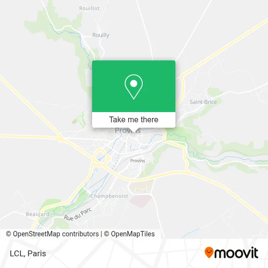
See LCL, Provins, on the map
Public Transit to LCL in Provins
Wondering how to get to LCL in Provins? Moovit helps you find the best way to get to LCL with step-by-step directions from the nearest public transit station.
Moovit provides free maps and live directions to help you navigate through your city. View schedules, routes, timetables, and find out how long does it take to get to LCL in real time.
Looking for the nearest stop or station to LCL? Check out this list of stops closest to your destination: Marais; Félix Bourquelot; Gare Routière; Gare Sncf Quai 4; Gare Sncf Quai 5; Gare Sncf Quai 1; Gare Sncf Quai 2; Gare Sncf Quai 3; Gare Sncf Quai 6; Provins.
Bus: 7704, 7705, 3209, SOIR, TÀD 3209, 3208, 3201, 3211, P, 3210, 7707, 3207, 3259.
Want to see if there’s another route that gets you there at an earlier time? Moovit helps you find alternative routes or times. Get directions from and directions to LCL easily from the Moovit App or Website.
We make riding to LCL easy, which is why over 1.5 million users, including users in Provins, trust Moovit as the best app for public transit. You don’t need to download an individual bus app or train app, Moovit is your all-in-one transit app that helps you find the best bus time or train time available.
For information on prices of bus, train and RER, costs and ride fares to LCL, please check the Moovit app.
Use the app to navigate to popular places including to the airport, hospital, stadium, grocery store, mall, coffee shop, school, college, and university.
LCL Address: 28 Rue de la Cordonnerie 77160 Provins street in Provins
- Montgolfiere Champagne Air Show,
- Optic 2000,
- Au Goût du Monde,
- La Vraie Joie,
- M S Callewaert,
- Ets Latour,
- FedEx,
- Bouhlel,
- M.S.P. du Provinois,
- Nancy Pineau,
- 2 Place du Maréchal Leclerc,
- La Maison des Travaux Provins,
- Bubble Hair Coiffure Provins,
- Parc du Prieuré,
- Morin Père et Fils,
- Asaep,
- Mpx,
- Amazon Locker-Vitalien,
- Club Seventeen,
- Catherine Ekene-Udo
Places Near LCL (Provins)
- Marché Saint-Pierre, Paris,
- Galeries Lafayette, Paris,
- Hôpital Cochin, Paris,
- Hôpital Pitié Salpêtrière, Paris,
- Fondation Louis Vuitton, Paris,
- Galeries Lafayette Haussmann, Paris,
- Atelier Des Lumieres, Paris,
- Institut Curie, Paris,
- Hôpital Necker, Paris,
- Théâtre Mogador, Paris,
- Gare Routière Flixbus, Paris,
- Centre Hospitalier des 15/20, Paris,
- 29 Rue Manin, Paris,
- Hôpital Saint-Joseph, Paris,
- Hopital Foch, Suresnes,
- Créteil Soleil, Creteil,
- Hôpital Beaujon, Clichy,
- Hôpital Henri Mondor, Creteil,
- Hopital Lariboisière, Paris,
- Hôpital de la Pitié-Salpêtrière, Paris
How to get to popular places in Paris with public transit
Get around Provins by public transit!
Traveling around Provins has never been so easy. See step by step directions as you travel to any attraction, street or major public transit station. View bus and train schedules, arrival times, service alerts and detailed routes on a map, so you know exactly how to get to anywhere in Provins.
When traveling to any destination around Provins use Moovit's Live Directions with Get Off Notifications to know exactly where and how far to walk, how long to wait for your line, and how many stops are left. Moovit will alert you when it's time to get off — no need to constantly re-check whether yours is the next stop.
Wondering how to use public transit in Provins or how to pay for public transit in Provins? Moovit public transit app can help you navigate your way with public transit easily, and at minimum cost. It includes public transit fees, ticket prices, and costs. Looking for a map of Provins public transit lines? Moovit public transit app shows all public transit maps in Provins with all Bus, Train, Metro, Light Rail, RER, Funicular and Gondola routes and stops on an interactive map.
Paris has 7 transit type(s), including: Bus, Train, Metro, Light Rail, RER, Funicular and Gondola, operated by several transit agencies, including RATP, RER, RER Bus de remplacement, Train, Train Bus de remplacement, Tramway Bus de remplacement, TER, ADP, Magical Shuttle, Argenteuil - Boucles de Seine, Autocars Dominique, Bièvre, Brie et 2 Morin, Le Bus - C.C. du Clermontois and Cœur d’Essonne