How to get to La Château Barnier by bus?
Click on the bus route to see step by step directions with maps, line arrival times and updated time schedules.
Bus stops near La Château Barnier in Nimes
- Clos Mirman, 1 min walk,VIEW
Bus lines to La Château Barnier in Nimes
What are the closest stations to La Château Barnier?
The closest stations to La Château Barnier are:
- Clos Mirman is 76 meters away, 1 min walk.
Which bus lines stop near La Château Barnier?
These bus lines stop near La Château Barnier: 41, 42, T4.
What’s the nearest bus station to La Château Barnier in Nimes?
The nearest bus station to La Château Barnier in Nimes is Clos Mirman. It’s a 1 min walk away.
What time is the first bus to La Château Barnier in Nimes?
The 41 is the first bus that goes to La Château Barnier in Nimes. It stops nearby at 6:17 AM.
What time is the last bus to La Château Barnier in Nimes?
The 41 is the last bus that goes to La Château Barnier in Nimes. It stops nearby at 7:54 PM.
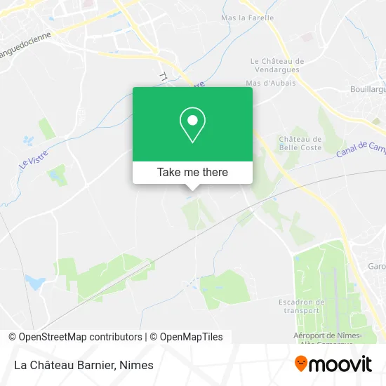
See La Château Barnier, Nimes, on the map
Public Transit to La Château Barnier in Nimes
Wondering how to get to La Château Barnier in Nimes? Moovit helps you find the best way to get to La Château Barnier with step-by-step directions from the nearest public transit station.
Moovit provides free maps and live directions to help you navigate through your city. View schedules, routes, timetables, and find out how long does it take to get to La Château Barnier in real time.
Looking for the nearest stop or station to La Château Barnier? Check out this list of stops closest to your destination: Clos Mirman.
Bus: 41, 42, T4, 218, 2017.
Want to see if there’s another route that gets you there at an earlier time? Moovit helps you find alternative routes or times. Get directions from and directions to La Château Barnier easily from the Moovit App or Website.
We make riding to La Château Barnier easy, which is why over 1.5 million users, including users in Nimes, trust Moovit as the best app for public transit. You don’t need to download an individual bus app or train app, Moovit is your all-in-one transit app that helps you find the best bus time or train time available.
For information on prices of bus, costs and ride fares to La Château Barnier, please check the Moovit app.
Use the app to navigate to popular places including to the airport, hospital, stadium, grocery store, mall, coffee shop, school, college, and university.
La Château Barnier Address: Chemin du Mas d'Estagel street in Nimes
- Oiseau Denim M,
- Intermarché Super Alimentaire Caissargues,
- Société de L Hôtel Gril de Nîmes,
- AG Hôtel,
- Courcelle Virginie,
- Au Cœur des Petits Délices,
- Julien Baudot-Roux-Sophrologue,
- ibis Budget,
- Viremouneix Alex,
- D42,
- Pharmacie de Mirman,
- Route de Saint-Gilles,
- Rs Plomberie,
- Les Paniers de Jo,
- GARAGE KOUBI,
- Geobiologie Gard,
- Paparin Jean-Paul,
- Les Tables de La Fontaine,
- Roger Gassier,
- Sn Distribution
Places Near La Château Barnier (Nimes)
- Carrefour Nîmes Sud,
- Rue Gilles Roberval 285,
- VILLE ACTIVE, Nîmes,
- Rond-Point Kilomètre Delta, Nîmes,
- Saint-Césaire,
- École Nationale De Police,
- Jardins de la Fontaine,
- Clinique Franciscaine,
- Les 7 Collines,
- E.Leclerc,
- Polyclinique Du Grand Sud,
- Parc Kennedy,
- CHU de Nîmes - Hôpital universitaire Carémeau,
- Geant Casino,
- Kinepolis,
- La Galerie - Cap Costières,
- Aire De Covoiturage Nîmes Ouest,
- Hôpital Privé Les Franciscaines,
- Le Parnasse, Nîmes,
- Centre hospitalier Caremeau
How to get to popular places in Nimes with public transit
Get around Nimes by public transit!
Traveling around Nimes has never been so easy. See step by step directions as you travel to any attraction, street or major public transit station. View bus and train schedules, arrival times, service alerts and detailed routes on a map, so you know exactly how to get to anywhere in Nimes.
When traveling to any destination around Nimes use Moovit's Live Directions with Get Off Notifications to know exactly where and how far to walk, how long to wait for your line, and how many stops are left. Moovit will alert you when it's time to get off — no need to constantly re-check whether yours is the next stop.
Wondering how to use public transit in Nimes or how to pay for public transit in Nimes? Moovit public transit app can help you navigate your way with public transit easily, and at minimum cost. It includes public transit fees, ticket prices, and costs. Looking for a map of Nimes public transit lines? Moovit public transit app shows all public transit maps in Nimes with all bus routes and stops on an interactive map.
Nimes has 1 transit type(s), including: bus, operated by several transit agencies, including TANGO