How to get to La Chalana by bus?
Click on the bus route to see step by step directions with maps, line arrival times and updated time schedules.
From Parque Zonal Mayta Cápac, San Martin
28 minFrom Av Wilson, Lima
27 minFrom Cementerio El Ángel, Lima
51 minFrom Av. 28 de Julio, Miraflores
47 minFrom Jr. Andahuaylas, Lima
42 minFrom Av. Ejercito - Miraflores, Miraflores
37 minFrom Ovalo José Quiñones, San Isidro
59 minFrom Estación Naranjal - Metropolitano, Independen
47 minFrom Vía Expresa Paseo de la República, Lima
35 minFrom Panamericana Norte, Independen
46 min
Bus stops near La Chalana in San Miguel
Bus lines to La Chalana in San Miguel
- 1163, Santa Margarita (Ventanilla) - Jockey Plaza (Surco),VIEW
- 1173, La Marina (San Miguel) - Pacasmayo (San Martin de Porres),VIEW
- 1203, Portón (San Juan De Lurigancho) - Plaza Norte (San Martin De Porres) - Portón (San Juan De Lurigancho),VIEW
- 1275, Upc (Santiago De Surco) - Oquendo (San Martín De Porres),VIEW
- 1276, Puente Benavides (Surco),VIEW
- 1286, San Diego (S.M. Porres) - Mariategui (S.J. Lurigancho),VIEW
- 1291, Ventanilla - Chorrillos,VIEW
- 1293, José Gálvez (Pachacamac) - Mi Perú (Ventanilla),VIEW
- 1300, San Juan De Lurigancho - Ventanilla,VIEW
- 1316, Pachacútec/Mi Perú (Ventanilla) - Mariátegui (San Juan de Lurigancho),VIEW
- 1435, Minka (Callao) - Torre Blanca (Carabayllo),VIEW
- 1442, Pachacútec (Ventanilla) - La Marina (San Miguel),VIEW
- 1482, Chorrillos - S.M.P.,VIEW
- 1491, Puente Benavides (Surco) - Pacasmayo (Callao),VIEW
- CR16, San Miguel - Ventanilla,VIEW
- CR34, San Miguel - Comas,VIEW
- CR35, Ventanilla - San Miguel,VIEW
- CR43, Ventanilla - Carabayllo,VIEW
- CR51, Comas - San Miguel,VIEW
- CR62, Carabayllo - Lima - Carabayllo,VIEW
What are the closest stations to La Chalana?
The closest stations to La Chalana are:
- Seguro Mongrut Muñoz & Faucett is 158 meters away, 3 min walk.
- Faucett is 305 meters away, 5 min walk.
- Venezuela is 309 meters away, 5 min walk.
- Venezuela / Faucett is 318 meters away, 5 min walk.
Which bus lines stop near La Chalana?
These bus lines stop near La Chalana: 1163, 1203, 1291, 1319, 1481, CR62, CR65.
What’s the nearest bus station to La Chalana in San Miguel?
The nearest bus station to La Chalana in San Miguel is Seguro Mongrut Muñoz & Faucett. It’s a 3 min walk away.
What time is the first bus to La Chalana in San Miguel?
The 1319 is the first bus that goes to La Chalana in San Miguel. It stops nearby at 3:00 AM.
What time is the last bus to La Chalana in San Miguel?
The 1319 is the last bus that goes to La Chalana in San Miguel. It stops nearby at 4:46 AM.
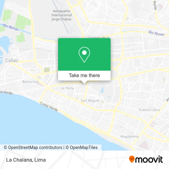
See La Chalana, San Miguel, on the map
Public Transit to La Chalana in San Miguel
Wondering how to get to La Chalana in San Miguel? Moovit helps you find the best way to get to La Chalana with step-by-step directions from the nearest public transit station.
Moovit provides free maps and live directions to help you navigate through your city. View schedules, routes, timetables, and find out how long does it take to get to La Chalana in real time.
Looking for the nearest stop or station to La Chalana? Check out this list of stops closest to your destination: Seguro Mongrut Muñoz & Faucett; Faucett; Venezuela; Venezuela / Faucett.
Bus: 1163, 1203, 1291, 1319, 1481, CR62, CR65, 1173, 1275, 1276, 1138, 1007, 1030, 1218, 1234, 1219 SX, 1223, 1228, 1254, 1258, 1317.
Want to see if there’s another route that gets you there at an earlier time? Moovit helps you find alternative routes or times. Get directions from and directions to La Chalana easily from the Moovit App or Website.
We make riding to La Chalana easy, which is why over 1.5 million users, including users in San Miguel, trust Moovit as the best app for public transit. You don’t need to download an individual bus app or train app, Moovit is your all-in-one transit app that helps you find the best bus time or train time available.
For information on prices of bus, costs and ride fares to La Chalana, please check the Moovit app.
Use the app to navigate to popular places including to the airport, hospital, stadium, grocery store, mall, coffee shop, school, college, and university.
La Chalana Address: Avenida Pío XII 150 Maranga 6ta Etapa, 15088 San Miguel street in San Miguel
- Maranga Av Pio XII Nº 184 Av Pio XII Nº 184,
- Club de Leones de Maranga,
- Pio XII Car Wash,
- García Matallana Erwin Maximilian,
- Star Cars Perú,
- La Boutique Rosa,
- Av Faucett con Pio XII cuadra 3,
- Dulce Limón,
- AV PIO XII SAN MIGUEL,
- Ascensores-Renkitec SAC,
- Bartra Amado Guadalupe,
- CALLE MIGUEL HIDALGO 5TA ETAPA URB MARANGA,
- Arroyo Tavara Ana Esmeralda,
- Calle Miguel Hidalgo,
- White Medics,
- Inversiones La Cruz,
- Botica,
- Banco de Comercio,
- Banco de Credito BCP,
- Avenida Elmer Faucett 571
Places Near La Chalana (San Miguel)
- Aeropuerto Internacional Jorge Chávez, Ventanilla,
- Av. Abancay, Lima,
- Jockey Plaza, Santiago D,
- Larcomar, Miraflores,
- Real Plaza Puruchuco, Ate,
- Gamarra,
- av arequipa, Lima,
- Miraflores, Miraflores,
- Av. Salaverry, Jesus Mari,
- Mall Del Sur,
- Parque de las Leyendas, San Miguel,
- Paradero Av.Brasil,
- Hospital Edgardo Rebagliati Martins, Jesus Mari,
- Barranco, Barranco,
- Plaza San Miguel, San Miguel,
- Circuito Mágico Del Agua, Lima,
- Pontificia Universidad Católica del Perú - PUCP, San Miguel,
- Av. La Marina, San Miguel,
- Parque Kennedy, Miraflores,
- Centro Comercial Plaza Norte, Independen
How to get to popular places in Lima with public transit
Get around San Miguel by public transit!
Traveling around San Miguel has never been so easy. See step by step directions as you travel to any attraction, street or major public transit station. View bus and train schedules, arrival times, service alerts and detailed routes on a map, so you know exactly how to get to anywhere in San Miguel.
When traveling to any destination around San Miguel use Moovit's Live Directions with Get Off Notifications to know exactly where and how far to walk, how long to wait for your line, and how many stops are left. Moovit will alert you when it's time to get off — no need to constantly re-check whether yours is the next stop.
Wondering how to use public transit in San Miguel or how to pay for public transit in San Miguel? Moovit public transit app can help you navigate your way with public transit easily, and at minimum cost. It includes public transit fees, ticket prices, and costs. Looking for a map of San Miguel public transit lines? Moovit public transit app shows all public transit maps in San Miguel with all Bus, Metro and Ferry routes and stops on an interactive map.
Lima has 3 transit type(s), including: Bus, Metro and Ferry, operated by several transit agencies, including Metro de Lima Línea 2 , Metro de Lima, Corredor Rojo, Metropolitano, Metropolitano - Alimentadores, Corredor Morado, Corredor Azul, Rutas Tradicionales, Transportes y Servicios La Esperanza S.A., Las Flores S.A., Virgen de la Asunción S.A., Consorcio HAM, Transportes y Service Canadá S.A., ETUL4SA and ETUCHISA