How to get to La Chamade by bus?
Click on the bus route to see step by step directions with maps, line arrival times and updated time schedules.
From Hôpital Ambroise Paré, Boulogne-Billancourt
46 minFrom Saint Denis Université, Saint-Denis
70 minFrom 93130, Noisy-Le-Sec
68 minFrom Chevilly-Larue, Chevilly-Larue
74 minFrom Westfield Les 4 Temps, Puteaux
59 minFrom Centre Commercial Les 4 Temps, Puteaux
62 minFrom Malakoff, Malakoff
48 minFrom Les 4 Temps, Puteaux
59 minFrom Musée Marmottan Monet, Paris
38 minFrom 15e Arrondissement, Paris
42 min
How to get to La Chamade by metro?
Click on the metro route to see step by step directions with maps, line arrival times and updated time schedules.
From Hôpital Ambroise Paré, Boulogne-Billancourt
51 minFrom Saint Denis Université, Saint-Denis
42 minFrom 93130, Noisy-Le-Sec
54 minFrom Chevilly-Larue, Chevilly-Larue
55 minFrom Westfield Les 4 Temps, Puteaux
35 minFrom Centre Commercial Les 4 Temps, Puteaux
37 minFrom Malakoff, Malakoff
53 minFrom Les 4 Temps, Puteaux
34 minFrom Musée Marmottan Monet, Paris
39 minFrom 15e Arrondissement, Paris
33 min
Bus stops near La Chamade in Paris
Bus lines to La Chamade in Paris
- 29, Gare Saint-Lazare,VIEW
- 91, Montparnasse 2 - Gare Tgv,VIEW
- N02, Barbès - Rochechouart,VIEW
- N01, Barbès - Rochechouart,VIEW
- 69, Champs de Mars,VIEW
- 76, Montreuil - Hôpital,VIEW
- N11, Pont de Neuilly - Métro,VIEW
- N16, Pont de Levallois - Bécon,VIEW
- 86, Champs de Mars,VIEW
- 87, Invalides,VIEW
- 96, Gare Montparnasse,VIEW
What are the closest stations to La Chamade?
The closest stations to La Chamade are:
- Bastille - Beaumarchais is 33 meters away, 1 min walk.
- Bastille is 81 meters away, 2 min walk.
- Bastille - Rue Saint-Antoine is 205 meters away, 3 min walk.
- Bastille - Henri IV is 261 meters away, 4 min walk.
- Saint-Paul is 267 meters away, 4 min walk.
- Sully - Morland is 414 meters away, 6 min walk.
Which metro lines stop near La Chamade?
These metro lines stop near La Chamade: 1, 5, 7, 8.
Which bus lines stop near La Chamade?
These bus lines stop near La Chamade: 69, 72, 76, 87, 96.
What’s the nearest metro station to La Chamade in Paris?
The nearest metro station to La Chamade in Paris is Bastille. It’s a 2 min walk away.
What’s the nearest bus station to La Chamade in Paris?
The nearest bus station to La Chamade in Paris is Bastille - Beaumarchais. It’s a 1 min walk away.
What time is the first metro to La Chamade in Paris?
The 1 is the first metro that goes to La Chamade in Paris. It stops nearby at 5:32 AM.
What time is the last metro to La Chamade in Paris?
The 5 is the last metro that goes to La Chamade in Paris. It stops nearby at 1:07 AM.
What time is the first bus to La Chamade in Paris?
The N16 is the first bus that goes to La Chamade in Paris. It stops nearby at 3:02 AM.
What time is the last bus to La Chamade in Paris?
The N16 is the last bus that goes to La Chamade in Paris. It stops nearby at 3:27 AM.
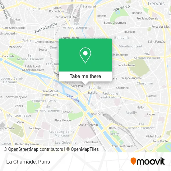
See La Chamade, Paris, on the map
Public Transit to La Chamade in Paris
Wondering how to get to La Chamade in Paris? Moovit helps you find the best way to get to La Chamade with step-by-step directions from the nearest public transit station.
Moovit provides free maps and live directions to help you navigate through your city. View schedules, routes, timetables, and find out how long does it take to get to La Chamade in real time.
Looking for the nearest stop or station to La Chamade? Check out this list of stops closest to your destination: Bastille - Beaumarchais; Bastille; Bastille - Rue Saint-Antoine; Bastille - Henri IV; Saint-Paul; Sully - Morland.
Metro: 1, 5, 7, 8.Bus: 69, 72, 76, 87, 96, N01, 29, 91, N02, N11, N16, 86.
Want to see if there’s another route that gets you there at an earlier time? Moovit helps you find alternative routes or times. Get directions from and directions to La Chamade easily from the Moovit App or Website.
We make riding to La Chamade easy, which is why over 1.5 million users, including users in Paris, trust Moovit as the best app for public transit. You don’t need to download an individual bus app or train app, Moovit is your all-in-one transit app that helps you find the best bus time or train time available.
For information on prices of metro, bus, train and RER, costs and ride fares to La Chamade, please check the Moovit app.
Use the app to navigate to popular places including to the airport, hospital, stadium, grocery store, mall, coffee shop, school, college, and university.
Location: Paris
- Rue de Birague,
- Boutique Hotel de la Place des Vosges Paris,
- la marquise,
- Hôtel de Sully,
- La Place Royale,
- Ecole des Francs Bourgeois,
- Hôtel de Béthune-Sully,
- Place des Vosges Chic,
- Showroom,
- Jardin de l'Hotel de Sully,
- Collège Privé Les Francs Bourgeois,
- Lycée Professionnel Théophile Gautier,
- Lycée Théophile Gautier,
- Hôtel de la Herse d'Or,
- Maison de Victor Hugo,
- Lycée privé des Francs-Bourgeois,
- Temple du Marais,
- Icpc Bastille,
- 2 Rue de Turenne,
- Turenne Le Marais Paris
Places Near La Chamade (Paris)
- Hôpital Necker, Paris,
- Beaugrenelle, Paris,
- Gare Routière Flixbus, Paris,
- Hôpital Beaujon, Clichy,
- Créteil Soleil, Creteil,
- Hôpital Pitié Salpêtrière, Paris,
- Hôpital Cochin, Paris,
- Hôpital Henri Mondor, Creteil,
- Hopital Foch, Suresnes,
- Hôpital de la Pitié-Salpêtrière, Paris,
- Hopital Lariboisière, Paris,
- Marché Saint-Pierre, Paris,
- Atelier Des Lumieres, Paris,
- Fondation Louis Vuitton, Paris,
- Centre Hospitalier des 15/20, Paris,
- 29 Rue Manin, Paris,
- Galeries Lafayette, Paris,
- Théâtre Mogador, Paris,
- Galeries Lafayette Haussmann, Paris,
- Hôpital Saint-Joseph, Paris
How to get to popular places in Paris with public transit
Get around Paris by public transit!
Traveling around Paris has never been so easy. See step by step directions as you travel to any attraction, street or major public transit station. View bus and train schedules, arrival times, service alerts and detailed routes on a map, so you know exactly how to get to anywhere in Paris.
When traveling to any destination around Paris use Moovit's Live Directions with Get Off Notifications to know exactly where and how far to walk, how long to wait for your line, and how many stops are left. Moovit will alert you when it's time to get off — no need to constantly re-check whether yours is the next stop.
Wondering how to use public transit in Paris or how to pay for public transit in Paris? Moovit public transit app can help you navigate your way with public transit easily, and at minimum cost. It includes public transit fees, ticket prices, and costs. Looking for a map of Paris public transit lines? Moovit public transit app shows all public transit maps in Paris with all Bus, Train, Metro, Light Rail, RER, Funicular and Gondola routes and stops on an interactive map.
Paris has 7 transit type(s), including: Bus, Train, Metro, Light Rail, RER, Funicular and Gondola, operated by several transit agencies, including RATP, RER, RER Bus de remplacement, Train, Train Bus de remplacement, Tramway Bus de remplacement, TER, ADP, Magical Shuttle, Argenteuil - Boucles de Seine, Autocars Dominique, Bièvre, Brie et 2 Morin, Le Bus - C.C. du Clermontois and Cœur d’Essonne