How to get to La Chope by bus?
Click on the bus route to see step by step directions with maps, line arrival times and updated time schedules.
From Mujeres Ilustres, Aguascalientes
55 minFrom Barlovento Residencial, Aguascalientes
71 minFrom República de Belice 703, Aguascalientes
39 minFrom Pirules, Aguascalientes
44 minFrom Lomas del Mirador I, II y III, Aguascalientes
55 minFrom Calle General Ignacio Zaragoza, Aguascalientes
33 minFrom Miguel Angel Barberena Vega, Aguascalientes
46 minFrom Parque Miguel Hidalgo, Aguascalientes
31 minFrom José Guadalupe Peralta Gámez, Aguascalientes
64 minFrom Fraccionamiento Sol Naciente, Aguascalientes
60 min
Bus stops near La Chope in Aguascalientes
Bus lines to La Chope in Aguascalientes
What are the closest stations to La Chope?
The closest stations to La Chope are:
- Avenida Independencia, 2214(145) is 51 meters away, 2 min walk.
- Boulevard Luis Donaldo Colosio Murrieta, 1722(722) is 326 meters away, 5 min walk.
Which bus lines stop near La Chope?
These bus lines stop near La Chope: RUTA 10, RUTA 18, RUTA 35, RUTA 45.
What’s the nearest bus station to La Chope in Aguascalientes?
The nearest bus station to La Chope in Aguascalientes is Avenida Independencia, 2214(145). It’s a 2 min walk away.
What time is the first bus to La Chope in Aguascalientes?
The RUTA 10 is the first bus that goes to La Chope in Aguascalientes. It stops nearby at 6:10 AM.
What time is the last bus to La Chope in Aguascalientes?
The RUTA 10 is the last bus that goes to La Chope in Aguascalientes. It stops nearby at 10:15 PM.
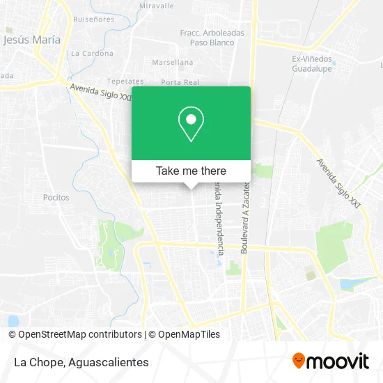
See La Chope, Aguascalientes, on the map
Public Transit to La Chope in Aguascalientes
Wondering how to get to La Chope in Aguascalientes? Moovit helps you find the best way to get to La Chope with step-by-step directions from the nearest public transit station.
Moovit provides free maps and live directions to help you navigate through your city. View schedules, routes, timetables, and find out how long does it take to get to La Chope in real time.
Looking for the nearest stop or station to La Chope? Check out this list of stops closest to your destination: Avenida Independencia; Boulevard Luis Donaldo Colosio Murrieta.
Bus: RUTA 10, RUTA 18, RUTA 35, RUTA 45, RUTA 06.
Want to see if there’s another route that gets you there at an earlier time? Moovit helps you find alternative routes or times. Get directions from and directions to La Chope easily from the Moovit App or Website.
We make riding to La Chope easy, which is why over 1.5 million users, including users in Aguascalientes, trust Moovit as the best app for public transit. You don’t need to download an individual bus app or train app, Moovit is your all-in-one transit app that helps you find the best bus time or train time available.
For information on prices of bus, costs and ride fares to La Chope, please check the Moovit app.
Use the app to navigate to popular places including to the airport, hospital, stadium, grocery store, mall, coffee shop, school, college, and university.
La Chope Address: Prolongación General Ignacio Zaragoza, Fraccionamiento Valle de las Trojes, 20115 Aguascalientes, A street in Aguascalientes
- Prolongación Zaragoza,
- Miravela S Restaurante y Cafe,
- Don Mostacho Barber Shop,
- Fracc. Valle De Las Trojes,
- Convoque Food Park Norte Ags,
- Station Car Wash Ags,
- Rancho Victoria,
- Bosques International School,
- Muuk Centro Integral,
- Ana Cabrera Microblading Studio and Academy,
- Cesrul Consultores Sc, contadores Públicos,
- Bisuteria Esthel,
- Academia de Bailes Españoles Flamenco Vive,
- Mexikaner Beer Factory,
- Plaza Zaragoza 712,
- Plasti Dp Ags - Norte,
- Coparmex Aguascalientes,
- Taquería Los Buenos,
- Thunder Disco,
- Plaza Infinite
Places Near La Chope (Aguascalientes)
- Centro, Aguascalientes,
- Nuevo Hospital Hidalgo, Aguascalientes,
- Imss Clinica 1, Aguascalientes,
- Villasuncion, Aguascalientes,
- Terminal De Combis, Aguascalientes,
- Isla San Marcos, Aguascalientes,
- Jesús María, Aguascalientes,
- Parque Las Tres Centurias, Aguascalientes,
- Blvd. Luis Donaldo Colosio, Aguascalientes,
- Universidad Autónoma de Aguascalientes, Aguascalientes,
- Centro Comercial Altaria, Aguascalientes,
- clinica 3 uaa, Aguascalientes,
- Central De Autobuses, Aguascalientes,
- Villas de Nuestra Señora de la Asunción, Aguascalientes,
- Agropecuario, Aguascalientes,
- Aeropuerto de Aguascalientes S.A. de C.V., Aguascalientes,
- Hospital Imss No. 3, Aguascalientes,
- Ciudad industrial, Aguascalientes,
- ESPACIOS, Aguascalientes,
- La Isla San Marcos, Aguascalientes
How to get to popular places in Aguascalientes with public transit
Get around Aguascalientes by public transit!
Traveling around Aguascalientes has never been so easy. See step by step directions as you travel to any attraction, street or major public transit station. View bus and train schedules, arrival times, service alerts and detailed routes on a map, so you know exactly how to get to anywhere in Aguascalientes.
When traveling to any destination around Aguascalientes use Moovit's Live Directions with Get Off Notifications to know exactly where and how far to walk, how long to wait for your line, and how many stops are left. Moovit will alert you when it's time to get off — no need to constantly re-check whether yours is the next stop.
Wondering how to use public transit in Aguascalientes or how to pay for public transit in Aguascalientes? Moovit public transit app can help you navigate your way with public transit easily, and at minimum cost. It includes public transit fees, ticket prices, and costs. Looking for a map of Aguascalientes public transit lines? Moovit public transit app shows all public transit maps in Aguascalientes with all bus routes and stops on an interactive map.
Aguascalientes has 1 transit type(s), including: bus, operated by several transit agencies, including Coordinación General de Movilidad