How to get to La Clef des Champs by bus?
Click on the bus route to see step by step directions with maps, line arrival times and updated time schedules.
From Pluto Gate, Torcy
92 minFrom Val d'Europe, Serris
58 minFrom Centre commercial Claye Souilly, Claye-Souilly
45 minFrom Allée de l'Orme Rond, Bailly-Romainvilliers
91 minFrom Villeparisis, Villeparisis
160 minFrom Centre Commercial Val d'Europe, Serris
52 minFrom La Vallée Village, Serris
49 minFrom Disneyland Paris, Serris
48 minFrom Claye-Souilly, Claye-Souilly
30 minFrom Hôpital Jossigny, Torcy
88 min
Bus stops near La Clef des Champs in Meaux
Bus lines to La Clef des Champs in Meaux
- 2153, Gare De Meaux Quai I - Gare De Dammartin - Juilly - Saint-Mard,VIEW
- 2154, Gare De Meaux Quai I - Gare De Dammartin - Juilly - Saint-Mard,VIEW
- 2158, Henri Iv Jardin - Les Frênes,VIEW
- 2302, Georges Claude - Gare De Meaux,VIEW
- 2317, Guillaume Apollinaire - Gare De Meaux,VIEW
- 2318, Gare De Meaux Quai I - Ancien Calvaire,VIEW
- 2321, Centre - Collot,VIEW
- 2322, Mairie - Gare De Meaux,VIEW
- 2326, Jean Vilar - Collot,VIEW
- 2327, Collège Parc Frot - Grosse Pierre,VIEW
- 2331, Collège Parc Frot - Pasteur Marguerite,VIEW
- 2333, Jean Rose - Château Du Vignois,VIEW
- 2335, Jean Rose - Jean Renoir,VIEW
- 2348, Jean Rose - Mairie,VIEW
- 2374, Philo - Gare D'esbly - Quai B,VIEW
- 2377, Gare De Meaux Quai H - Gare De Meaux,VIEW
- 2490, Lycée Pierre De Coubertin - Chessy Nord,VIEW
- 2491, Lycée Pierre De Coubertin - Gare De Crécy-La-Chapelle,VIEW
- 2492, Lycée Pierre De Coubertin - Gare De La Ferté-Sous-Jouarre (quai I),VIEW
- 2104, Jean Rose,VIEW
What are the closest stations to La Clef des Champs?
The closest stations to La Clef des Champs are:
- Henri IV Cinéma is 123 meters away, 2 min walk.
- Henri IV Jardin is 151 meters away, 3 min walk.
- Poste Allende is 393 meters away, 6 min walk.
- Pinteville is 593 meters away, 8 min walk.
- Marché is 769 meters away, 10 min walk.
- Chemin de Velours is 897 meters away, 12 min walk.
Which bus lines stop near La Clef des Champs?
These bus lines stop near La Clef des Champs: 7702, 7720, P.
What’s the nearest bus station to La Clef des Champs in Meaux?
The nearest bus station to La Clef des Champs in Meaux is Henri IV Cinéma. It’s a 2 min walk away.
What time is the first train to La Clef des Champs in Meaux?
The P is the first train that goes to La Clef des Champs in Meaux. It stops nearby at 5:36 AM.
What time is the last train to La Clef des Champs in Meaux?
The P is the last train that goes to La Clef des Champs in Meaux. It stops nearby at 11:17 PM.
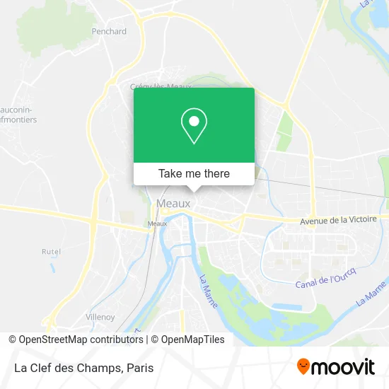
See La Clef des Champs, Meaux, on the map
Public Transit to La Clef des Champs in Meaux
Wondering how to get to La Clef des Champs in Meaux? Moovit helps you find the best way to get to La Clef des Champs with step-by-step directions from the nearest public transit station.
Moovit provides free maps and live directions to help you navigate through your city. View schedules, routes, timetables, and find out how long does it take to get to La Clef des Champs in real time.
Looking for the nearest stop or station to La Clef des Champs? Check out this list of stops closest to your destination: Henri IV Cinéma; Henri IV Jardin; Poste Allende; Pinteville; Marché; Chemin de Velours.
Bus: 7702, 7720, P, 2153, 2154, 2158, 2302, 2317, 2104, 2406, SOIR, 2301, 2304, 2307, 2309, 2310, 2308, 2306, 2311, 2319, 2403, 2411, 2325.
Want to see if there’s another route that gets you there at an earlier time? Moovit helps you find alternative routes or times. Get directions from and directions to La Clef des Champs easily from the Moovit App or Website.
We make riding to La Clef des Champs easy, which is why over 1.5 million users, including users in Meaux, trust Moovit as the best app for public transit. You don’t need to download an individual bus app or train app, Moovit is your all-in-one transit app that helps you find the best bus time or train time available.
For information on prices of bus and RER, costs and ride fares to La Clef des Champs, please check the Moovit app.
Use the app to navigate to popular places including to the airport, hospital, stadium, grocery store, mall, coffee shop, school, college, and university.
La Clef des Champs Address: 39 Boulevard Jean Rose 77100 Meaux street in Meaux
- Habitat Educatif,
- Axa Assurance Pierre Héros,
- Axa,
- Crédit du Nord,
- Rabier et Associes,
- Moneyron et Leveillard,
- Peretmere Marie,
- Cabinet de Serris,
- Acheter à Meaux,
- Crédit Social des Fonctionnaires - Csf Agence de Meaux,
- Maison de l'Emploi et de la Formation Mission Locale Nord-Est 77,
- Maison de l'Emploi Mission Locale Nord-Est 77,
- Mairie de Couilly,
- Bureau Information Jeunesse,
- Chambre de Commerce et d'Industrie de Seine-et-Marne,
- Sg,
- 12 Boulevard Jean Rose,
- Dr. Joublin Michel,
- Gonzalez Éric,
- Restaurant la Table
Places Near La Clef des Champs (Meaux)
- Galeries Lafayette, Paris,
- Hôpital de la Pitié-Salpêtrière, Paris,
- Centre Hospitalier des 15/20, Paris,
- Hopital Lariboisière, Paris,
- Hôpital Pitié Salpêtrière, Paris,
- Hôpital Henri Mondor, Creteil,
- Théâtre Mogador, Paris,
- Atelier Des Lumieres, Paris,
- Galeries Lafayette Haussmann, Paris,
- Hôpital Saint-Joseph, Paris,
- Beaugrenelle, Paris,
- Hôpital Beaujon, Clichy,
- 29 Rue Manin, Paris,
- Créteil Soleil, Creteil,
- Gare Routière Flixbus, Paris,
- Hôpital Cochin, Paris,
- Fondation Louis Vuitton, Paris,
- Hôpital Necker, Paris,
- Hopital Foch, Suresnes,
- Marché Saint-Pierre, Paris
How to get to popular places in Paris with public transit
Get around Meaux by public transit!
Traveling around Meaux has never been so easy. See step by step directions as you travel to any attraction, street or major public transit station. View bus and train schedules, arrival times, service alerts and detailed routes on a map, so you know exactly how to get to anywhere in Meaux.
When traveling to any destination around Meaux use Moovit's Live Directions with Get Off Notifications to know exactly where and how far to walk, how long to wait for your line, and how many stops are left. Moovit will alert you when it's time to get off — no need to constantly re-check whether yours is the next stop.
Wondering how to use public transit in Meaux or how to pay for public transit in Meaux? Moovit public transit app can help you navigate your way with public transit easily, and at minimum cost. It includes public transit fees, ticket prices, and costs. Looking for a map of Meaux public transit lines? Moovit public transit app shows all public transit maps in Meaux with all Bus, Train, Metro, Light Rail, RER, Funicular and Gondola routes and stops on an interactive map.
Paris has 7 transit type(s), including: Bus, Train, Metro, Light Rail, RER, Funicular and Gondola, operated by several transit agencies, including RATP, RER, RER Bus de remplacement, Train, Train Bus de remplacement, Tramway Bus de remplacement, TER, ADP, Magical Shuttle, Argenteuil - Boucles de Seine, Autocars Dominique, Bièvre, Brie et 2 Morin, Le Bus - C.C. du Clermontois and Cœur d’Essonne