How to get to La Gocha by bus?
Click on the bus route to see step by step directions with maps, line arrival times and updated time schedules.
From Flagler & 57 Ave, Miami
34 minFrom Baptist Hospital, Kendall-Palmetto Bay
71 minFrom G. Holmes Braddock Senior High School, Kendale Lakes-Tamiami
46 minFrom Turnpike Exit @ Doral Blvd. (NW 41 Street), North Westside
29 minFrom John A. Ferguson Senior High School, Kendale Lakes-Tamiami
62 minFrom Miami Arts Studio (Zelda Glazer), Kendale Lakes-Tamiami
44 minFrom FIU, Miami
46 minFrom Florida Lottery, Miami
106 minFrom Red Coach, Miami
106 minFrom Terminal Aeropuerto Internacional del Miami, Miami
106 min
Bus stops near La Gocha in North Westside
Bus lines to La Gocha in North Westside
What are the closest stations to La Gocha?
The closest stations to La Gocha are:
- Sw 109 Av @ Sw 4 St is 358 yards away, 5 min walk.
- Sw 4 St @ Sw 109 Av is 385 yards away, 5 min walk.
- Sw 107 Av @ Sw 4 St is 729 yards away, 9 min walk.
Which bus lines stop near La Gocha?
These bus lines stop near La Gocha: 107, 11, 211, DLOOP4, SWTWTB.
What’s the nearest bus station to La Gocha in North Westside?
The nearest bus stations to La Gocha in North Westside are Sw 109 Av @ Sw 4 St and Sw 4 St @ Sw 109 Av. The closest one is a 5 min walk away.
What time is the first bus to La Gocha in North Westside?
The 11 is the first bus that goes to La Gocha in North Westside. It stops nearby at 3:05 AM.
What time is the last bus to La Gocha in North Westside?
The 11 is the last bus that goes to La Gocha in North Westside. It stops nearby at 2:46 AM.
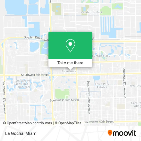
See La Gocha, North Westside, on the map
Public Transit to La Gocha in North Westside
Wondering how to get to La Gocha in North Westside? Moovit helps you find the best way to get to La Gocha with step-by-step directions from the nearest public transit station.
Moovit provides free maps and live directions to help you navigate through your city. View schedules, routes, timetables, and find out how long does it take to get to La Gocha in real time.
Looking for the nearest stop or station to La Gocha? Check out this list of stops closest to your destination: Sw 109 Av @ Sw 4 St; Sw 4 St @ Sw 109 Av; Sw 107 Av @ Sw 4 St.
Bus: 107, 11, 211, DLOOP4, SWTWTB, SWTWTA, 8.
Want to see if there’s another route that gets you there at an earlier time? Moovit helps you find alternative routes or times. Get directions from and directions to La Gocha easily from the Moovit App or Website.
We make riding to La Gocha easy, which is why over 1.7 million users, including users in North Westside, trust Moovit as the best app for public transit. You don’t need to download an individual bus app or train app, Moovit is your all-in-one transit app that helps you find the best bus time or train time available.
For information on prices of bus and light rail, costs and ride fares to La Gocha, please check the Moovit app.
Use the app to navigate to popular places including to the airport, hospital, stadium, grocery store, mall, coffee shop, school, college, and university.
La Gocha Address: 529 SW 109th Ave street in North Westside
- Sweetwater, FL,
- City Of Sweetwater Government,
- Sweetwater Miami Dade County FL USA,
- Sushi Sake Fiu,
- Velozshop,
- Barnes & Noble,
- Farmacia Latina,
- Farmacia Latina Discount,
- Clinica Latina Inc,
- Primera Farmacia Latina,
- 108th Ave,
- FIU PG5 - Market Station,
- EVgo,
- Bubapet,
- Restaurante Mi Pueblo,
- Wow Dental Design,
- Amscot #198,
- SW 107 Ave & 8 St,
- Healthcare Management Americas at Fiu Stempel College,
- Blink Charging
Places Near La Gocha (North Westside)
- Sawgrass mall ( FL ), Miami Beach,
- Marlins Park, Miami,
- Richard E. Gerstein Justice Building, Miami,
- Sawgrass Mall, Miami,
- Bayside Marketplace, Miami,
- Aventura Mall, Miami Beach,
- Hard Rock Stadium, Miami Gardens,
- Port of Miami Cruise Terminal, Miami,
- Miami VA Hospital, Miami,
- Miami Freedom Park, Miami,
- Keiser University Flagship Campus, West Palm Beach,
- Wynwood, Miami,
- Dolphin Mall Bus, Miami,
- Miami-Dade County Courthouse, Miami,
- Dolphin Mall, Miami,
- Brickell City Centre, Miami,
- Aventura Mall, Miami,
- Miami Design District, Miami,
- Zoo Miami, Miami,
- Little Havana, Miami
How to get to popular places in Miami with public transit
Get around North Westside by public transit!
Traveling around North Westside has never been so easy. See step by step directions as you travel to any attraction, street or major public transit station. View bus and train schedules, arrival times, service alerts and detailed routes on a map, so you know exactly how to get to anywhere in North Westside.
When traveling to any destination around North Westside use Moovit's Live Directions with Get Off Notifications to know exactly where and how far to walk, how long to wait for your line, and how many stops are left. Moovit will alert you when it's time to get off — no need to constantly re-check whether yours is the next stop.
Wondering how to use public transit in North Westside or how to pay for public transit in North Westside? Moovit public transit app can help you navigate your way with public transit easily, and at minimum cost. It includes public transit fees, ticket prices, and costs. Looking for a map of North Westside public transit lines? Moovit public transit app shows all public transit maps in North Westside with all Bus, Train, Light Rail and Ferry routes and stops on an interactive map.
Miami has 4 transit type(s), including: Bus, Train, Light Rail and Ferry, operated by several transit agencies, including Broward County Transit, Miami-Dade Transit, Metrorail, Palm Tran, Tri-Rail, Brightline, MARTY, City of Homestead Trolley, Key West Transit, Treasure Coast Connector, GoLine IRT, Amtrak, Greyhound-us, FlixBus-us and Aventura Express Shuttle Bus