How to get to La Huerta de Chicho by bus?
Click on the bus route to see step by step directions with maps, line arrival times and updated time schedules.
From Universidad Camilo José Cela (UCJC), Villanueva De La Cañada
30 minFrom Universidad Europea De Madrid, Área Metropolitana De Madrid Y Corredor Del Henares
44 minFrom Hospital Universitario Puerta de Hierro, Majadahonda
31 minFrom Mercadillo de Majadahonda, Majadahonda
47 minFrom Polígono Európolis, Las Rozas De Madrid
65 minFrom Heron City Madrid, Área Metropolitana De Madrid Y Corredor Del Henares
64 minFrom Autovía A-6 Km 20, Las Rozas De Madrid
79 minFrom Mercado De Majadahonda, Área Metropolitana De Madrid Y Corredor Del Henares
44 minFrom The Style Outlets Las Rozas, Las Rozas De Madrid
69 minFrom Gran Plaza 2 Majadahonda, Área Metropolitana De Madrid Y Corredor Del Henares
69 min
Bus stops near La Huerta de Chicho in Villanueva De La Cañada
Bus lines to La Huerta de Chicho in Villanueva De La Cañada
What are the closest stations to La Huerta de Chicho?
The closest stations to La Huerta de Chicho are:
- Real - Larra is 232 meters away, 4 min walk.
- Barrancas - Jacinto Benavente is 363 meters away, 5 min walk.
Which bus lines stop near La Huerta de Chicho?
These bus lines stop near La Huerta de Chicho: 581, 627.
What’s the nearest bus station to La Huerta de Chicho in Villanueva De La Cañada?
The nearest bus station to La Huerta de Chicho in Villanueva De La Cañada is Real - Larra. It’s a 4 min walk away.
What time is the first bus to La Huerta de Chicho in Villanueva De La Cañada?
The N907 is the first bus that goes to La Huerta de Chicho in Villanueva De La Cañada. It stops nearby at 3:51 AM.
What time is the last bus to La Huerta de Chicho in Villanueva De La Cañada?
The N907 is the last bus that goes to La Huerta de Chicho in Villanueva De La Cañada. It stops nearby at 2:53 AM.
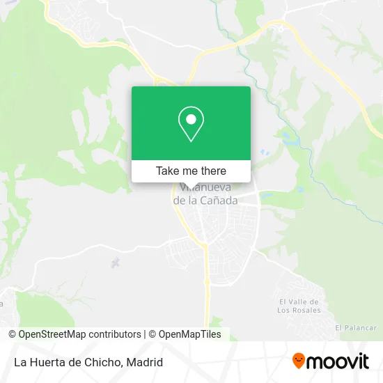
See La Huerta de Chicho, Villanueva De La Cañada, on the map
Public Transit to La Huerta de Chicho in Villanueva De La Cañada
Wondering how to get to La Huerta de Chicho in Villanueva De La Cañada? Moovit helps you find the best way to get to La Huerta de Chicho with step-by-step directions from the nearest public transit station.
Moovit provides free maps and live directions to help you navigate through your city. View schedules, routes, timetables, and find out how long does it take to get to La Huerta de Chicho in real time.
Looking for the nearest stop or station to La Huerta de Chicho? Check out this list of stops closest to your destination: Real - Larra; Barrancas - Jacinto Benavente.
Bus: 581, 627, 626, 669, N907, 530.
Want to see if there’s another route that gets you there at an earlier time? Moovit helps you find alternative routes or times. Get directions from and directions to La Huerta de Chicho easily from the Moovit App or Website.
We make riding to La Huerta de Chicho easy, which is why over 1.5 million users, including users in Villanueva De La Cañada, trust Moovit as the best app for public transit. You don’t need to download an individual bus app or train app, Moovit is your all-in-one transit app that helps you find the best bus time or train time available.
For information on prices of bus, costs and ride fares to La Huerta de Chicho, please check the Moovit app.
Use the app to navigate to popular places including to the airport, hospital, stadium, grocery store, mall, coffee shop, school, college, and university.
La Huerta de Chicho Address: Calle Real, 28691 Villanueva de la Cañada street in Villanueva De La Cañada
- Noemar Pech S, l,L,
- Clínica Dental Smilecompany,
- María Dolores Gutiérrez Gómez,
- Mercado Hibericum,
- The Fine Global Soluti,
- Oasis Fusión,
- Asesoramientos Francisco Campos,
- El Tigre de Rif Papa,
- Oasis,
- Solutemia,
- Alfredo Girón Dominguez,
- Mon Dla Her,
- Zafiro Tours,
- Sánchez Cano Mario,
- Frutería Barae,
- Supercor Exprés,
- Restaurante Chino Take Hao,
- Podología Cristina Men,
- Restaurante Cafeteria Villacañada,
- Clean Machine
Places Near La Huerta de Chicho (Villanueva De La Cañada)
- Centro Comercial La Gavia, Área Metropolitana De Madrid Y Corredor Del Henares,
- Centro Comercial Oasiz Madrid, Área Metropolitana De Madrid Y Corredor Del Henares,
- Wizink Center, Madrid,
- Mendez Alvaro, Madrid,
- Hospital Universitario La Paz, Madrid,
- Rastro De Madrid, Área Metropolitana De Madrid Y Corredor Del Henares,
- Centro Comercial Islazul, Área Metropolitana De Madrid Y Corredor Del Henares,
- Nassica, Área Metropolitana De Madrid Y Corredor Del Henares,
- Plenilunio, Área Metropolitana De Madrid Y Corredor Del Henares,
- Estadio Wanda Metropolitano, Área Metropolitana De Madrid Y Corredor Del Henares,
- Centro Comercial La Vaguada, Área Metropolitana De Madrid Y Corredor Del Henares,
- Estacion de Chamartin, Madrid,
- Hospital Universitario Ramón y Cajal, Madrid,
- Tres Aguas, Alcorcón,
- Plaza Mayor, Madrid,
- Calle de López de Hoyos 169, Madrid,
- Palacio De Vistalegre, Área Metropolitana De Madrid Y Corredor Del Henares,
- Sala La Riviera, Madrid,
- Mercadillo de Majadahonda, Majadahonda,
- Hospital Clínico Universitario San Carlos, Madrid
How to get to popular places in Madrid with public transit
Get around Villanueva De La Cañada by public transit!
Traveling around Villanueva De La Cañada has never been so easy. See step by step directions as you travel to any attraction, street or major public transit station. View bus and train schedules, arrival times, service alerts and detailed routes on a map, so you know exactly how to get to anywhere in Villanueva De La Cañada.
When traveling to any destination around Villanueva De La Cañada use Moovit's Live Directions with Get Off Notifications to know exactly where and how far to walk, how long to wait for your line, and how many stops are left. Moovit will alert you when it's time to get off — no need to constantly re-check whether yours is the next stop.
Wondering how to use public transit in Villanueva De La Cañada or how to pay for public transit in Villanueva De La Cañada? Moovit public transit app can help you navigate your way with public transit easily, and at minimum cost. It includes public transit fees, ticket prices, and costs. Looking for a map of Villanueva De La Cañada public transit lines? Moovit public transit app shows all public transit maps in Villanueva De La Cañada with all Bus, Train, Metro and Light Rail routes and stops on an interactive map.
Madrid has 4 transit type(s), including: Bus, Train, Metro and Light Rail, operated by several transit agencies, including Metro de Madrid, Metro Ligero, Tranvía de Parla, Renfe Cercanías - Servicios de Autobús especiales, Renfe Cercanias, Renfe Cercanías, EMT, Interurbanos, Urbanos de Alcalá de Henares, Urbanos de Alcobendas, Urbanos de Alcorcón, Urbanos de Algete, Urbanos de Aranjuez, Urbanos de Arganda del Rey and Urbanos de Arroyomolinos