How to get to La Pasta Italiana by bus?
Click on the bus route to see step by step directions with maps, line arrival times and updated time schedules.
From Escuela Secundaria Técnica #32, Aguascalientes
40 minFrom Paseos de San Antonio, Aguascalientes
48 minFrom Ruiseñores [Fraccionamiento], Aguascalientes
70 minFrom Ex-Viñedos Guadalupe, Aguascalientes
53 minFrom Villa de Nuestra Señora de La Asunción, Aguascalientes
60 minFrom Parque Industrial Valle de Aguascalientes (PIVA), Aguascalientes
52 minFrom Calle Paseos de Frutilandia, Aguascalientes
56 minFrom Cerro del Muerto, Aguascalientes
41 minFrom Fracc. Villa las Norias, Aguascalientes
51 minFrom Fracc Rinconada Jesús María, Aguascalientes
72 min
Bus stops near La Pasta Italiana in Aguascalientes
Bus lines to La Pasta Italiana in Aguascalientes
- RUTA 20S, Terminal Oriente - Terminal Oriente (S),VIEW
- RUTA 27, Vicente Guerrero,VIEW
- RUTA 33, Jesús María,VIEW
- RUTA 20N, Terminal Oriente - Terminal Oriente (N),VIEW
- RUTA 16, Bellavista,VIEW
- RUTA 30, Martínez Dóminguez,VIEW
- RUTA 40, Terminal Oriente - Terminal Oriente (N),VIEW
- RUTA 23, Villa Montaña,VIEW
- RUTA 24, Vistas De Oriente - Los Negritos,VIEW
- RUTA 25, Universidad Tecnológica,VIEW
- RUTA 41, Terminal Oriente (Penal),VIEW
- RUTA 41, Terminal Oriente (Alameda),VIEW
- RUTA 40, Terminal Oriente - Terminal Oriente (S),VIEW
What are the closest stations to La Pasta Italiana?
The closest stations to La Pasta Italiana are:
- Convencion 1914 Poniente, 219 is 24 meters away, 1 min walk.
- Convencion 1914 Poniente, 420 is 113 meters away, 2 min walk.
- Avenida Aguascalientes, 802c is 417 meters away, 6 min walk.
- Calvillo - Aguascalientes, 806 is 427 meters away, 6 min walk.
- Avenida Aguascalientes Poniente, 101 is 614 meters away, 8 min walk.
Which bus lines stop near La Pasta Italiana?
These bus lines stop near La Pasta Italiana: RUTA 16, RUTA 20N, RUTA 20S, RUTA 24, RUTA 27, RUTA 30, RUTA 40.
What’s the nearest bus station to La Pasta Italiana in Aguascalientes?
The nearest bus station to La Pasta Italiana in Aguascalientes is Convencion 1914 Poniente, 219. It’s a 1 min walk away.
What time is the first bus to La Pasta Italiana in Aguascalientes?
The RUTA 41 is the first bus that goes to La Pasta Italiana in Aguascalientes. It stops nearby at 5:52 AM.
What time is the last bus to La Pasta Italiana in Aguascalientes?
The RUTA 30 is the last bus that goes to La Pasta Italiana in Aguascalientes. It stops nearby at 10:11 PM.
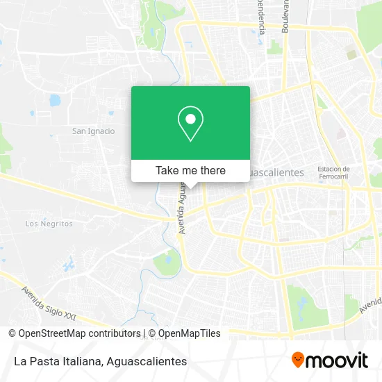
See La Pasta Italiana, Aguascalientes, on the map
Public Transit to La Pasta Italiana in Aguascalientes
Wondering how to get to La Pasta Italiana in Aguascalientes? Moovit helps you find the best way to get to La Pasta Italiana with step-by-step directions from the nearest public transit station.
Moovit provides free maps and live directions to help you navigate through your city. View schedules, routes, timetables, and find out how long does it take to get to La Pasta Italiana in real time.
Looking for the nearest stop or station to La Pasta Italiana? Check out this list of stops closest to your destination: Convencion 1914 Poniente; Convencion 1914 Poniente; Avenida Aguascalientes; Calvillo - Aguascalientes; Avenida Aguascalientes Poniente.
Bus: RUTA 16, RUTA 20N, RUTA 20S, RUTA 24, RUTA 27, RUTA 30, RUTA 40, RUTA 33, RUTA 23, RUTA 25, RUTA 41, RUTA 41.
Want to see if there’s another route that gets you there at an earlier time? Moovit helps you find alternative routes or times. Get directions from and directions to La Pasta Italiana easily from the Moovit App or Website.
We make riding to La Pasta Italiana easy, which is why over 1.5 million users, including users in Aguascalientes, trust Moovit as the best app for public transit. You don’t need to download an individual bus app or train app, Moovit is your all-in-one transit app that helps you find the best bus time or train time available.
For information on prices of bus, costs and ride fares to La Pasta Italiana, please check the Moovit app.
Use the app to navigate to popular places including to the airport, hospital, stadium, grocery store, mall, coffee shop, school, college, and university.
La Pasta Italiana Address: La Pasta Italiana, Calle Campeche 506, Barrio San Marcos, 20070 Aguascalientes, Aguascalientes street in Aguascalientes
- Doña sobadora,
- Santos Botanas,
- Abts Munoz,
- Dulceria Atilano,
- Abarrotes El Nuevo Amanacer,
- Cocina Doña Martha,
- Picapscho,
- Escuela Cendi y Preescolar Papalote,
- Smile Master,
- Parque Recreativo Benito Juarez,
- Tortilleria,
- Pescaderia,
- Tamales Calle Paris,
- Villa Sara,
- Club Minecraft,
- Mushroom Curados,
- Gorditas Calle Londres,
- Spa Beauty Wellness,
- Consultorio Medico General Valentino,
- Jardín de Eventos Casa Rosa
Places Near La Pasta Italiana (Aguascalientes)
- Aeropuerto de Aguascalientes S.A. de C.V., Aguascalientes,
- Universidad Autónoma de Aguascalientes, Aguascalientes,
- Imss Clinica 1, Aguascalientes,
- Hospital Imss No. 3, Aguascalientes,
- Centro, Aguascalientes,
- Ciudad industrial, Aguascalientes,
- Centro Comercial Altaria, Aguascalientes,
- Villasuncion, Aguascalientes,
- clinica 3 uaa, Aguascalientes,
- Jesús María, Aguascalientes,
- Terminal De Combis, Aguascalientes,
- Isla San Marcos, Aguascalientes,
- Central De Autobuses, Aguascalientes,
- Nuevo Hospital Hidalgo, Aguascalientes,
- Villas de Nuestra Señora de la Asunción, Aguascalientes,
- Blvd. Luis Donaldo Colosio, Aguascalientes,
- La Isla San Marcos, Aguascalientes,
- Agropecuario, Aguascalientes,
- ESPACIOS, Aguascalientes,
- Parque Las Tres Centurias, Aguascalientes
How to get to popular places in Aguascalientes with public transit
Get around Aguascalientes by public transit!
Traveling around Aguascalientes has never been so easy. See step by step directions as you travel to any attraction, street or major public transit station. View bus and train schedules, arrival times, service alerts and detailed routes on a map, so you know exactly how to get to anywhere in Aguascalientes.
When traveling to any destination around Aguascalientes use Moovit's Live Directions with Get Off Notifications to know exactly where and how far to walk, how long to wait for your line, and how many stops are left. Moovit will alert you when it's time to get off — no need to constantly re-check whether yours is the next stop.
Wondering how to use public transit in Aguascalientes or how to pay for public transit in Aguascalientes? Moovit public transit app can help you navigate your way with public transit easily, and at minimum cost. It includes public transit fees, ticket prices, and costs. Looking for a map of Aguascalientes public transit lines? Moovit public transit app shows all public transit maps in Aguascalientes with all bus routes and stops on an interactive map.
Aguascalientes has 1 transit type(s), including: bus, operated by several transit agencies, including Coordinación General de Movilidad