How to get to La Poste by bus?
Click on the bus route to see step by step directions with maps, line arrival times and updated time schedules.
From Choisy-Le-Roi, Arrondissement de L'Haÿ-Les-Roses
75 minFrom Clinique du Mousseau, Evry
131 minFrom ibis Paris Coeur d Orly Airport, Orly
77 minFrom Espace Jean Monnet, Rungis
121 minFrom Créteil, Creteil
65 minFrom Maison du Handball, Créteil
77 minFrom Bonneuil-sur-Marne, Bonneuil-Sur-Marne
82 minFrom E.Leclerc, Vitry-Sur-Seine
87 minFrom Cimetière Parisien de Thiais, Thiais
77 minFrom Maisons-Alfort, Maisons-Alfort
72 min
Bus stops near La Poste in Yerres
RER station near La Poste in Yerres
- Yerres, 19 min walk,VIEW
Bus lines to La Poste in Yerres
What are the closest stations to La Poste?
The closest stations to La Poste are:
- Poste is 37 meters away, 1 min walk.
- Cec is 80 meters away, 2 min walk.
- Hôtel de Ville is 262 meters away, 4 min walk.
- Yerres is 1389 meters away, 19 min walk.
Which RER line stops near La Poste?
D (Malesherbes/ Melun/ Corbeil-Essonnes /Juvisy)
Which bus lines stop near La Poste?
These bus lines stop near La Poste: 4115, 4121, 4131, 450.
What’s the nearest bus station to La Poste in Yerres?
The nearest bus station to La Poste in Yerres is Poste. It’s a 1 min walk away.
What’s the nearest RER station to La Poste in Yerres?
The nearest RER station to La Poste in Yerres is Yerres. It’s a 19 min walk away.
What time is the first bus to La Poste in Yerres?
The 450 is the first bus that goes to La Poste in Yerres. It stops nearby at 7:57 AM.
What time is the last bus to La Poste in Yerres?
The 450 is the last bus that goes to La Poste in Yerres. It stops nearby at 11:59 PM.
What time is the first RER to La Poste in Yerres?
The D is the first RER that goes to La Poste in Yerres. It stops nearby at 5:09 AM.
What time is the last RER to La Poste in Yerres?
The D is the last RER that goes to La Poste in Yerres. It stops nearby at 1:05 AM.
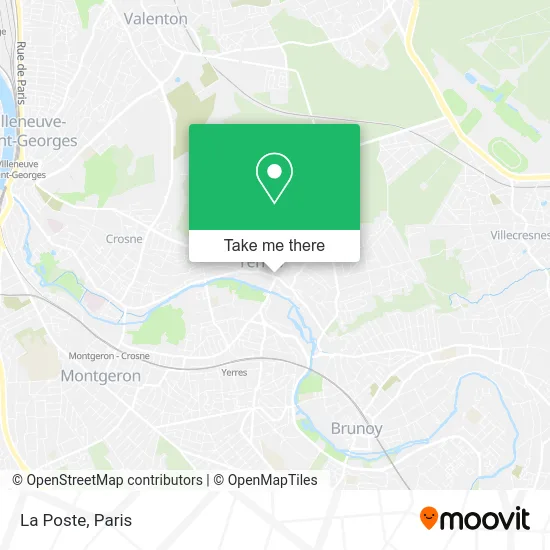
See La Poste, Yerres, on the map
Public Transit to La Poste in Yerres
Wondering how to get to La Poste in Yerres? Moovit helps you find the best way to get to La Poste with step-by-step directions from the nearest public transit station.
Moovit provides free maps and live directions to help you navigate through your city. View schedules, routes, timetables, and find out how long does it take to get to La Poste in real time.
Looking for the nearest stop or station to La Poste? Check out this list of stops closest to your destination: Poste; Cec; Hôtel de Ville; Yerres.
RER: D.Bus: 4115, 4121, 4131, 450, 4153, 4156, 4119, SOIR, 4120, 4154.
Want to see if there’s another route that gets you there at an earlier time? Moovit helps you find alternative routes or times. Get directions from and directions to La Poste easily from the Moovit App or Website.
We make riding to La Poste easy, which is why over 1.5 million users, including users in Yerres, trust Moovit as the best app for public transit. You don’t need to download an individual bus app or train app, Moovit is your all-in-one transit app that helps you find the best bus time or train time available.
For information on prices of bus, RER, light rail and metro, costs and ride fares to La Poste, please check the Moovit app.
Use the app to navigate to popular places including to the airport, hospital, stadium, grocery store, mall, coffee shop, school, college, and university.
La Poste Address: 40 Rue Charles de Gaulle 91330 Yerres street in Yerres
- 40 Rue Charles de Gaulle Parking,
- La Banque Postale,
- Karukera Traiteur,
- Ethik'Créative,
- Laiterie Gilbert Yerres,
- Revillon,
- Pika Pika,
- Les Douze Commandements Culinaires,
- Église Saint-Honest,
- Boulangerie - Pâtisserie Maison Davory,
- FedEx,
- Rue Marc Sangnier,
- 5 Allée Camille Guérin Parking,
- Le Jardin d'Ethan,
- Médiathèque Danielle Bianu,
- M Cyrille Guyard,
- Résidence de la Fontaine Budé,
- Le Cirines,
- Mairie de Yerres,
- Amazon Locker-Honorin
Places Near La Poste (Yerres)
- Hôpital Beaujon, Clichy,
- Hôpital Saint-Joseph, Paris,
- Hôpital Henri Mondor, Creteil,
- Atelier Des Lumieres, Paris,
- Hopital Lariboisière, Paris,
- Fondation Louis Vuitton, Paris,
- Théâtre Mogador, Paris,
- Galeries Lafayette, Paris,
- Hôpital Cochin, Paris,
- 29 Rue Manin, Paris,
- Institut Curie, Paris,
- Hopital Foch, Suresnes,
- Hôpital de la Pitié-Salpêtrière, Paris,
- Hôpital Necker, Paris,
- Créteil Soleil, Creteil,
- Centre Hospitalier des 15/20, Paris,
- Gare Routière Flixbus, Paris,
- Galeries Lafayette Haussmann, Paris,
- Hôpital Pitié Salpêtrière, Paris,
- Marché Saint-Pierre, Paris
How to get to popular places in Paris with public transit
Get around Yerres by public transit!
Traveling around Yerres has never been so easy. See step by step directions as you travel to any attraction, street or major public transit station. View bus and train schedules, arrival times, service alerts and detailed routes on a map, so you know exactly how to get to anywhere in Yerres.
When traveling to any destination around Yerres use Moovit's Live Directions with Get Off Notifications to know exactly where and how far to walk, how long to wait for your line, and how many stops are left. Moovit will alert you when it's time to get off — no need to constantly re-check whether yours is the next stop.
Wondering how to use public transit in Yerres or how to pay for public transit in Yerres? Moovit public transit app can help you navigate your way with public transit easily, and at minimum cost. It includes public transit fees, ticket prices, and costs. Looking for a map of Yerres public transit lines? Moovit public transit app shows all public transit maps in Yerres with all Bus, Train, Metro, Light Rail, RER, Funicular and Gondola routes and stops on an interactive map.
Paris has 7 transit type(s), including: Bus, Train, Metro, Light Rail, RER, Funicular and Gondola, operated by several transit agencies, including RATP, RER, RER Bus de remplacement, Train, Train Bus de remplacement, Tramway Bus de remplacement, TER, ADP, Magical Shuttle, Argenteuil - Boucles de Seine, Autocars Dominique, Bièvre, Brie et 2 Morin, Le Bus - C.C. du Clermontois and Cœur d’Essonne