Directions to LabCorp (Indianapolis City (Balance)) with public transportation
The following transit lines have routes that pass near LabCorp
 Bus: 31.
How to get to LabCorp by bus?
Click on the bus route to see step by step directions with maps, line arrival times and updated time schedules.
From Maryland, Indianapolis City (Balance)
35 minFrom Indianapolis Amtrak Station, Indianapolis City (Balance)
35 minFrom God Is One Petroleum, Indianapolis City (Balance)
49 minFrom Five Star Hand Car Wash, Indianapolis City (Balance)
63 minFrom Southeastern And Sherman, Indianapolis City (Balance)
65 minFrom Salon700, Beech Grove
116 minFrom Union Station Garage, Indianapolis City (Balance)
32 minFrom Greyhound Bus, Indianapolis City (Balance)
36 minFrom Bluebelle Beauty at Salon Lofts City Way, Indianapolis City (Balance)
34 min
Bus stop near LabCorp in Indianapolis City (Balance)
- Us 31 & Banta Rd, 2 min walk,VIEW
Bus lines to LabCorp in Indianapolis City (Balance)
- 31, Transit Center,VIEW
What are the closest stations to LabCorp?
The closest stations to LabCorp are:
- Us 31 & Banta Rd is 139 yards away, 2 min walk.
Which bus line stops near LabCorp?
31 (Greenwood Mall)
What’s the nearest bus station to LabCorp in Indianapolis City (Balance)?
The nearest bus station to LabCorp in Indianapolis City (Balance) is Us 31 & Banta Rd. It’s a 2 min walk away.
What time is the first bus to LabCorp in Indianapolis City (Balance)?
The 31 is the first bus that goes to LabCorp in Indianapolis City (Balance). It stops nearby at 5:36 AM.
What time is the last bus to LabCorp in Indianapolis City (Balance)?
The 31 is the last bus that goes to LabCorp in Indianapolis City (Balance). It stops nearby at 9:55 PM.
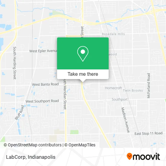
See LabCorp, Indianapolis City (Balance), on the map
Public Transit to LabCorp in Indianapolis City (Balance)
Wondering how to get to LabCorp in Indianapolis City (Balance)? Moovit helps you find the best way to get to LabCorp with step-by-step directions from the nearest public transit station.
Moovit provides free maps and live directions to help you navigate through your city. View schedules, routes, timetables, and find out how long does it take to get to LabCorp in real time.
Looking for the nearest stop or station to LabCorp? Check out this list of stops closest to your destination: Us 31 & Banta Rd.
Bus: 31.
Want to see if there’s another route that gets you there at an earlier time? Moovit helps you find alternative routes or times. Get directions from and directions to LabCorp easily from the Moovit App or Website.
We make riding to LabCorp easy, which is why over 1.5 million users, including users in Indianapolis City (Balance), trust Moovit as the best app for public transit. You don’t need to download an individual bus app or train app, Moovit is your all-in-one transit app that helps you find the best bus time or train time available.
For information on prices of bus, costs and ride fares to LabCorp, please check the Moovit app.
Use the app to navigate to popular places including to the airport, hospital, stadium, grocery store, mall, coffee shop, school, college, and university.
LabCorp Address: 6447 S East St Indianapolis, IN 46227 street in Indianapolis City (Balance)
- Jeffrey N. De Wester Treatment And Research Center,
- Mimms Functional Rehabilitation,
- Rhodes To Wellness Family Chiropractic,
- Tradesmen International,
- Villarrubia & Rosenberger,
- Banta Trails Office Park,
- State of Indiana,
- Hunt Suedhoff Kalamaros : Guillory Ryan J,
- Anesthesia Pain Specialist (I. C. Pain Solutions PC),
- Finding Me Now Learning Center,
- Finding Me Now,
- Riviera Daycare & Preschool,
- Life Vantage Farms And Mcqualla Carriages,
- John Lane - Ameriprise Financial Services, Inc.,
- Asap Roofing Construction,
- E Widdifield G MD,
- Pettit & Company, Llc,
- Plus Garage Door Services,
- Stepping Stones Group,
- Kaiser, Rush, Cook Wealth Advisors
Places Near LabCorp (Indianapolis City (Balance))
- St. Vincent Hospital - Indianapolis, Indianapolis City (Balance),
- I-465 / I-65 Interchange, Indianapolis City (Balance),
- Cotter's Massage Parlor With Happy Endings, Indianapolis City (Balance),
- Indiana Convention Center, Indianapolis City (Balance),
- Gainbridge Fieldhouse, Indianapolis City (Balance),
- Plainfield, IN, Plainfield,
- THE BALT, Indianapolis City (Balance),
- St. Vincent entrance #1, Indianapolis City (Balance),
- Castleton Square Mall, Indianapolis,
- Indianapolis Motor Speedway, Speedway,
- I U Health Methodist Hospital, Indianapolis City (Balance),
- 119 W 19th St Parking, Indianapolis City (Balance),
- Lucas Oil Stadium, Indianapolis City (Balance),
- Eskenazi Hospital, Indianapolis City (Balance),
- Lilly Corporate Center (Eli Lilly & Co), Indianapolis City (Balance),
- Methodist Hospital of Indianapolis, Indianapolis City (Balance),
- Indianapolis Airport Zone 2, Indianapolis City (Balance),
- Jersey Barn, Indianapolis City (Balance),
- Train Ride At Castleton Mall, Indianapolis City (Balance),
- Indiana, Indianapolis City (Balance)
How to get to popular places in Indianapolis with public transit
Get around Indianapolis City (Balance) by public transit!
Traveling around Indianapolis City (Balance) has never been so easy. See step by step directions as you travel to any attraction, street or major public transit station. View bus and train schedules, arrival times, service alerts and detailed routes on a map, so you know exactly how to get to anywhere in Indianapolis City (Balance).
When traveling to any destination around Indianapolis City (Balance) use Moovit's Live Directions with Get Off Notifications to know exactly where and how far to walk, how long to wait for your line, and how many stops are left. Moovit will alert you when it's time to get off — no need to constantly re-check whether yours is the next stop.
Wondering how to use public transit in Indianapolis City (Balance) or how to pay for public transit in Indianapolis City (Balance)? Moovit public transit app can help you navigate your way with public transit easily, and at minimum cost. It includes public transit fees, ticket prices, and costs. Looking for a map of Indianapolis City (Balance) public transit lines? Moovit public transit app shows all public transit maps in Indianapolis City (Balance) with all bus routes and stops on an interactive map.
Indianapolis has 1 transit type(s), including: bus, operated by several transit agencies, including IndyGo, FlixBus-us and Greyhound-us