How to get to LabCorp by bus?
Click on the bus route to see step by step directions with maps, line arrival times and updated time schedules.
From American Dream, East Rutherford, Nj
37 minFrom Bergen Community College, Paramus, Nj
61 minFrom Verona, NJ, Verona, Nj
61 minFrom MetLife Stadium, East Rutherford, Nj
37 minFrom William Paterson University, Wayne, Nj
46 minFrom King Spa, Palisades Park, Nj
85 minFrom Kearny, NJ, Kearny, Nj
59 minFrom Secaucus, NJ, Secaucus, Nj
46 minFrom MetLife Stadium, East Rutherford, Nj
33 minFrom Wayne, NJ, Wayne, Nj
101 min
Bus stops near LabCorp in Passaic, Nj
Train station near LabCorp in Passaic, Nj
- Garfield, 12 min walk,VIEW
Bus lines to LabCorp in Passaic, Nj
What are the closest stations to LabCorp?
The closest stations to LabCorp are:
- Main Ave at Summer St is 11 yards away, 1 min walk.
- Lexington Ave at Sherman St# is 694 yards away, 9 min walk.
- Lexington Ave at Summer St# is 759 yards away, 9 min walk.
- Garfield is 996 yards away, 12 min walk.
Which bus lines stop near LabCorp?
These bus lines stop near LabCorp: 190, 74.
What’s the nearest train station to LabCorp in Passaic, Nj?
The nearest train station to LabCorp in Passaic, Nj is Garfield. It’s a 12 min walk away.
What’s the nearest bus station to LabCorp in Passaic, Nj?
The nearest bus station to LabCorp in Passaic, Nj is Main Ave at Summer St. It’s a 1 min walk away.
What time is the first train to LabCorp in Passaic, Nj?
The MCL is the first train that goes to LabCorp in Passaic, Nj. It stops nearby at 5:28 AM.
What time is the last train to LabCorp in Passaic, Nj?
The MCL is the last train that goes to LabCorp in Passaic, Nj. It stops nearby at 2:00 AM.
What time is the first bus to LabCorp in Passaic, Nj?
The 190 is the first bus that goes to LabCorp in Passaic, Nj. It stops nearby at 4:36 AM.
What time is the last bus to LabCorp in Passaic, Nj?
The 190 is the last bus that goes to LabCorp in Passaic, Nj. It stops nearby at 2:53 AM.
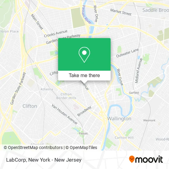
See LabCorp, Passaic, Nj, on the map
Public Transit to LabCorp in Passaic, Nj
Wondering how to get to LabCorp in Passaic, Nj? Moovit helps you find the best way to get to LabCorp with step-by-step directions from the nearest public transit station.
Moovit provides free maps and live directions to help you navigate through your city. View schedules, routes, timetables, and find out how long does it take to get to LabCorp in real time.
Looking for the nearest stop or station to LabCorp? Check out this list of stops closest to your destination: Main Ave at Summer St; Lexington Ave at Sherman St#; Lexington Ave at Summer St#; Garfield.
Bus: 190, 74, 705, 703.Train: MCL, PJL.
Want to see if there’s another route that gets you there at an earlier time? Moovit helps you find alternative routes or times. Get directions from and directions to LabCorp easily from the Moovit App or Website.
We make riding to LabCorp easy, which is why over 1.5 million users, including users in Passaic, Nj, trust Moovit as the best app for public transit. You don’t need to download an individual bus app or train app, Moovit is your all-in-one transit app that helps you find the best bus time or train time available.
For information on prices of bus, costs and ride fares to LabCorp, please check the Moovit app.
Use the app to navigate to popular places including to the airport, hospital, stadium, grocery store, mall, coffee shop, school, college, and university.
LabCorp Address: 916 Main Ave Passaic, NJ 07011 street in Passaic, Nj
- T-Mobile,
- La Costumbre Domi,
- Martinez Mexican Restaurant,
- Amsterdam Management,
- Main and Summer St,
- Gaspar Bail Bond,
- Deleon Francisco,
- Star Main Wireless,
- Rosticeria los Chilangos,
- Amazing Wireless,
- House Unlock Passaic,
- OH Main Grocery,
- Technical Assistance,
- Avr Translations,
- Health Insurance Brokers Passaic,
- NJT - Bus 74,
- LP Auto Shop,
- Juan's Grocery,
- Central and Summer,
- La Virra
Places Near LabCorp (Passaic, Nj)
- 26 Federal Plaza, Manhattan,
- San Gennaro Feast, Manhattan,
- Wall Street, Manhattan,
- 911 Memorial, Manhattan,
- SoHo, Manhattan,
- qqqq, Manhattan,
- 66 John Street, Manhattan,
- Times Square, Manhattan,
- Hudson Yards, Manhattan,
- Mountainside Hospital, Glen Ridge,
- Katz's Deli, Manhattan,
- 111 Centre New York City Supreme Court, Manhattan,
- Rockefeller Center, Manhattan,
- Bellevue Hospital, Manhattan,
- 376 Hudson Street, Manhattan,
- Queens Center Mall, Queens,
- 1 Police Plaza, Manhattan,
- Chinatown, Manhattan,
- 3 Stone St, Manhattan,
- Pier 83, Manhattan
How to get to popular places in New York - New Jersey with public transit
Get around Passaic, Nj by public transit!
Traveling around Passaic, Nj has never been so easy. See step by step directions as you travel to any attraction, street or major public transit station. View bus and train schedules, arrival times, service alerts and detailed routes on a map, so you know exactly how to get to anywhere in Passaic, Nj.
When traveling to any destination around Passaic, Nj use Moovit's Live Directions with Get Off Notifications to know exactly where and how far to walk, how long to wait for your line, and how many stops are left. Moovit will alert you when it's time to get off — no need to constantly re-check whether yours is the next stop.
Wondering how to use public transit in Passaic, Nj or how to pay for public transit in Passaic, Nj? Moovit public transit app can help you navigate your way with public transit easily, and at minimum cost. It includes public transit fees, ticket prices, and costs. Looking for a map of Passaic, Nj public transit lines? Moovit public transit app shows all public transit maps in Passaic, Nj with all Bus, Train, Subway, Light Rail, Ferry and Cable Car routes and stops on an interactive map.
New York - New Jersey has 6 transit type(s), including: Bus, Train, Subway, Light Rail, Ferry and Cable Car, operated by several transit agencies, including MTA Subway, Metro-North Railroad, LIRR, PATH, MTA New York City Transit - Express routes, MTA Bus, NJ Transit, NYC Ferry, NICE bus, Bee-Line Bus, NJ Transit Rail, Norwalk Transit District, Hartford Line, River Valley Transit and HART