How to get to LabCorp by bus?
Click on the bus route to see step by step directions with maps, line arrival times and updated time schedules.
From Lorton, VA, Fairfax County
131 minFrom Lorton, VA - Amtrak Auto Train Station (LOR), Fairfax County
136 minFrom Department of State SA 34, Fairfax County
189 minFrom Woodbridge, VA, Prince William County
46 minFrom Potomac Mills Mall, Prince William County
35 minFrom Jiffy Lube, Manassas
83 minFrom Burke, VA, Fairfax County
386 minFrom 8604 Phoenix Drive, Manassas
89 minFrom Rose Gaming Resort, Prince William County
97 min
Bus stops near LabCorp in Prince William County
Bus lines to LabCorp in Prince William County
What are the closest stations to LabCorp?
The closest stations to LabCorp are:
- Prince William Pkwy @ Laurel Hills Dr is 235 yards away, 3 min walk.
- Touchstone Cir @ Seeton Sq is 705 yards away, 9 min walk.
- Prince William Pkwy @ Hillendale Dr is 1095 yards away, 13 min walk.
Which bus lines stop near LabCorp?
These bus lines stop near LabCorp: 92, 93, 96.
What’s the nearest bus station to LabCorp in Prince William County?
The nearest bus station to LabCorp in Prince William County is Prince William Pkwy @ Laurel Hills Dr. It’s a 3 min walk away.
What time is the first bus to LabCorp in Prince William County?
The 93 is the first bus that goes to LabCorp in Prince William County. It stops nearby at 5:15 AM.
What time is the last bus to LabCorp in Prince William County?
The 93 is the last bus that goes to LabCorp in Prince William County. It stops nearby at 10:38 PM.
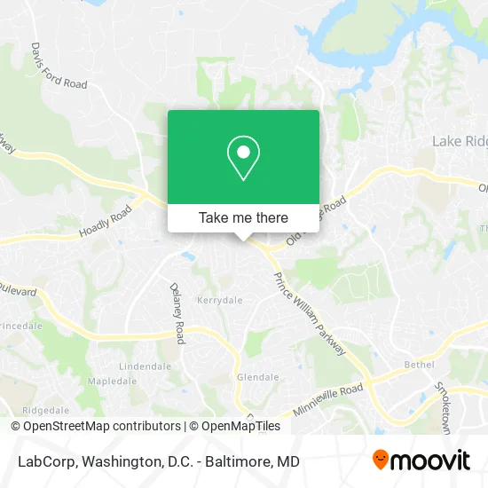
See LabCorp, Prince William County, on the map
Public Transit to LabCorp in Prince William County
Wondering how to get to LabCorp in Prince William County? Moovit helps you find the best way to get to LabCorp with step-by-step directions from the nearest public transit station.
Moovit provides free maps and live directions to help you navigate through your city. View schedules, routes, timetables, and find out how long does it take to get to LabCorp in real time.
Looking for the nearest stop or station to LabCorp? Check out this list of stops closest to your destination: Prince William Pkwy @ Laurel Hills Dr; Touchstone Cir @ Seeton Sq; Prince William Pkwy @ Hillendale Dr.
Bus: 92, 93, 96.
Want to see if there’s another route that gets you there at an earlier time? Moovit helps you find alternative routes or times. Get directions from and directions to LabCorp easily from the Moovit App or Website.
We make riding to LabCorp easy, which is why over 1.5 million users, including users in Prince William County, trust Moovit as the best app for public transit. You don’t need to download an individual bus app or train app, Moovit is your all-in-one transit app that helps you find the best bus time or train time available.
For information on prices of bus, costs and ride fares to LabCorp, please check the Moovit app.
Use the app to navigate to popular places including to the airport, hospital, stadium, grocery store, mall, coffee shop, school, college, and university.
LabCorp Address: 4379 Ridgewood Center Dr Woodbridge, VA 22192 street in Prince William County
- Ridgewood,
- Newman Properties,
- Upstairs Massage,
- Dr. Tejas Shah MD,
- O R Construction Group,
- Forever Yours,
- Prince William County Government Personnel Office,
- Christian Lighthouse Church,
- Representative Gerry Connolly,
- Epic Salon Studios,
- Evermore Senior Living,
- Rick Martin Keller Williams,
- AJ Team Realty,
- C Bailey LCSW,
- Abby Gale Davis, Realtor,
- Uhuru Real Estate,
- The Occoquan Overlook Community Association,
- Mateen Riaz - Licensed Realtor,
- Ismoke Youeat,
- Fredy's Irrigation
Places Near LabCorp (Prince William County)
- Westfield Montgomery Mall, Montgomery County,
- National Mall, Washington,
- The Anthem, Washington,
- PG Mall, Prince George's County,
- Capital One Arena, Washington,
- Pennsylvania Ave NW (3rd st and pennsylvania), Washington,
- Warner Theatre, Washington,
- Museum Of The Bible, Washington,
- Camden Yards, Baltimore,
- Washington DC VA Medical Center, Washington,
- Rock Creek Tennis Center, Washington,
- National Zoo, Washington,
- Sibley Memorial Hospital, Washington,
- Marriott Marquis Washington, DC, Washington,
- Basilica of the National Shrine, Washington,
- National Museum of African American History and Culture, Washington,
- Georgetown, Washington,
- M&T Bank Stadium, Baltimore,
- Amazon Hq2, Arlington County,
- Washington National Cathedral, Washington
How to get to popular places in Washington, D.C. - Baltimore, MD with public transit
Get around Prince William County by public transit!
Traveling around Prince William County has never been so easy. See step by step directions as you travel to any attraction, street or major public transit station. View bus and train schedules, arrival times, service alerts and detailed routes on a map, so you know exactly how to get to anywhere in Prince William County.
When traveling to any destination around Prince William County use Moovit's Live Directions with Get Off Notifications to know exactly where and how far to walk, how long to wait for your line, and how many stops are left. Moovit will alert you when it's time to get off — no need to constantly re-check whether yours is the next stop.
Wondering how to use public transit in Prince William County or how to pay for public transit in Prince William County? Moovit public transit app can help you navigate your way with public transit easily, and at minimum cost. It includes public transit fees, ticket prices, and costs. Looking for a map of Prince William County public transit lines? Moovit public transit app shows all public transit maps in Prince William County with all Bus, Train, Metro, Light Rail and Ferry routes and stops on an interactive map.
Washington, D.C. - Baltimore, MD has 5 transit type(s), including: Bus, Train, Metro, Light Rail and Ferry, operated by several transit agencies, including WMATA, Montgomery County Ride On, Fairfax Connector, TheBus, PRTC, DASH - Alexandria, Arlington Transit (ART), RTA of Central Maryland, MDOT MTA, MDOT MTA Light RailLink, MDOT MTA Commuter Bus, MDOT MTA Local Bus, FXBGO!, Virginia Railway Express (VRE) and MARC