How to get to LabCorp by bus?
Click on the bus route to see step by step directions with maps, line arrival times and updated time schedules.
From Embassy Row, Washington
84 minFrom Barnes & Noble, Washington
84 minFrom Chef Geoff's, Washington
96 minFrom St. Albans School, Washington
84 minFrom The Catholic University of America (CUA), Washington
87 minFrom The Cheesecake Factory, Washington
58 minFrom Children's Hospital, Washington
54 minFrom Washington DC VA Medical Center, Washington
68 minFrom Hyattsville, MD, Prince George's County
75 minFrom VA Medical Center, Washington
66 min
How to get to LabCorp by metro?
Click on the metro route to see step by step directions with maps, line arrival times and updated time schedules.
From Embassy Row, Washington
62 minFrom Barnes & Noble, Washington
34 minFrom St. Albans School, Washington
69 minFrom The Catholic University of America (CUA), Washington
34 minFrom The Cheesecake Factory, Washington
54 minFrom Children's Hospital, Washington
45 minFrom Washington DC VA Medical Center, Washington
55 minFrom Hyattsville, MD, Prince George's County
57 minFrom VA Medical Center, Washington
54 min
Bus stops near LabCorp in Montgomery County
Metro station near LabCorp in Montgomery County
- Wheaton Metro Station, 15 min walk,VIEW
Train station near LabCorp in Montgomery County
- Silver Spring Marc Wb, 28 min walk,VIEW
What are the closest stations to LabCorp?
The closest stations to LabCorp are:
- Forest Glen Rd & Sligo Creek is 168 yards away, 3 min walk.
- Forest Grove Dr & Forest Glen Rd is 791 yards away, 10 min walk.
- Wheaton Metro Station is 1266 yards away, 15 min walk.
- Silver Spring Marc Wb is 2361 yards away, 28 min walk.
Which bus lines stop near LabCorp?
These bus lines stop near LabCorp: 8, M20.
Which metro line stops near LabCorp?
RED (Glenmont)
What’s the nearest metro station to LabCorp in Montgomery County?
The nearest metro station to LabCorp in Montgomery County is Wheaton Metro Station. It’s a 15 min walk away.
What’s the nearest train station to LabCorp in Montgomery County?
The nearest train station to LabCorp in Montgomery County is Silver Spring Marc Wb. It’s a 28 min walk away.
What’s the nearest bus station to LabCorp in Montgomery County?
The nearest bus station to LabCorp in Montgomery County is Forest Glen Rd & Sligo Creek. It’s a 3 min walk away.
What time is the first metro to LabCorp in Montgomery County?
The RED is the first metro that goes to LabCorp in Montgomery County. It stops nearby at 5:04 AM.
What time is the last metro to LabCorp in Montgomery County?
The RED is the last metro that goes to LabCorp in Montgomery County. It stops nearby at 12:32 AM.
What time is the first train to LabCorp in Montgomery County?
The MARC is the first train that goes to LabCorp in Montgomery County. It stops nearby at 5:51 AM.
What time is the last train to LabCorp in Montgomery County?
The MARC is the last train that goes to LabCorp in Montgomery County. It stops nearby at 7:37 PM.
What time is the first bus to LabCorp in Montgomery County?
The 8 is the first bus that goes to LabCorp in Montgomery County. It stops nearby at 5:41 AM.
What time is the last bus to LabCorp in Montgomery County?
The 8 is the last bus that goes to LabCorp in Montgomery County. It stops nearby at 8:34 PM.
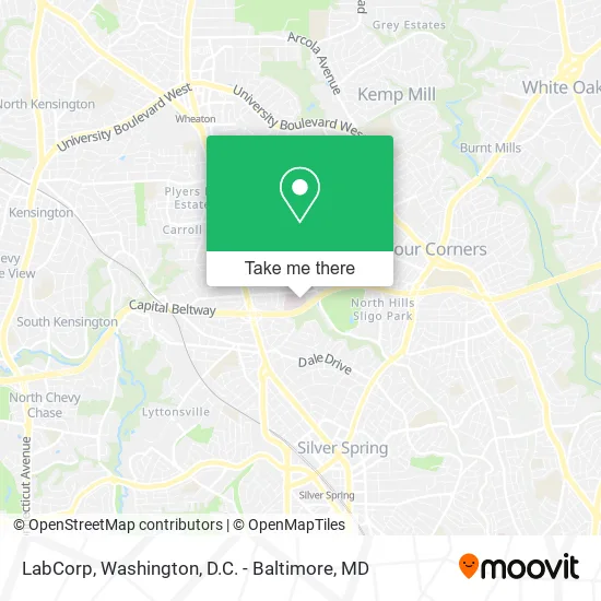
See LabCorp, Montgomery County, on the map
Public Transit to LabCorp in Montgomery County
Wondering how to get to LabCorp in Montgomery County? Moovit helps you find the best way to get to LabCorp with step-by-step directions from the nearest public transit station.
Moovit provides free maps and live directions to help you navigate through your city. View schedules, routes, timetables, and find out how long does it take to get to LabCorp in real time.
Looking for the nearest stop or station to LabCorp? Check out this list of stops closest to your destination: Forest Glen Rd & Sligo Creek; Forest Grove Dr & Forest Glen Rd; Wheaton Metro Station; Silver Spring Marc Wb.
Bus: 8, M20, 7.Train: MARC.Metro: RED.
Want to see if there’s another route that gets you there at an earlier time? Moovit helps you find alternative routes or times. Get directions from and directions to LabCorp easily from the Moovit App or Website.
We make riding to LabCorp easy, which is why over 1.5 million users, including users in Montgomery County, trust Moovit as the best app for public transit. You don’t need to download an individual bus app or train app, Moovit is your all-in-one transit app that helps you find the best bus time or train time available.
For information on prices of bus and metro, costs and ride fares to LabCorp, please check the Moovit app.
Use the app to navigate to popular places including to the airport, hospital, stadium, grocery store, mall, coffee shop, school, college, and university.
LabCorp Address: 1400 Forest Glen Rd Silver Spring, MD 20910 street in Montgomery County
- Holy Cross Emergency Room,
- Holy Cross Hospital MD USA,
- Beltway Exit 31,
- Zion Home Remodeling,
- Sligo Golf Course,
- Exit 31 - MD 97 (Georgia Ave) / Wheaton, Silver Spring,
- Siena School,
- Calvary, Silver Spring,
- Margaret Richey Design Sense,
- Forest Glen Station,
- Aldi,
- Forest Glen Metro,
- Sligo Creek Park,
- Milk & Honey - Silver Spring,
- Little Free Library,
- Bethesda Metro Center,
- Wheaton Branch Stormwater Management Pond 1,
- Dennis Avenue Health Center (Montgomery County Local Health Department),
- Dennis Avenue Health Center,
- Wheaton Mall
Places Near LabCorp (Montgomery County)
- The Anthem, Washington,
- Warner Theatre, Washington,
- Amazon Hq2, Arlington County,
- Westfield Montgomery Mall, Montgomery County,
- Basilica of the National Shrine, Washington,
- Camden Yards, Baltimore,
- Sibley Memorial Hospital, Washington,
- National Theatre, Washington,
- Washington National Cathedral, Washington,
- Museum Of The Bible, Washington,
- M&T Bank Stadium, Baltimore,
- Pennsylvania Ave NW (3rd st and pennsylvania), Washington,
- Marriott Marquis Washington, DC, Washington,
- Georgetown, Washington,
- Capital One Arena, Washington,
- Washington DC VA Medical Center, Washington,
- PG Mall, Prince George's County,
- National Museum of African American History and Culture, Washington,
- National Zoo, Washington,
- Rock Creek Tennis Center, Washington
How to get to popular places in Washington, D.C. - Baltimore, MD with public transit
Get around Montgomery County by public transit!
Traveling around Montgomery County has never been so easy. See step by step directions as you travel to any attraction, street or major public transit station. View bus and train schedules, arrival times, service alerts and detailed routes on a map, so you know exactly how to get to anywhere in Montgomery County.
When traveling to any destination around Montgomery County use Moovit's Live Directions with Get Off Notifications to know exactly where and how far to walk, how long to wait for your line, and how many stops are left. Moovit will alert you when it's time to get off — no need to constantly re-check whether yours is the next stop.
Wondering how to use public transit in Montgomery County or how to pay for public transit in Montgomery County? Moovit public transit app can help you navigate your way with public transit easily, and at minimum cost. It includes public transit fees, ticket prices, and costs. Looking for a map of Montgomery County public transit lines? Moovit public transit app shows all public transit maps in Montgomery County with all Bus, Train, Metro, Light Rail and Ferry routes and stops on an interactive map.
Washington, D.C. - Baltimore, MD has 5 transit type(s), including: Bus, Train, Metro, Light Rail and Ferry, operated by several transit agencies, including WMATA, Montgomery County Ride On, Fairfax Connector, TheBus, PRTC, DASH - Alexandria, Arlington Transit (ART), RTA of Central Maryland, MDOT MTA, MDOT MTA Light RailLink, MDOT MTA Commuter Bus, MDOT MTA Local Bus, FXBGO!, Virginia Railway Express (VRE) and MARC