How to get to LabCorp by bus?
Click on the bus route to see step by step directions with maps, line arrival times and updated time schedules.
From Western High School, Baltimore
42 minFrom Johns Hopkins University, Baltimore
55 minFrom Baltimore Poly Tech High School, Baltimore
43 minFrom Loyola University Maryland, Baltimore
49 minFrom I-83 Exit 16 (Timonium Road), Baltimore County
90 minFrom I-695 @ Exit 26 (York Rd/MD 45), Baltimore County
62 minFrom Owings Mills, Maryland, Baltimore County
25 minFrom Baltimore Museum Of Art, Baltimore
61 minFrom Medstar Union Memorial Hospital, Baltimore
53 minFrom The Maryland Zoo In Baltimore, Baltimore
33 min
How to get to LabCorp by metro?
Click on the metro route to see step by step directions with maps, line arrival times and updated time schedules.
Bus stops near LabCorp in Baltimore County
Metro station near LabCorp in Baltimore County
- Old Court Metro, 25 min walk,VIEW
Bus lines to LabCorp in Baltimore County
What are the closest stations to LabCorp?
The closest stations to LabCorp are:
- Reisterstown Rd & Mchenry Ave Sb is 59 yards away, 1 min walk.
- Old Court Rd & Reisterstown Rd Eb is 189 yards away, 3 min walk.
- Old Court Metro is 2080 yards away, 25 min walk.
Which bus lines stop near LabCorp?
These bus lines stop near LabCorp: 83, 89.
Which metro line stops near LabCorp?
METRO (Towards John Hopkins)
What’s the nearest metro station to LabCorp in Baltimore County?
The nearest metro station to LabCorp in Baltimore County is Old Court Metro. It’s a 25 min walk away.
What’s the nearest bus station to LabCorp in Baltimore County?
The nearest bus station to LabCorp in Baltimore County is Reisterstown Rd & Mchenry Ave Sb. It’s a 1 min walk away.
What time is the first metro to LabCorp in Baltimore County?
The METRO is the first metro that goes to LabCorp in Baltimore County. It stops nearby at 3:45 AM.
What time is the last metro to LabCorp in Baltimore County?
The METRO is the last metro that goes to LabCorp in Baltimore County. It stops nearby at 12:26 AM.
What time is the first bus to LabCorp in Baltimore County?
The 83 is the first bus that goes to LabCorp in Baltimore County. It stops nearby at 4:08 AM.
What time is the last bus to LabCorp in Baltimore County?
The 83 is the last bus that goes to LabCorp in Baltimore County. It stops nearby at 2:14 AM.
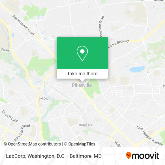
See LabCorp, Baltimore County, on the map
Public Transit to LabCorp in Baltimore County
Wondering how to get to LabCorp in Baltimore County? Moovit helps you find the best way to get to LabCorp with step-by-step directions from the nearest public transit station.
Moovit provides free maps and live directions to help you navigate through your city. View schedules, routes, timetables, and find out how long does it take to get to LabCorp in real time.
Looking for the nearest stop or station to LabCorp? Check out this list of stops closest to your destination: Reisterstown Rd & Mchenry Ave Sb; Old Court Rd & Reisterstown Rd Eb; Old Court Metro.
Bus: 83, 89, 92.Metro: METRO.
Want to see if there’s another route that gets you there at an earlier time? Moovit helps you find alternative routes or times. Get directions from and directions to LabCorp easily from the Moovit App or Website.
We make riding to LabCorp easy, which is why over 1.5 million users, including users in Baltimore County, trust Moovit as the best app for public transit. You don’t need to download an individual bus app or train app, Moovit is your all-in-one transit app that helps you find the best bus time or train time available.
For information on prices of bus, light rail and metro, costs and ride fares to LabCorp, please check the Moovit app.
Use the app to navigate to popular places including to the airport, hospital, stadium, grocery store, mall, coffee shop, school, college, and university.
LabCorp Address: 19 Walker Ave Pikesville, MD 21208 street in Baltimore County
- Mindcypress,
- Mileone's Elizabeth Erwin,
- Big al,
- Elite Realty,
- DF Medspa,
- Maryland State Police Headquarters,
- Senior Assisted Housing,
- Chainbot Solutions,
- Dive Staffing Services,
- Creditsweepersllc,
- Ava Barron-Shasho, LCSW-C, Acc,
- Penny Green,
- Main Squeeze,
- Maryland Ambulance Service Collections,
- Zephoria,
- Gold & Diamond Appraisal PCGS,
- Amazon Locker-Vulcano,
- Pikes Thrift Store,
- Connected Teletherapy,
- Adt Security Services
Places Near LabCorp (Baltimore County)
- Capital One Arena, Washington,
- Camden Yards, Baltimore,
- Westfield Montgomery Mall, Montgomery County,
- Basilica of the National Shrine, Washington,
- Georgetown, Washington,
- Sibley Memorial Hospital, Washington,
- National Mall, Washington,
- Amazon Hq2, Arlington County,
- The Anthem, Washington,
- PG Mall, Prince George's County,
- Warner Theatre, Washington,
- Rock Creek Tennis Center, Washington,
- M&T Bank Stadium, Baltimore,
- Museum Of The Bible, Washington,
- Marriott Marquis Washington, DC, Washington,
- Washington National Cathedral, Washington,
- Washington DC VA Medical Center, Washington,
- Pennsylvania Ave NW (3rd st and pennsylvania), Washington,
- National Zoo, Washington,
- National Museum of African American History and Culture, Washington
How to get to popular places in Washington, D.C. - Baltimore, MD with public transit
Get around Baltimore County by public transit!
Traveling around Baltimore County has never been so easy. See step by step directions as you travel to any attraction, street or major public transit station. View bus and train schedules, arrival times, service alerts and detailed routes on a map, so you know exactly how to get to anywhere in Baltimore County.
When traveling to any destination around Baltimore County use Moovit's Live Directions with Get Off Notifications to know exactly where and how far to walk, how long to wait for your line, and how many stops are left. Moovit will alert you when it's time to get off — no need to constantly re-check whether yours is the next stop.
Wondering how to use public transit in Baltimore County or how to pay for public transit in Baltimore County? Moovit public transit app can help you navigate your way with public transit easily, and at minimum cost. It includes public transit fees, ticket prices, and costs. Looking for a map of Baltimore County public transit lines? Moovit public transit app shows all public transit maps in Baltimore County with all Bus, Train, Metro, Light Rail and Ferry routes and stops on an interactive map.
Washington, D.C. - Baltimore, MD has 5 transit type(s), including: Bus, Train, Metro, Light Rail and Ferry, operated by several transit agencies, including WMATA, Montgomery County Ride On, Fairfax Connector, TheBus, PRTC, DASH - Alexandria, Arlington Transit (ART), RTA of Central Maryland, MDOT MTA, MDOT MTA Light RailLink, MDOT MTA Commuter Bus, MDOT MTA Local Bus, FXBGO!, Virginia Railway Express (VRE) and MARC