Directions to Lab Computers (West Hempstead) with public transportation
The following transit lines have routes that pass near Lab Computers
 Bus: N31, N6, N6X, N32.
- Train: HEMPSTEAD BRANCH, WEST HEMPSTEAD BRANCH.
How to get to Lab Computers by bus?
Click on the bus route to see step by step directions with maps, line arrival times and updated time schedules.
From North Shore Hospital, Manhasset
52 minFrom Roy Wilkins Park, Queens
66 minFrom Saint Albans, NY, Queens
58 minFrom Walmart, Queens
67 minFrom Long Island Jewish Hospital, Queens
54 minFrom DMV Jamaica Nys, Queens
56 minFrom North Shore Towers, Queens
48 minFrom Manhasset, NY, Manhasset
67 minFrom Queens Village, Queens
46 minFrom DMV, Queens
87 min
How to get to Lab Computers by train?
Click on the train route to see step by step directions with maps, line arrival times and updated time schedules.
Bus stops near Lab Computers in West Hempstead
Train stations near Lab Computers in West Hempstead
Bus lines to Lab Computers in West Hempstead
What are the closest stations to Lab Computers?
The closest stations to Lab Computers are:
- Brooklyn Av / Hempstead is 136 yards away, 2 min walk.
- Cherry Val Av / Hempstead is 501 yards away, 7 min walk.
- Hempstead Ave + Wilson St. is 530 yards away, 7 min walk.
- Hempstead Gardens is 983 yards away, 12 min walk.
- Nassau Boulevard is 3451 yards away, 41 min walk.
Which bus lines stop near Lab Computers?
These bus lines stop near Lab Computers: N31, N6, N6X.
Which train lines stop near Lab Computers?
These train lines stop near Lab Computers: HEMPSTEAD BRANCH, WEST HEMPSTEAD BRANCH.
What’s the nearest train station to Lab Computers in West Hempstead?
The nearest train station to Lab Computers in West Hempstead is Hempstead Gardens. It’s a 12 min walk away.
What’s the nearest bus station to Lab Computers in West Hempstead?
The nearest bus station to Lab Computers in West Hempstead is Brooklyn Av / Hempstead. It’s a 2 min walk away.
What time is the first train to Lab Computers in West Hempstead?
The HEMPSTEAD BRANCH is the first train that goes to Lab Computers in West Hempstead. It stops nearby at 3:19 AM.
What time is the last train to Lab Computers in West Hempstead?
The HEMPSTEAD BRANCH is the last train that goes to Lab Computers in West Hempstead. It stops nearby at 3:22 AM.
What time is the first bus to Lab Computers in West Hempstead?
The N6 is the first bus that goes to Lab Computers in West Hempstead. It stops nearby at 3:13 AM.
What time is the last bus to Lab Computers in West Hempstead?
The N6 is the last bus that goes to Lab Computers in West Hempstead. It stops nearby at 2:49 AM.
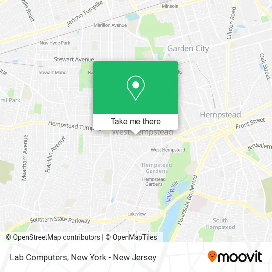
See Lab Computers, West Hempstead, on the map
Public Transit to Lab Computers in West Hempstead
Wondering how to get to Lab Computers in West Hempstead? Moovit helps you find the best way to get to Lab Computers with step-by-step directions from the nearest public transit station.
Moovit provides free maps and live directions to help you navigate through your city. View schedules, routes, timetables, and find out how long does it take to get to Lab Computers in real time.
Looking for the nearest stop or station to Lab Computers? Check out this list of stops closest to your destination: Brooklyn Av / Hempstead; Cherry Val Av / Hempstead; Hempstead Ave + Wilson St.; Hempstead Gardens; Nassau Boulevard.
Bus: N31, N6, N6X, N32.Train: HEMPSTEAD BRANCH, WEST HEMPSTEAD BRANCH.
Want to see if there’s another route that gets you there at an earlier time? Moovit helps you find alternative routes or times. Get directions from and directions to Lab Computers easily from the Moovit App or Website.
We make riding to Lab Computers easy, which is why over 1.5 million users, including users in West Hempstead, trust Moovit as the best app for public transit. You don’t need to download an individual bus app or train app, Moovit is your all-in-one transit app that helps you find the best bus time or train time available.
For information on prices of bus and train, costs and ride fares to Lab Computers, please check the Moovit app.
Use the app to navigate to popular places including to the airport, hospital, stadium, grocery store, mall, coffee shop, school, college, and university.
Lab Computers Address: 357 Hempstead Tpke street in West Hempstead
- I Lock New York,
- William P Graham: Primerica - Financial Services,
- Neva Chung: Primerica - Financial Services,
- Hudusa,
- Aboff's Paints,
- J & J Insurance Agency,
- Sara Salon & Spa,
- Savage Sounds Recording Studios,
- Helene Kaplan,
- Studio Strength,
- Enjoy Foot Spa Inc,
- Taylor Made Homecare Agency,
- Aboff's Paints,
- Alpha Tech Lending,
- Froyo_Zone West Hempstead,
- Jiffy Lube,
- Fire Island News,
- What Better Looks Like,
- Pizza Hut Express,
- The Neurospicy Ceo
Places Near Lab Computers (West Hempstead)
- Chinatown, Manhattan,
- Wall Street, Manhattan,
- 376 Hudson Street, Manhattan,
- Mountainside Hospital, Glen Ridge,
- Hudson Yards, Manhattan,
- Queens Center Mall, Queens,
- 26 Federal Plaza, Manhattan,
- 1 Police Plaza, Manhattan,
- SoHo, Manhattan,
- Katz's Deli, Manhattan,
- Bellevue Hospital, Manhattan,
- 3 Stone St, Manhattan,
- Pier 83, Manhattan,
- 111 Centre New York City Supreme Court, Manhattan,
- Rockefeller Center, Manhattan,
- San Gennaro Feast, Manhattan,
- Times Square, Manhattan,
- 66 John Street, Manhattan,
- qqqq, Manhattan,
- 911 Memorial, Manhattan
How to get to popular places in New York - New Jersey with public transit
Get around West Hempstead by public transit!
Traveling around West Hempstead has never been so easy. See step by step directions as you travel to any attraction, street or major public transit station. View bus and train schedules, arrival times, service alerts and detailed routes on a map, so you know exactly how to get to anywhere in West Hempstead.
When traveling to any destination around West Hempstead use Moovit's Live Directions with Get Off Notifications to know exactly where and how far to walk, how long to wait for your line, and how many stops are left. Moovit will alert you when it's time to get off — no need to constantly re-check whether yours is the next stop.
Wondering how to use public transit in West Hempstead or how to pay for public transit in West Hempstead? Moovit public transit app can help you navigate your way with public transit easily, and at minimum cost. It includes public transit fees, ticket prices, and costs. Looking for a map of West Hempstead public transit lines? Moovit public transit app shows all public transit maps in West Hempstead with all Bus, Train, Subway, Light Rail, Ferry and Cable Car routes and stops on an interactive map.
New York - New Jersey has 6 transit type(s), including: Bus, Train, Subway, Light Rail, Ferry and Cable Car, operated by several transit agencies, including MTA Subway, Metro-North Railroad, LIRR, PATH, MTA New York City Transit - Express routes, MTA Bus, NJ Transit, NYC Ferry, NICE bus, Bee-Line Bus, NJ Transit Rail, Norwalk Transit District, Hartford Line, River Valley Transit and HART