How to get to Labamba One by bus?
Click on the bus route to see step by step directions with maps, line arrival times and updated time schedules.
From Consulate General of Brazil, Miami
58 minFrom Mall Of The Americas, North Westside
67 minFrom Four Seasons Hotel Miami, Miami
52 minFrom Ocean Reef Suites Miami Beach FL USA, Miami Beach
55 minFrom Mall Of The Americas Food Court, North Westside
68 minFrom Lorraine Hotel, Miami Beach
61 minFrom Vizcaya Metrorail Station, Miami
39 minFrom Doral Voice, North Westside
61 minFrom Consulado General de Honduras en Miami, Miami
68 minFrom Doral, Miami Beach
62 min
How to get to Labamba One by train?
Click on the train route to see step by step directions with maps, line arrival times and updated time schedules.
Bus stops near Labamba One in Miami
Train station near Labamba One in Miami
- Civic Center Station, 15 min walk,VIEW
Bus lines to Labamba One in Miami
What are the closest stations to Labamba One?
The closest stations to Labamba One are:
- Nw 20 St & Nw 18 Av is 284 yards away, 4 min walk.
- Nw 17 Av & Nw 21 Te is 306 yards away, 5 min walk.
- Civic Center Station is 1253 yards away, 15 min walk.
Which bus lines stop near Labamba One?
These bus lines stop near Labamba One: 17, 20, 32, MIAALP.
Which train line stops near Labamba One?
ORANGE (Dadeland South Stat.rail Northbound→MIA Northbound)
What’s the nearest train station to Labamba One in Miami?
The nearest train station to Labamba One in Miami is Civic Center Station. It’s a 15 min walk away.
What’s the nearest bus station to Labamba One in Miami?
The nearest bus station to Labamba One in Miami is Nw 20 St & Nw 18 Av. It’s a 4 min walk away.
What time is the first train to Labamba One in Miami?
The ORANGE is the first train that goes to Labamba One in Miami. It stops nearby at 5:08 AM.
What time is the last train to Labamba One in Miami?
The GREEN is the last train that goes to Labamba One in Miami. It stops nearby at 12:37 AM.
What time is the first bus to Labamba One in Miami?
The 17 is the first bus that goes to Labamba One in Miami. It stops nearby at 4:15 AM.
What time is the last bus to Labamba One in Miami?
The 17 is the last bus that goes to Labamba One in Miami. It stops nearby at 1:26 AM.
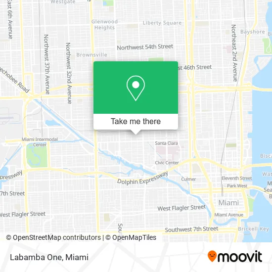
See Labamba One, Miami, on the map
Public Transit to Labamba One in Miami
Wondering how to get to Labamba One in Miami? Moovit helps you find the best way to get to Labamba One with step-by-step directions from the nearest public transit station.
Moovit provides free maps and live directions to help you navigate through your city. View schedules, routes, timetables, and find out how long does it take to get to Labamba One in real time.
Looking for the nearest stop or station to Labamba One? Check out this list of stops closest to your destination: Nw 20 St & Nw 18 Av; Nw 17 Av & Nw 21 Te; Civic Center Station.
Bus: 17, 20, 32, MIAALP.Train: ORANGE, GREEN.
Want to see if there’s another route that gets you there at an earlier time? Moovit helps you find alternative routes or times. Get directions from and directions to Labamba One easily from the Moovit App or Website.
We make riding to Labamba One easy, which is why over 1.5 million users, including users in Miami, trust Moovit as the best app for public transit. You don’t need to download an individual bus app or train app, Moovit is your all-in-one transit app that helps you find the best bus time or train time available.
For information on prices of bus and train, costs and ride fares to Labamba One, please check the Moovit app.
Use the app to navigate to popular places including to the airport, hospital, stadium, grocery store, mall, coffee shop, school, college, and university.
Labamba One Address: 1810 NW 21st Ter Miami, FL 33142 street in Miami
- Heydi Lorena Juarez,
- Papi's Crepe,
- Jesus Rojas,
- Bright Passion Corve,
- Waldemar Santiago,
- Dominican Chimi,
- Rainbow Fish,
- Los Lobos de Mantilla,
- Al Natural,
- New York Stile,
- Flamingo Ice Cream,
- Date Aqui Grill,
- Babilonia Miami,
- Podio Energy Drink,
- Gula Texas Smokehouse,
- M & L Soul Food Kitchen,
- FRM Ashe,
- Arianna Gonzalez Pando,
- Mama Dee's,
- Tropical International Flavor
Places Near Labamba One (Miami)
- Miami Freedom Park, Miami,
- Keiser University Flagship Campus, West Palm Beach,
- Port of Miami Cruise Terminal, Miami,
- 1351 NW 12th St, Miami,
- Dolphin Mall, Miami,
- Wynwood, Miami,
- Little Havana, Miami,
- Richard E. Gerstein Justice Building, Miami,
- Miami Design District, Miami,
- Zoo Miami, Miami,
- Sawgrass mall ( FL ), Miami Beach,
- Bayside Marketplace, Miami,
- Marlins Park, Miami,
- Sawgrass Mall, Miami,
- Aventura Mall, Miami,
- Brickell City Centre, Miami,
- Aventura Mall, Miami Beach,
- Dolphin Mall Bus, Miami,
- Miami-Dade County Courthouse, Miami,
- Hard Rock Stadium, Miami Gardens
How to get to popular places in Miami with public transit
Get around Miami by public transit!
Traveling around Miami has never been so easy. See step by step directions as you travel to any attraction, street or major public transit station. View bus and train schedules, arrival times, service alerts and detailed routes on a map, so you know exactly how to get to anywhere in Miami.
When traveling to any destination around Miami use Moovit's Live Directions with Get Off Notifications to know exactly where and how far to walk, how long to wait for your line, and how many stops are left. Moovit will alert you when it's time to get off — no need to constantly re-check whether yours is the next stop.
Wondering how to use public transit in Miami or how to pay for public transit in Miami? Moovit public transit app can help you navigate your way with public transit easily, and at minimum cost. It includes public transit fees, ticket prices, and costs. Looking for a map of Miami public transit lines? Moovit public transit app shows all public transit maps in Miami with all Bus, Train, Light Rail and Ferry routes and stops on an interactive map.
Miami has 4 transit type(s), including: Bus, Train, Light Rail and Ferry, operated by several transit agencies, including Broward County Transit, Miami-Dade Transit, Metrorail, Palm Tran, Tri-Rail, Brightline, MARTY, City of Homestead Trolley, Key West Transit, Treasure Coast Connector, GoLine IRT, Amtrak, Greyhound-us, FlixBus-us and Aventura Express Shuttle Bus