How to get to Labcorp by bus?
Click on the bus route to see step by step directions with maps, line arrival times and updated time schedules.
From Nova Southeastern University, Davie
63 minFrom Florida Memorial University, Miami
117 minFrom 595 Express, Davie
83 minFrom Uline Shipping Supplies - Sales Office, Davie
82 minFrom Griffin Road And 441, Hollywood
45 minFrom MIAMI hurricanes Game, Miami
80 minFrom Yellow Green Farmers Market, Hollywood
53 minFrom St Thomas University, Miami
73 minFrom Yellow Green Farmers Market, Hollywood
57 minFrom Intersection I 95 & Sheridan St, Hollywood
76 min
Bus stop near Labcorp in Miramar-Pembroke Pines
- Pines Boulevard/Douglas Road - Walgreen, 4 min walk,VIEW
Bus lines to Labcorp in Miramar-Pembroke Pines
- 07, Young Circle Via Century Village,VIEW
What are the closest stations to Labcorp?
The closest stations to Labcorp are:
- Pines Boulevard/Douglas Road - Walgreen is 316 yards away, 4 min walk.
Which bus lines stop near Labcorp?
These bus lines stop near Labcorp: 02, 07.
What’s the nearest bus station to Labcorp in Miramar-Pembroke Pines?
The nearest bus station to Labcorp in Miramar-Pembroke Pines is Pines Boulevard/Douglas Road - Walgreen. It’s a 4 min walk away.
What time is the first bus to Labcorp in Miramar-Pembroke Pines?
The 07 is the first bus that goes to Labcorp in Miramar-Pembroke Pines. It stops nearby at 4:56 AM.
What time is the last bus to Labcorp in Miramar-Pembroke Pines?
The 07 is the last bus that goes to Labcorp in Miramar-Pembroke Pines. It stops nearby at 11:21 PM.
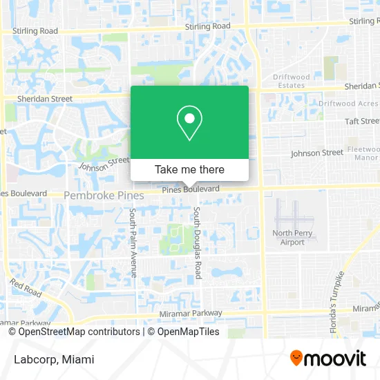
See Labcorp, Miramar-Pembroke Pines, on the map
Public Transit to Labcorp in Miramar-Pembroke Pines
Wondering how to get to Labcorp in Miramar-Pembroke Pines? Moovit helps you find the best way to get to Labcorp with step-by-step directions from the nearest public transit station.
Moovit provides free maps and live directions to help you navigate through your city. View schedules, routes, timetables, and find out how long does it take to get to Labcorp in real time.
Looking for the nearest stop or station to Labcorp? Check out this list of stops closest to your destination: Pines Boulevard/Douglas Road - Walgreen.
Bus: 02, 07.
Want to see if there’s another route that gets you there at an earlier time? Moovit helps you find alternative routes or times. Get directions from and directions to Labcorp easily from the Moovit App or Website.
We make riding to Labcorp easy, which is why over 1.7 million users, including users in Miramar-Pembroke Pines, trust Moovit as the best app for public transit. You don’t need to download an individual bus app or train app, Moovit is your all-in-one transit app that helps you find the best bus time or train time available.
For information on prices of bus and train, costs and ride fares to Labcorp, please check the Moovit app.
Use the app to navigate to popular places including to the airport, hospital, stadium, grocery store, mall, coffee shop, school, college, and university.
Labcorp Address: 9005 Pines Blvd street in Miramar-Pembroke Pines
- Miami International Boat Show,
- Pines Middle School,
- Dr. Patch-Ovens,
- Hollybrook Golf And Tennis Club,
- S Palm Ave / Pines Blvd,
- Octapharma Plasma,
- Micasita Panaderia Colombiana (Mi Casita Bakery),
- Iglesia San Bonifacio,
- Colombia Mia Dance Studio,
- Johnson St / N Palm Ave,
- Fahari Detailing,
- Pembroke Rd & Douglas Rd.,
- BMO Harris Bank,
- Salud Wellness Products,
- Almadi Beauty,
- South Florida State Hospital,
- Maya Physical Therapy,
- Somerset Academy Central Miramar,
- Sally Beauty Supply,
- Fifth Third Bank & ATM
Places Near Labcorp (Miramar-Pembroke Pines)
- Keiser University Flagship Campus, West Palm Beach,
- Zoo Miami, Miami,
- Miami-Dade County Courthouse, Miami,
- Little Havana, Miami,
- Hard Rock Stadium, Miami Gardens,
- Miami Freedom Park, Miami,
- Port of Miami Cruise Terminal, Miami,
- Bayside Marketplace, Miami,
- Aventura Mall, Miami Beach,
- Wynwood, Miami,
- Miami Design District, Miami,
- Marlins Park, Miami,
- Richard E. Gerstein Justice Building, Miami,
- Miami VA Hospital, Miami,
- Sawgrass mall ( FL ), Miami Beach,
- Aventura Mall, Miami,
- Brickell City Centre, Miami,
- Dolphin Mall, Miami,
- Sawgrass Mall, Miami,
- Dolphin Mall Bus, Miami
How to get to popular places in Miami with public transit
Get around Miramar-Pembroke Pines by public transit!
Traveling around Miramar-Pembroke Pines has never been so easy. See step by step directions as you travel to any attraction, street or major public transit station. View bus and train schedules, arrival times, service alerts and detailed routes on a map, so you know exactly how to get to anywhere in Miramar-Pembroke Pines.
When traveling to any destination around Miramar-Pembroke Pines use Moovit's Live Directions with Get Off Notifications to know exactly where and how far to walk, how long to wait for your line, and how many stops are left. Moovit will alert you when it's time to get off — no need to constantly re-check whether yours is the next stop.
Wondering how to use public transit in Miramar-Pembroke Pines or how to pay for public transit in Miramar-Pembroke Pines? Moovit public transit app can help you navigate your way with public transit easily, and at minimum cost. It includes public transit fees, ticket prices, and costs. Looking for a map of Miramar-Pembroke Pines public transit lines? Moovit public transit app shows all public transit maps in Miramar-Pembroke Pines with all Bus, Train, Light Rail and Ferry routes and stops on an interactive map.
Miami has 4 transit type(s), including: Bus, Train, Light Rail and Ferry, operated by several transit agencies, including Broward County Transit, Miami-Dade Transit, Metrorail, Palm Tran, Tri-Rail, Brightline, MARTY, City of Homestead Trolley, Key West Transit, Treasure Coast Connector, GoLine IRT, Amtrak, Greyhound-us, FlixBus-us and Aventura Express Shuttle Bus