How to get to Labcorp by bus?
Click on the bus route to see step by step directions with maps, line arrival times and updated time schedules.
From 32-20 northern blvd, Queens
118 minFrom North Bergen, NJ, North Bergen
68 minFrom E 87th St, Manhattan
106 minFrom Museo Americano de Historia Natural, Manhattan
90 minFrom East 57 St, Manhattan
95 minFrom Guggenheim Museum, Manhattan
107 minFrom Naumburg Bandshell, Central Park, Manhattan
96 minFrom Consulado General Central de Colombia, Manhattan
67 minFrom Upper East Side, Manhattan
102 minFrom New Jersey/New York border - Lincoln Tunnel crossing, Manhattan
78 min
How to get to Labcorp by train?
Click on the train route to see step by step directions with maps, line arrival times and updated time schedules.
Bus stops near Labcorp in Jersey City
Light Rail stations near Labcorp in Jersey City
- Essex Street Light Rail Station, 12 min walk,VIEW
Train station near Labcorp in Jersey City
- Grove Street, 17 min walk,VIEW
Ferry station near Labcorp in Jersey City
- Liberty Harbor, 24 min walk,VIEW
Bus lines to Labcorp in Jersey City
- 9, Montgomery St West Side Ave Newport Mall,VIEW
- 16, Journal Square,VIEW
- 63, X Lakewood Express To Union Hill Park Ride,VIEW
- 64, Weehawken Hoboken,VIEW
- 68, Weehawken Via Exchange Pl Via Hoboken,VIEW
- 80, Gates Ave Via Journal Sq,VIEW
- 81, L Bayonne Local,VIEW
- 82, Union City Summit & Hague St,VIEW
- 86, Newport Mall,VIEW
- 206, Jersey City - Parkway Express,VIEW
- 1, Newark 6th St,VIEW
What are the closest stations to Labcorp?
The closest stations to Labcorp are:
- C Columbus Drive at Grove St is 61 yards away, 1 min walk.
- Warren Street 231 is 292 yards away, 4 min walk.
- Essex Street Light Rail Station is 938 yards away, 12 min walk.
- Grove Street is 1380 yards away, 17 min walk.
- Liberty Harbor is 2034 yards away, 24 min walk.
Which bus lines stop near Labcorp?
These bus lines stop near Labcorp: 119, 80, 86.
Which train lines stop near Labcorp?
These train lines stop near Labcorp: RED, YEL.
Which light rail line stops near Labcorp?
HBLR (Liberty State Park-Ride Light Rail Sta)
Which ferry line stops near Labcorp?
PAULUS HOOK - MIDTOWN / W 39TH ST (Paulus Hook)
What’s the nearest light rail station to Labcorp in Jersey City?
The nearest light rail station to Labcorp in Jersey City is Essex Street Light Rail Station. It’s a 12 min walk away.
What’s the nearest train station to Labcorp in Jersey City?
The nearest train station to Labcorp in Jersey City is Grove Street. It’s a 17 min walk away.
What’s the nearest bus station to Labcorp in Jersey City?
The nearest bus station to Labcorp in Jersey City is C Columbus Drive at Grove St. It’s a 1 min walk away.
What’s the nearest ferry station to Labcorp in Jersey City?
The nearest ferry station to Labcorp in Jersey City is Liberty Harbor. It’s a 24 min walk away.
What time is the first light rail to Labcorp in Jersey City?
The HBLR is the first light rail that goes to Labcorp in Jersey City. It stops nearby at 4:40 AM.
What time is the last light rail to Labcorp in Jersey City?
The HBLR is the last light rail that goes to Labcorp in Jersey City. It stops nearby at 2:19 AM.
What time is the first train to Labcorp in Jersey City?
The ATW is the first train that goes to Labcorp in Jersey City. It stops nearby at 3:14 AM.
What time is the last train to Labcorp in Jersey City?
The ATW is the last train that goes to Labcorp in Jersey City. It stops nearby at 3:14 AM.
What time is the first bus to Labcorp in Jersey City?
The 80 is the first bus that goes to Labcorp in Jersey City. It stops nearby at 4:44 AM.
What time is the last bus to Labcorp in Jersey City?
The 81 is the last bus that goes to Labcorp in Jersey City. It stops nearby at 1:03 AM.
What time is the first ferry to Labcorp in Jersey City?
The LIBERTY HARBOR - PIER 11 / WALL ST is the first ferry that goes to Labcorp in Jersey City. It stops nearby at 6:00 AM.
What time is the last ferry to Labcorp in Jersey City?
The LIBERTY HARBOR - PIER 11 / WALL ST is the last ferry that goes to Labcorp in Jersey City. It stops nearby at 7:12 PM.
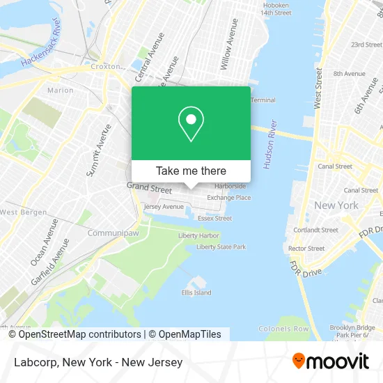
See Labcorp, Jersey City, on the map
Public Transit to Labcorp in Jersey City
Wondering how to get to Labcorp in Jersey City? Moovit helps you find the best way to get to Labcorp with step-by-step directions from the nearest public transit station.
Moovit provides free maps and live directions to help you navigate through your city. View schedules, routes, timetables, and find out how long does it take to get to Labcorp in real time.
Looking for the nearest stop or station to Labcorp? Check out this list of stops closest to your destination: C Columbus Drive at Grove St; Warren Street 231; Essex Street Light Rail Station; Grove Street; Liberty Harbor.
Bus: 119, 80, 86, 9, 16, 63, 64, 68, 1.Train: RED, YEL, ATW.Light Rail: HBLR.Ferry: PAULUS HOOK - MIDTOWN / W 39TH ST, LIBERTY HARBOR - PIER 11 / WALL ST.
Want to see if there’s another route that gets you there at an earlier time? Moovit helps you find alternative routes or times. Get directions from and directions to Labcorp easily from the Moovit App or Website.
We make riding to Labcorp easy, which is why over 1.5 million users, including users in Jersey City, trust Moovit as the best app for public transit. You don’t need to download an individual bus app or train app, Moovit is your all-in-one transit app that helps you find the best bus time or train time available.
For information on prices of bus, train, subway, light rail and ferry, costs and ride fares to Labcorp, please check the Moovit app.
Use the app to navigate to popular places including to the airport, hospital, stadium, grocery store, mall, coffee shop, school, college, and university.
Labcorp Address: 169 York St street in Jersey City
- Pinch-Hitter Professional Organizing & Productivity Solutions, Llc.,
- Dream Vista,
- Victory Hall Drawing Rooms,
- Above Grounds,
- The Olc School,
- Little Harbor Academy,
- Crypto Helpline,
- St. Peter Grammar School,
- Jersey City Fire Department,
- Dr. Reshma Shetty Dds,
- Riverhouse Extended Stay Apartments,
- Bluecrux Offices New Jersey,
- O'Keefe Commons,
- The Store at City Fire,
- Budget Rent A Car,
- The Village Soul Clinic,
- Little Man Parking - Gotham Garage,
- Avis,
- Jersey City Party Characters,
- Team 5438 - Technological Terrors
Places Near Labcorp (Jersey City)
- Wall Street, Manhattan,
- Times Square, Manhattan,
- Queens Center Mall, Queens,
- Rockefeller Center, Manhattan,
- 26 Federal Plaza, Manhattan,
- Katz's Deli, Manhattan,
- Bellevue Hospital, Manhattan,
- Mountainside Hospital, Glen Ridge,
- Pier 83, Manhattan,
- 376 Hudson Street, Manhattan,
- 1 Police Plaza, Manhattan,
- 66 John Street, Manhattan,
- Chinatown, Manhattan,
- 111 Centre New York City Supreme Court, Manhattan,
- qqqq, Manhattan,
- Hudson Yards, Manhattan,
- SoHo, Manhattan,
- 3 Stone St, Manhattan,
- 911 Memorial, Manhattan,
- San Gennaro Feast, Manhattan
How to get to popular places in New York - New Jersey with public transit
Get around Jersey City by public transit!
Traveling around Jersey City has never been so easy. See step by step directions as you travel to any attraction, street or major public transit station. View bus and train schedules, arrival times, service alerts and detailed routes on a map, so you know exactly how to get to anywhere in Jersey City.
When traveling to any destination around Jersey City use Moovit's Live Directions with Get Off Notifications to know exactly where and how far to walk, how long to wait for your line, and how many stops are left. Moovit will alert you when it's time to get off — no need to constantly re-check whether yours is the next stop.
Wondering how to use public transit in Jersey City or how to pay for public transit in Jersey City? Moovit public transit app can help you navigate your way with public transit easily, and at minimum cost. It includes public transit fees, ticket prices, and costs. Looking for a map of Jersey City public transit lines? Moovit public transit app shows all public transit maps in Jersey City with all Bus, Train, Subway, Light Rail, Ferry and Cable Car routes and stops on an interactive map.
New York - New Jersey has 6 transit type(s), including: Bus, Train, Subway, Light Rail, Ferry and Cable Car, operated by several transit agencies, including MTA Subway, Metro-North Railroad, LIRR, PATH, MTA New York City Transit - Express routes, MTA Bus, NJ Transit, NYC Ferry, NICE bus, Bee-Line Bus, NJ Transit Rail, Norwalk Transit District, Hartford Line, River Valley Transit and HART