How to get to Labcorp by bus?
Click on the bus route to see step by step directions with maps, line arrival times and updated time schedules.
From Gunnison Beach, Highlands
156 minFrom Perth Amboy, NJ, Perth Amboy
161 minFrom Freehold, NJ, Freehold
54 minFrom Long Branch Beach & Boardwalk, Long Branch
211 minFrom Amdur Ambulatory Care Center, Neptune
134 minFrom Toms River, NJ, Toms River
58 minFrom Baps Shri Swaminarayan Mandir, Edison, NJ, USA, Edison
149 minFrom PNC Bank Arts Center, Holmdel
209 min
Bus stops near Labcorp in Lakewood
Bus lines to Labcorp in Lakewood
What are the closest stations to Labcorp?
The closest stations to Labcorp are:
- Lakewood - Rt 9 @ Pine St (Northbound) is 656 yards away, 8 min walk.
- Us-9 at Birch St is 798 yards away, 10 min walk.
- Central Ave at Freeman Rd# is 993 yards away, 12 min walk.
- Lakewood Bus Terminal is 1027 yards away, 13 min walk.
Which bus lines stop near Labcorp?
These bus lines stop near Labcorp: 139, 559.
What’s the nearest bus station to Labcorp in Lakewood?
The nearest bus station to Labcorp in Lakewood is Lakewood - Rt 9 @ Pine St (Northbound). It’s a 8 min walk away.
What time is the first bus to Labcorp in Lakewood?
The 559 is the first bus that goes to Labcorp in Lakewood. It stops nearby at 3:34 AM.
What time is the last bus to Labcorp in Lakewood?
The 559 is the last bus that goes to Labcorp in Lakewood. It stops nearby at 4:38 AM.
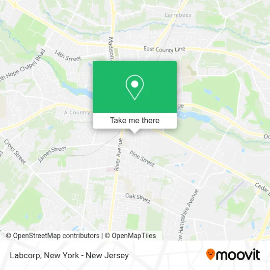
See Labcorp, Lakewood, on the map
Public Transit to Labcorp in Lakewood
Wondering how to get to Labcorp in Lakewood? Moovit helps you find the best way to get to Labcorp with step-by-step directions from the nearest public transit station.
Moovit provides free maps and live directions to help you navigate through your city. View schedules, routes, timetables, and find out how long does it take to get to Labcorp in real time.
Looking for the nearest stop or station to Labcorp? Check out this list of stops closest to your destination: Lakewood - Rt 9 @ Pine St (Northbound); Us-9 at Birch St; Central Ave at Freeman Rd#; Lakewood Bus Terminal.
Bus: 139, 559, 404, 317.
Want to see if there’s another route that gets you there at an earlier time? Moovit helps you find alternative routes or times. Get directions from and directions to Labcorp easily from the Moovit App or Website.
We make riding to Labcorp easy, which is why over 1.5 million users, including users in Lakewood, trust Moovit as the best app for public transit. You don’t need to download an individual bus app or train app, Moovit is your all-in-one transit app that helps you find the best bus time or train time available.
For information on prices of bus and train, costs and ride fares to Labcorp, please check the Moovit app.
Use the app to navigate to popular places including to the airport, hospital, stadium, grocery store, mall, coffee shop, school, college, and university.
Labcorp Address: 214 Martin Luther King Dr street in Lakewood
- Faith and Miracles Deliverance Ministry,
- The Chelsea at Brick,
- Lakewood Plaza I,
- Jads Construction Masonry and Pavers,
- Assouline Fany,
- Exclusive Luggage,
- Lauraton Village Nursing,
- Samba Care,
- Priority Auto Service Inc,
- Priority Auto Service,
- Samba at Home: Home Health Care In New Jersey | Home Care Services Agency In New Jersey,
- Gold Star Care,
- Nativ Usa,
- Imperial Eyewear,
- Valetine Raksin Od,
- Trabajos En Lakewood,
- Dbd Imperial, Llc,
- Samba at Home: Home Care In New Jersey,
- Chelsea Management,
- Papillon Gowns
Places Near Labcorp (Lakewood)
- 26 Federal Plaza, Manhattan,
- Hudson Yards, Manhattan,
- Bellevue Hospital, Manhattan,
- Rockefeller Center, Manhattan,
- Katz's Deli, Manhattan,
- Pier 83, Manhattan,
- 3 Stone St, Manhattan,
- 1 Police Plaza, Manhattan,
- qqqq, Manhattan,
- 376 Hudson Street, Manhattan,
- SoHo, Manhattan,
- 111 Centre New York City Supreme Court, Manhattan,
- Times Square, Manhattan,
- 911 Memorial, Manhattan,
- Wall Street, Manhattan,
- Chinatown, Manhattan,
- Mountainside Hospital, Glen Ridge,
- 66 John Street, Manhattan,
- Queens Center Mall, Queens,
- San Gennaro Feast, Manhattan
How to get to popular places in New York - New Jersey with public transit
Get around Lakewood by public transit!
Traveling around Lakewood has never been so easy. See step by step directions as you travel to any attraction, street or major public transit station. View bus and train schedules, arrival times, service alerts and detailed routes on a map, so you know exactly how to get to anywhere in Lakewood.
When traveling to any destination around Lakewood use Moovit's Live Directions with Get Off Notifications to know exactly where and how far to walk, how long to wait for your line, and how many stops are left. Moovit will alert you when it's time to get off — no need to constantly re-check whether yours is the next stop.
Wondering how to use public transit in Lakewood or how to pay for public transit in Lakewood? Moovit public transit app can help you navigate your way with public transit easily, and at minimum cost. It includes public transit fees, ticket prices, and costs. Looking for a map of Lakewood public transit lines? Moovit public transit app shows all public transit maps in Lakewood with all Bus, Train, Subway, Light Rail, Ferry and Cable Car routes and stops on an interactive map.
New York - New Jersey has 6 transit type(s), including: Bus, Train, Subway, Light Rail, Ferry and Cable Car, operated by several transit agencies, including MTA Subway, Metro-North Railroad, LIRR, PATH, MTA New York City Transit - Express routes, MTA Bus, NJ Transit, NYC Ferry, NICE bus, Bee-Line Bus, NJ Transit Rail, Norwalk Transit District, Hartford Line, River Valley Transit and HART