How to get to Labcorp by bus?
Click on the bus route to see step by step directions with maps, line arrival times and updated time schedules.
From Hillwood Estate, Museum & Gardens, Washington
85 minFrom Embassy Of Pakistan, Washington
74 minFrom College Park Marriott Hotel & Conference Center, Prince George's County
72 minFrom Days Inn Connecticut Ave, Washington
67 minFrom Exit 39 - MD 190 (River Road) / Potomac, Washington, Montgomery County
83 minFrom Westfield Montgomery (Montgomery Mall), Montgomery County
52 minFrom Rockville, MD, Montgomery County
52 minFrom Tenleytown, Washington
70 minFrom Avalon Theatre, Washington
62 min
How to get to Labcorp by train?
Click on the train route to see step by step directions with maps, line arrival times and updated time schedules.
How to get to Labcorp by metro?
Click on the metro route to see step by step directions with maps, line arrival times and updated time schedules.
Bus stops near Labcorp in Montgomery County
- Wheaton Plz Ring Rd Rd & Ring Rd, 4 min walk,VIEW
- Wheaton Station & Bay N, 5 min walk,VIEW
- Wheaton Station & Bay M, 5 min walk,VIEW
- Wheaton+Bay A, 5 min walk,VIEW
- Wheaton+Bay B, 5 min walk,VIEW
- Wheaton Station & Bay H, 5 min walk,VIEW
- Wheaton Station & Bay C, 5 min walk,VIEW
- Wheaton Station & Bay J, 5 min walk,VIEW
- Wheaton Station & Bay H & Bay K, 6 min walk,VIEW
- Wheaton Station & Bay G, 6 min walk,VIEW
- Wheaton Station & Bay F, 6 min walk,VIEW
Train station near Labcorp in Montgomery County
- Kensington Marc Wb, 38 min walk,VIEW
Metro station near Labcorp in Montgomery County
- Glenmont, 48 min walk,VIEW
Bus lines to Labcorp in Montgomery County
- 38, North Bethesda Via Holiday Park & Wheaton Plaza,VIEW
- 4, Wheaton Via Kensington,VIEW
- 37, Wheaton,VIEW
- M20, South To Silver Spring,VIEW
- M22, South To Bethesda,VIEW
- M12, East To Hyattsville Xing,VIEW
- 31, Wheaton,VIEW
- 40, Wheaton,VIEW
- 9, Silver Spring,VIEW
- 7, Forest Glen,VIEW
- 8, Silver Spring,VIEW
- 48, Wheaton,VIEW
- 34, Bethesda,VIEW
- 41, Aspen Hill Via Glenmont,VIEW
What are the closest stations to Labcorp?
The closest stations to Labcorp are:
- Wheaton Plz Ring Rd Rd & Ring Rd is 250 yards away, 4 min walk.
- Wheaton Station & Bay N is 336 yards away, 5 min walk.
- Wheaton Station & Bay M is 353 yards away, 5 min walk.
- Wheaton+Bay A is 361 yards away, 5 min walk.
- Wheaton+Bay B is 366 yards away, 5 min walk.
- Wheaton Station & Bay H is 383 yards away, 5 min walk.
- Wheaton Station & Bay C is 387 yards away, 5 min walk.
- Wheaton Station & Bay J is 396 yards away, 5 min walk.
- Wheaton Station & Bay H & Bay K is 413 yards away, 6 min walk.
- Wheaton Station & Bay G is 437 yards away, 6 min walk.
- Wheaton Station & Bay F is 456 yards away, 6 min walk.
- Kensington Marc Wb is 3238 yards away, 38 min walk.
- Glenmont is 4054 yards away, 48 min walk.
Which bus lines stop near Labcorp?
These bus lines stop near Labcorp: 37, 40, 9, M12, M20, M22.
Which train line stops near Labcorp?
MARC (Outbound - Washington)
Which metro line stops near Labcorp?
RED (Glenmont)
What’s the nearest bus station to Labcorp in Montgomery County?
The nearest bus station to Labcorp in Montgomery County is Wheaton Plz Ring Rd Rd & Ring Rd. It’s a 4 min walk away.
What time is the first metro to Labcorp in Montgomery County?
The RED is the first metro that goes to Labcorp in Montgomery County. It stops nearby at 5:00 AM.
What time is the last metro to Labcorp in Montgomery County?
The RED is the last metro that goes to Labcorp in Montgomery County. It stops nearby at 12:35 AM.
What time is the first train to Labcorp in Montgomery County?
The MARC is the first train that goes to Labcorp in Montgomery County. It stops nearby at 5:45 AM.
What time is the last train to Labcorp in Montgomery County?
The MARC is the last train that goes to Labcorp in Montgomery County. It stops nearby at 7:42 PM.
What time is the first bus to Labcorp in Montgomery County?
The 40 is the first bus that goes to Labcorp in Montgomery County. It stops nearby at 4:29 AM.
What time is the last bus to Labcorp in Montgomery County?
The M22 is the last bus that goes to Labcorp in Montgomery County. It stops nearby at 2:42 AM.
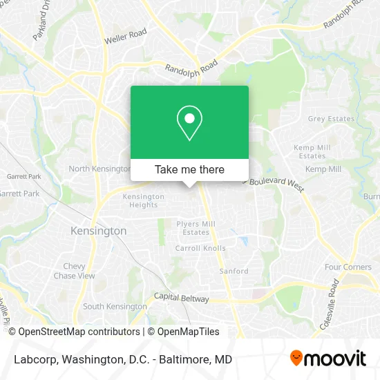
See Labcorp, Montgomery County, on the map
Public Transit to Labcorp in Montgomery County
Wondering how to get to Labcorp in Montgomery County? Moovit helps you find the best way to get to Labcorp with step-by-step directions from the nearest public transit station.
Moovit provides free maps and live directions to help you navigate through your city. View schedules, routes, timetables, and find out how long does it take to get to Labcorp in real time.
Looking for the nearest stop or station to Labcorp? Check out this list of stops closest to your destination: Wheaton Plz Ring Rd Rd & Ring Rd; Wheaton Station & Bay N; Wheaton Station & Bay M; Wheaton+Bay A; Wheaton+Bay B; Wheaton Station & Bay H; Wheaton Station & Bay C; Wheaton Station & Bay J; Wheaton Station & Bay H & Bay K; Wheaton Station & Bay G; Wheaton Station & Bay F; Kensington Marc Wb; Glenmont.
Bus: 37, 40, 9, M12, M20, M22, 38, 4.Train: MARC.Metro: RED.
Want to see if there’s another route that gets you there at an earlier time? Moovit helps you find alternative routes or times. Get directions from and directions to Labcorp easily from the Moovit App or Website.
We make riding to Labcorp easy, which is why over 1.7 million users, including users in Montgomery County, trust Moovit as the best app for public transit. You don’t need to download an individual bus app or train app, Moovit is your all-in-one transit app that helps you find the best bus time or train time available.
For information on prices of bus, metro and train, costs and ride fares to Labcorp, please check the Moovit app.
Use the app to navigate to popular places including to the airport, hospital, stadium, grocery store, mall, coffee shop, school, college, and university.
Labcorp Address: 11002 Veirs Mill Rd street in Montgomery County
- Target Optical Wheaton Maryland,
- Hector Lazo: Primerica - Financial Services,
- JCPenney-Wheaton Plaza,
- Wheaton Plaza Regional Shopping Plaza,
- Costco Wholesale,
- Wheaton Metro Station Parking,
- Westfield Wheaton,
- Andrew Mensah,
- Uac Moving Company Maryland,
- Wheaton Station & Bus Bay A,
- 34 ride on Friendship Heights Metro,
- Radio America 1540,
- Metro Y9 Bus to Silver Spring,
- Macy's,
- Kiss & Ride Convenience,
- Costco,
- Kiss & Ride,
- Chuck Levin's Washington Music Center,
- 2730 University Blvd W (University Blvd W,2730),
- Wheaton Plaza
Places Near Labcorp (Montgomery County)
- Washington National Cathedral, Washington,
- Camden Yards, Baltimore,
- Georgetown, Washington,
- Pennsylvania Ave NW (3rd st and pennsylvania), Washington,
- Washington DC VA Medical Center, Washington,
- National Museum of African American History and Culture, Washington,
- PG Mall, Prince George's County,
- Basilica of the National Shrine, Washington,
- Museum Of The Bible, Washington,
- Warner Theatre, Washington,
- Capital One Arena, Washington,
- National Zoo, Washington,
- Sibley Memorial Hospital, Washington,
- Marriott Marquis Washington, DC, Washington,
- M&T Bank Stadium, Baltimore,
- Westfield Montgomery Mall, Montgomery County,
- Rock Creek Tennis Center, Washington,
- The Anthem, Washington,
- Amazon Hq2, Arlington County,
- National Theatre, Washington
How to get to popular places in Washington, D.C. - Baltimore, MD with public transit
Get around Montgomery County by public transit!
Traveling around Montgomery County has never been so easy. See step by step directions as you travel to any attraction, street or major public transit station. View bus and train schedules, arrival times, service alerts and detailed routes on a map, so you know exactly how to get to anywhere in Montgomery County.
When traveling to any destination around Montgomery County use Moovit's Live Directions with Get Off Notifications to know exactly where and how far to walk, how long to wait for your line, and how many stops are left. Moovit will alert you when it's time to get off — no need to constantly re-check whether yours is the next stop.
Wondering how to use public transit in Montgomery County or how to pay for public transit in Montgomery County? Moovit public transit app can help you navigate your way with public transit easily, and at minimum cost. It includes public transit fees, ticket prices, and costs. Looking for a map of Montgomery County public transit lines? Moovit public transit app shows all public transit maps in Montgomery County with all Bus, Train, Metro, Light Rail and Ferry routes and stops on an interactive map.
Washington, D.C. - Baltimore, MD has 5 transit type(s), including: Bus, Train, Metro, Light Rail and Ferry, operated by several transit agencies, including WMATA, Montgomery County Ride On, Fairfax Connector, TheBus, PRTC, DASH - Alexandria, Arlington Transit (ART), RTA of Central Maryland, MDOT MTA, MDOT MTA Light RailLink, MDOT MTA Commuter Bus, MDOT MTA Local Bus, FXBGO!, Virginia Railway Express (VRE) and MARC