Directions to Labcorp at Walgreens (Jupiter) with public transportation
The following transit lines have routes that pass near Labcorp at Walgreens
 Bus: 10.
How to get to Labcorp at Walgreens by bus?
Click on the bus route to see step by step directions with maps, line arrival times and updated time schedules.
From Inlet Grove Community High School, Riviera Beach
101 minFrom Congress/45th Street, West Palm Beach
123 minFrom HCA Florida JFK North Hospital-ER, West Palm Beach
142 minFrom Marriott s Ocean Pointe Palm Beach Shores, Riviera Beach
128 minFrom The Ballpark of the Palm Beaches, West Palm Beach
115 minFrom Phil Foster Park (Blue Heron Foster Park), Riviera Beach
112 minFrom Singer Island, Riviera Beach
116 minFrom Suncoast High School, Riviera Beach
104 minFrom Donald Ross Rd / Military Trl, Jupiter
36 minFrom William T. Dwyer High School, Jupiter
43 min
Bus stop near Labcorp at Walgreens in Jupiter
- INDIANTOWN RD at DELAWARE BLVD, 5 min walk,VIEW
Bus lines to Labcorp at Walgreens in Jupiter
- 10, Rt 10 Southbound,VIEW
What are the closest stations to Labcorp at Walgreens?
The closest stations to Labcorp at Walgreens are:
- INDIANTOWN RD at DELAWARE BLVD is 350 yards away, 5 min walk.
Which bus line stops near Labcorp at Walgreens?
10 (Rt 10 Northbound)
What’s the nearest bus station to Labcorp at Walgreens in Jupiter?
The nearest bus station to Labcorp at Walgreens in Jupiter is INDIANTOWN RD at DELAWARE BLVD. It’s a 5 min walk away.
What time is the first bus to Labcorp at Walgreens in Jupiter?
The 10 is the first bus that goes to Labcorp at Walgreens in Jupiter. It stops nearby at 6:05 AM.
What time is the last bus to Labcorp at Walgreens in Jupiter?
The 10 is the last bus that goes to Labcorp at Walgreens in Jupiter. It stops nearby at 7:53 PM.
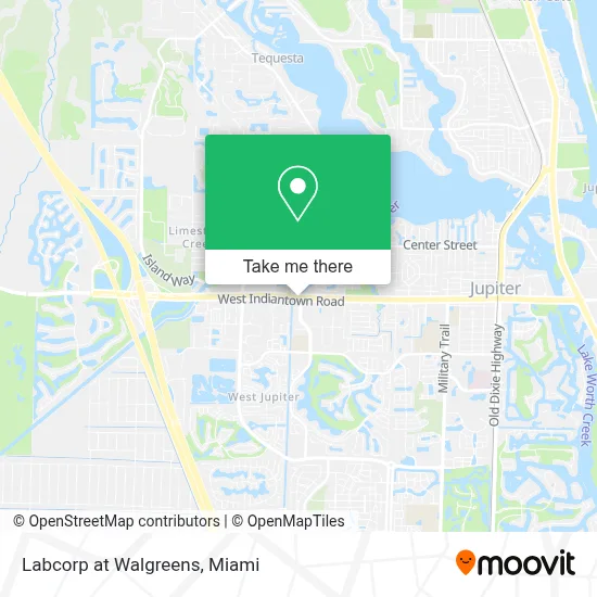
See Labcorp at Walgreens, Jupiter, on the map
Public Transit to Labcorp at Walgreens in Jupiter
Wondering how to get to Labcorp at Walgreens in Jupiter? Moovit helps you find the best way to get to Labcorp at Walgreens with step-by-step directions from the nearest public transit station.
Moovit provides free maps and live directions to help you navigate through your city. View schedules, routes, timetables, and find out how long does it take to get to Labcorp at Walgreens in real time.
Looking for the nearest stop or station to Labcorp at Walgreens? Check out this list of stops closest to your destination: INDIANTOWN RD at DELAWARE BLVD.
Bus: 10.
Want to see if there’s another route that gets you there at an earlier time? Moovit helps you find alternative routes or times. Get directions from and directions to Labcorp at Walgreens easily from the Moovit App or Website.
We make riding to Labcorp at Walgreens easy, which is why over 1.7 million users, including users in Jupiter, trust Moovit as the best app for public transit. You don’t need to download an individual bus app or train app, Moovit is your all-in-one transit app that helps you find the best bus time or train time available.
For information on prices of bus, costs and ride fares to Labcorp at Walgreens, please check the Moovit app.
Use the app to navigate to popular places including to the airport, hospital, stadium, grocery store, mall, coffee shop, school, college, and university.
Labcorp at Walgreens Address: 1800 W Indiantown Rd street in Jupiter
- Jupiter Tequesta & Hobe Sound,
- Metrocentre Corp Partners GP,
- Jupiter Town Public Works,
- Parametric Solutions,
- Piper's Angels Foundation,
- Cesbahamas,
- Perry Slingsby Systems,
- Organized Pool Service,
- Custom Cabinetry Of the Palm Beaches,
- One Ocean Drive Realty,
- Service Experts Heating & Air Conditioning,
- Service Experts,
- Price Termite & Pest Control,
- Ms Brad,
- Palm Beach Provisions Inc,
- Ready Network,
- Definitive Electronics,
- The Golf Clinic,
- Waldog Astoria,
- Rexpro Sealers & Coatings
Places Near Labcorp at Walgreens (Jupiter)
- Keiser University Flagship Campus, West Palm Beach,
- Sawgrass Mall, Miami,
- Miami Design District, Miami,
- Miami VA Hospital, Miami,
- Bayside Marketplace, Miami,
- Sawgrass mall ( FL ), Miami Beach,
- Hard Rock Stadium, Miami Gardens,
- Marlins Park, Miami,
- Wynwood, Miami,
- Richard E. Gerstein Justice Building, Miami,
- Aventura Mall, Miami Beach,
- Port of Miami Cruise Terminal, Miami,
- Dolphin Mall Bus, Miami,
- Zoo Miami, Miami,
- Aventura Mall, Miami,
- Miami Freedom Park, Miami,
- Little Havana, Miami,
- Brickell City Centre, Miami,
- Miami-Dade County Courthouse, Miami,
- Dolphin Mall, Miami
How to get to popular places in Miami with public transit
Get around Jupiter by public transit!
Traveling around Jupiter has never been so easy. See step by step directions as you travel to any attraction, street or major public transit station. View bus and train schedules, arrival times, service alerts and detailed routes on a map, so you know exactly how to get to anywhere in Jupiter.
When traveling to any destination around Jupiter use Moovit's Live Directions with Get Off Notifications to know exactly where and how far to walk, how long to wait for your line, and how many stops are left. Moovit will alert you when it's time to get off — no need to constantly re-check whether yours is the next stop.
Wondering how to use public transit in Jupiter or how to pay for public transit in Jupiter? Moovit public transit app can help you navigate your way with public transit easily, and at minimum cost. It includes public transit fees, ticket prices, and costs. Looking for a map of Jupiter public transit lines? Moovit public transit app shows all public transit maps in Jupiter with all Bus, Train, Light Rail and Ferry routes and stops on an interactive map.
Miami has 4 transit type(s), including: Bus, Train, Light Rail and Ferry, operated by several transit agencies, including Broward County Transit, Miami-Dade Transit, Metrorail, Palm Tran, Tri-Rail, Brightline, MARTY, City of Homestead Trolley, Key West Transit, Treasure Coast Connector, GoLine IRT, Amtrak, Greyhound-us, FlixBus-us and Aventura Express Shuttle Bus