How to get to Labie by bus?
Click on the bus route to see step by step directions with maps, line arrival times and updated time schedules.
From Avenue de l'Espace 270, Wambrechies
126 minFrom Rectorat de Lille, Lille
159 minFrom Sainghin En weppes, Sainghin-En-Weppes
48 minFrom Emmaüs, Wambrechies
121 minFrom Ifp, Lille
173 minFrom Métro Cité Scientifique ➊, Villeneuve-D'Ascq
114 minFrom Université de Lille, Villeneuve-D'Ascq
111 minFrom Euralille, Lille
158 min
How to get to Labie by train?
Click on the train route to see step by step directions with maps, line arrival times and updated time schedules.
How to get to Labie by metro?
Click on the metro route to see step by step directions with maps, line arrival times and updated time schedules.
Bus stops near Labie in Haubourdin
Train stations near Labie in Haubourdin
Metro station near Labie in Haubourdin
- Chu - Centre Oscar Lambret, 24 min walk,VIEW
Bus lines to Labie in Haubourdin
What are the closest stations to Labie?
The closest stations to Labie are:
- Gare is 380 meters away, 5 min walk.
- Haubourdin is 382 meters away, 5 min walk.
- Jacquard is 425 meters away, 6 min walk.
- Jardin Public is 591 meters away, 8 min walk.
- Longchamp is 748 meters away, 10 min walk.
- Pn De Loos is 811 meters away, 11 min walk.
- Chu - Centre Oscar Lambret is 1839 meters away, 24 min walk.
- Lille Centre Hospitalier Régional is 2052 meters away, 27 min walk.
Which bus lines stop near Labie?
These bus lines stop near Labie: 58, 61R.
Which train lines stop near Labie?
These train lines stop near Labie: C50, C51.
Which metro line stops near Labie?
M1 (Lille Chu Eurasanté)
What’s the nearest metro station to Labie in Haubourdin?
The nearest metro station to Labie in Haubourdin is Chu - Centre Oscar Lambret. It’s a 24 min walk away.
What’s the nearest train station to Labie in Haubourdin?
The nearest train station to Labie in Haubourdin is Haubourdin. It’s a 5 min walk away.
What’s the nearest bus station to Labie in Haubourdin?
The nearest bus station to Labie in Haubourdin is Gare. It’s a 5 min walk away.
What time is the first metro to Labie in Haubourdin?
The M1 is the first metro that goes to Labie in Haubourdin. It stops nearby at 5:00 AM.
What time is the last metro to Labie in Haubourdin?
The M1 is the last metro that goes to Labie in Haubourdin. It stops nearby at 12:39 AM.
What time is the first train to Labie in Haubourdin?
The K51 is the first train that goes to Labie in Haubourdin. It stops nearby at 6:25 AM.
What time is the last train to Labie in Haubourdin?
The K50 is the last train that goes to Labie in Haubourdin. It stops nearby at 9:17 PM.
What time is the first bus to Labie in Haubourdin?
The 58 is the first bus that goes to Labie in Haubourdin. It stops nearby at 5:48 AM.
What time is the last bus to Labie in Haubourdin?
The 58 is the last bus that goes to Labie in Haubourdin. It stops nearby at 9:22 PM.
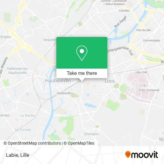
See Labie, Haubourdin, on the map
Public Transit to Labie in Haubourdin
Wondering how to get to Labie in Haubourdin? Moovit helps you find the best way to get to Labie with step-by-step directions from the nearest public transit station.
Moovit provides free maps and live directions to help you navigate through your city. View schedules, routes, timetables, and find out how long does it take to get to Labie in real time.
Looking for the nearest stop or station to Labie? Check out this list of stops closest to your destination: Gare; Haubourdin; Jacquard; Jardin Public; Longchamp; Pn De Loos; Chu - Centre Oscar Lambret; Lille Centre Hospitalier Régional.
Bus: 58, 61R, 913, 901, 931, 934.Train: C50, C51, K50, K51.Metro: M1.
Want to see if there’s another route that gets you there at an earlier time? Moovit helps you find alternative routes or times. Get directions from and directions to Labie easily from the Moovit App or Website.
We make riding to Labie easy, which is why over 1.5 million users, including users in Haubourdin, trust Moovit as the best app for public transit. You don’t need to download an individual bus app or train app, Moovit is your all-in-one transit app that helps you find the best bus time or train time available.
For information on prices of bus, metro, train and light rail, costs and ride fares to Labie, please check the Moovit app.
Use the app to navigate to popular places including to the airport, hospital, stadium, grocery store, mall, coffee shop, school, college, and university.
Labie Address: 55 Rue des Lostes 59320 Haubourdin street in Haubourdin
- Le 89,
- La Mie Dorè Sandwicherie Pátisserie Pains,
- Suez Recyclage et Valorisation-Agence Commerciale Professionnelle-Centre de Tri des Déchets,
- Centre Médico Scolaire,
- Salle Gaston Caby,
- Bricorama,
- Trayab,
- Access - Totalenergies,
- Totalenergies Access,
- Rue Thirion et Ferron 16,
- Quick,
- Tour Clément Marot,
- Match,
- 4 Rue Jean Zay Parking,
- Centre Hospitalier De Loos,
- Ponce Pilate,
- Norauto Lille Loos,
- 73 Rue Lucien Pickaert Parking,
- Rue Henri Barbusse 20,
- Café le Populaire Chambres
Places Near Labie (Haubourdin)
- Hôpital Claude Huriez, Lille,
- Zénith Arena, Lille,
- Consulat General D'Algerie, Lille,
- Euratechnologies, Lille,
- Kinepolis Lomme, Lille,
- Centre Commercial V2, Villeneuve-D'Ascq,
- Auchan Englos, Englos,
- Marché De Wazemmes, Lille,
- Zoo De Lille, Lille,
- Champ De Mars, Lille,
- Saint-André-Lez-Lille, Saint-André-Lez-Lille,
- Théâtre Sébastopol, Lille,
- L'Usine, Roubaix,
- Hôpital Salengro, Lille,
- Ffffff, Lezennes,
- Rue de la Porte d'Ypres 1, Lille,
- Clinique du Bois, Lille,
- Ikea, Lille,
- Hôpital Saint-Vincent De Paul, Lille,
- Université Catholique, Lille
How to get to popular places in Lille with public transit
Get around Haubourdin by public transit!
Traveling around Haubourdin has never been so easy. See step by step directions as you travel to any attraction, street or major public transit station. View bus and train schedules, arrival times, service alerts and detailed routes on a map, so you know exactly how to get to anywhere in Haubourdin.
When traveling to any destination around Haubourdin use Moovit's Live Directions with Get Off Notifications to know exactly where and how far to walk, how long to wait for your line, and how many stops are left. Moovit will alert you when it's time to get off — no need to constantly re-check whether yours is the next stop.
Wondering how to use public transit in Haubourdin or how to pay for public transit in Haubourdin? Moovit public transit app can help you navigate your way with public transit easily, and at minimum cost. It includes public transit fees, ticket prices, and costs. Looking for a map of Haubourdin public transit lines? Moovit public transit app shows all public transit maps in Haubourdin with all Bus, Train, Metro and Light Rail routes and stops on an interactive map.
Lille has 4 transit type(s), including: Bus, Train, Metro and Light Rail, operated by several transit agencies, including TRANSPOLE and SNCF VOYAGEURS