How to get to Lac Laticinios by bus?
Click on the bus route to see step by step directions with maps, line arrival times and updated time schedules.
From Feira de Honório Gurgel, Honório Gurgel
55 minFrom West Shopping, Campo Grande
47 minFrom West Shopping, Campo Grande
31 minFrom Nilópolis, Nilópolis
55 minFrom CS 32 - Vila Militar alistamento, Deodoro
37 minFrom Guadalupe, Guadalupe
41 minFrom Hospital Estadual Da Mãe, Mesquita
67 minFrom Estrada da Posse, Campo Grande
46 minFrom Cemitério Jardim Da Saudade, Jardim Sulacap
48 minFrom Estrada Intendente Magalhães, Bento Ribeiro
53 min
How to get to Lac Laticinios by train?
Click on the train route to see step by step directions with maps, line arrival times and updated time schedules.
Bus stops near Lac Laticinios in Bangu
Train station near Lac Laticinios in Bangu
- Senador Camará, 31 min walk,VIEW
Bus lines to Lac Laticinios in Bangu
What are the closest stations to Lac Laticinios?
The closest stations to Lac Laticinios are:
- Rua Marechal Marciano, 3056-3114 is 425 meters away, 6 min walk.
- Estrada Da Água Branca, 4505 is 558 meters away, 8 min walk.
- Estrada Da Água Branca, 4243-4287 is 720 meters away, 10 min walk.
- Senador Camará is 2404 meters away, 31 min walk.
Which bus lines stop near Lac Laticinios?
These bus lines stop near Lac Laticinios: 394, 451T, 731, 737, 790.
Which train line stops near Lac Laticinios?
RAMAL SANTA CRUZ (Santa Cruz (Parador))
What’s the nearest bus station to Lac Laticinios in Bangu?
The nearest bus station to Lac Laticinios in Bangu is Rua Marechal Marciano, 3056-3114. It’s a 6 min walk away.
What time is the first train to Lac Laticinios in Bangu?
The RAMAL SANTA CRUZ is the first train that goes to Lac Laticinios in Bangu. It stops nearby at 4:25 AM.
What time is the last train to Lac Laticinios in Bangu?
The RAMAL SANTA CRUZ is the last train that goes to Lac Laticinios in Bangu. It stops nearby at 11:27 PM.
What time is the first bus to Lac Laticinios in Bangu?
The SN 731 is the first bus that goes to Lac Laticinios in Bangu. It stops nearby at 3:00 AM.
What time is the last bus to Lac Laticinios in Bangu?
The 737 is the last bus that goes to Lac Laticinios in Bangu. It stops nearby at 3:40 AM.
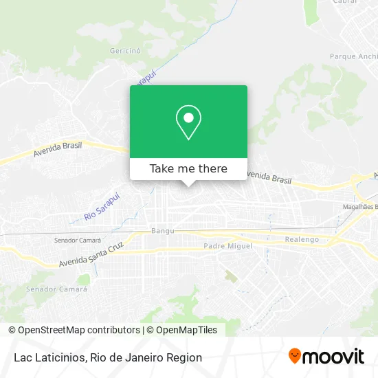
See Lac Laticinios, Bangu, on the map
Public Transit to Lac Laticinios in Bangu
Wondering how to get to Lac Laticinios in Bangu? Moovit helps you find the best way to get to Lac Laticinios with step-by-step directions from the nearest public transit station.
Moovit provides free maps and live directions to help you navigate through your city. View schedules, routes, timetables, and find out how long does it take to get to Lac Laticinios in real time.
Looking for the nearest stop or station to Lac Laticinios? Check out this list of stops closest to your destination: Rua Marechal Marciano; Estrada Da Água Branca; Estrada Da Água Branca; Senador Camará.
Bus: 394, 451T, 731, 737, 790, SN 731, 819, SP 389.Train: RAMAL SANTA CRUZ.
Want to see if there’s another route that gets you there at an earlier time? Moovit helps you find alternative routes or times. Get directions from and directions to Lac Laticinios easily from the Moovit App or Website.
We make riding to Lac Laticinios easy, which is why over 1.5 million users, including users in Bangu, trust Moovit as the best app for public transit. You don’t need to download an individual bus app or train app, Moovit is your all-in-one transit app that helps you find the best bus time or train time available.
For information on prices of bus and train, costs and ride fares to Lac Laticinios, please check the Moovit app.
Use the app to navigate to popular places including to the airport, hospital, stadium, grocery store, mall, coffee shop, school, college, and university.
Lac Laticinios Address: Rua Jacaiol, 126 Bangu Rio de Janeiro-RJ 21860-170 street in Bangu
- Rua Professor Plínio Olinto / Travessa Porto Brilhante,
- Rua Professor Plínio Olinto / Praça Professor Ferreira de Abreu,
- Praça Professor Ferreira De Abreu,
- Escola Municipal Professor Firmo Costa,
- Lady Lu,
- Salão de Festas Opção.,
- Morro De São Bento,
- 8° CRE - Coordenadoria Regional de Educação,
- Colegio Estadual Monsenhor Miguel Santa Maria Mochon,
- Estrada Porto Nacional,
- Rua Figueiredo de Sá,
- Rua Sargento João Lima S/Nº,
- Rua Guaiaca,
- Paróquia Cristo Ressuscitado,
- Rua Porto Brilhante, 55,
- Clinica de Saude da Familia Fiorello Raymundo,
- Rua Santana do Ipanema 509,
- Rua Netuno,
- Rua El Shaday 45,
- Estrada Porto Nacional / Rua Porto Brilhante
Places Near Lac Laticinios (Bangu)
- Hospital Pedro Ernesto, Vila Isabel,
- Museu Do Amanhã, Centro,
- Hospital Federal Cardoso Fontes, Jacarepaguá,
- Rodoviária Novo Rio (Rodoviária do Rio de Janeiro), Santo Cristo,
- Shopping RioSul, Botafogo,
- Norte Shopping, Cachambi,
- Rua Licínio Cardoso, São Francisco Xavier,
- Avenida Venezuela 134, Saúde,
- Rua Ulysses Guimarães 16, Cidade Nova,
- Praia do Arpoador, Ipanema,
- Hospital Federal Do Andaraí, Andaraí,
- Shopping Nova América, Del Castilho,
- Avenida Rio Branco, Centro,
- Hospital Municipal Ronaldo Gazolla, Acari,
- Shopping Rio Sul, Botafogo,
- Niterói, Niterói,
- Feira Livre da Gloria, Glória,
- Feirão De Malhas, Duque De Caxias,
- Rio De Janeiro,
- Shopping Downtown, Barra Da Tijuca
How to get to popular places in Rio de Janeiro Region with public transit
Get around Bangu by public transit!
Traveling around Bangu has never been so easy. See step by step directions as you travel to any attraction, street or major public transit station. View bus and train schedules, arrival times, service alerts and detailed routes on a map, so you know exactly how to get to anywhere in Bangu.
When traveling to any destination around Bangu use Moovit's Live Directions with Get Off Notifications to know exactly where and how far to walk, how long to wait for your line, and how many stops are left. Moovit will alert you when it's time to get off — no need to constantly re-check whether yours is the next stop.
Wondering how to use public transit in Bangu or how to pay for public transit in Bangu? Moovit public transit app can help you navigate your way with public transit easily, and at minimum cost. It includes public transit fees, ticket prices, and costs. Looking for a map of Bangu public transit lines? Moovit public transit app shows all public transit maps in Bangu with all Bus, Train, Metro, Light Rail, Ferry, Cable Car, Gondola and Funicular routes and stops on an interactive map.
Rio de Janeiro Region has 8 transit type(s), including: Bus, Train, Metro, Light Rail, Ferry, Cable Car, Gondola and Funicular, operated by several transit agencies, including TrensRJ, Metrô Rio, VLT Carioca, Barcas Rio, BRT MOBI-Rio, Auto Viação Alpha, Auto Viação Tijuca, Gire Transportes, Transurb, Viação Nossa Senhora das Graças, Consórcio INTERSUL, Braso Lisboa (Municipal), Caprichosa Auto Ônibus, Auto Viação Três Amigos and Rodoviária Âncora Matias