Directions to Lake Barcroft, Virginia (Fairfax County) with public transportation
The following transit lines have routes that pass near Lake Barcroft, Virginia
 Bus: A58, F20, F44, F26.
- Metro: ORANGE, SILVER.
How to get to Lake Barcroft, Virginia by bus?
Click on the bus route to see step by step directions with maps, line arrival times and updated time schedules.
Bus stop near Lake Barcroft, Virginia in Fairfax County
- Columbia Pk+Lakewood Dr, 17 min walk,
Metro station near Lake Barcroft, Virginia in Fairfax County
- East Falls Church, 47 min walk,
Bus lines to Lake Barcroft, Virginia in Fairfax County
- F26, East To East Falls Church,
- F44, East To Pentagon,
What are the closest stations to Lake Barcroft, Virginia?
The closest stations to Lake Barcroft, Virginia are:
- Columbia Pk+Lakewood Dr is 1432 yards away, 17 min walk.
- East Falls Church is 3968 yards away, 47 min walk.
Which bus lines stop near Lake Barcroft, Virginia?
These bus lines stop near Lake Barcroft, Virginia: A58, F20, F44.
What time is the first metro to Lake Barcroft, Virginia in Fairfax County?
The SILVER is the first metro that goes to Lake Barcroft, Virginia in Fairfax County. It stops nearby at 5:09 AM.
What time is the last metro to Lake Barcroft, Virginia in Fairfax County?
The SILVER is the last metro that goes to Lake Barcroft, Virginia in Fairfax County. It stops nearby at 12:31 AM.
What time is the first bus to Lake Barcroft, Virginia in Fairfax County?
The F44 is the first bus that goes to Lake Barcroft, Virginia in Fairfax County. It stops nearby at 6:10 AM.
What time is the last bus to Lake Barcroft, Virginia in Fairfax County?
The F44 is the last bus that goes to Lake Barcroft, Virginia in Fairfax County. It stops nearby at 12:28 AM.
See Lake Barcroft, Virginia, Fairfax County, on the map
Public Transit to Lake Barcroft, Virginia in Fairfax County
Wondering how to get to Lake Barcroft, Virginia in Fairfax County? Moovit helps you find the best way to get to Lake Barcroft, Virginia with step-by-step directions from the nearest public transit station.
Moovit provides free maps and live directions to help you navigate through your city. View schedules, routes, timetables, and find out how long does it take to get to Lake Barcroft, Virginia in real time.
Looking for the nearest stop or station to Lake Barcroft, Virginia? Check out this list of stops closest to your destination: Columbia Pk+Lakewood Dr; East Falls Church.
Bus: A58, F20, F44, F26.Metro: ORANGE, SILVER.
Want to see if there’s another route that gets you there at an earlier time? Moovit helps you find alternative routes or times. Get directions from and directions to Lake Barcroft, Virginia easily from the Moovit App or Website.
We make riding to Lake Barcroft, Virginia easy, which is why over 1.5 million users, including users in Fairfax County, trust Moovit as the best app for public transit. You don’t need to download an individual bus app or train app, Moovit is your all-in-one transit app that helps you find the best bus time or train time available.
For information on prices of bus and metro, costs and ride fares to Lake Barcroft, Virginia, please check the Moovit app.
Use the app to navigate to popular places including to the airport, hospital, stadium, grocery store, mall, coffee shop, school, college, and university.
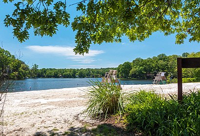
Lake Barcroft, Virginia Address: Falls Church, VA 22041 street in Fairfax County
- Lake Barcroft Beach 4,
- Mast Holding I,
- Columbia Pike VA-620,
- Van Arsdall,
- Coinstar,
- Blair Rd & Glen Carlyn Dr,
- Justice High School (Falls Church Schools - High Schools),
- Taco Zocalo-Falls Church,
- MQR Cafe,
- Everyday Yard Sale,
- Purple Can Club,
- Magic Cleaning Services,
- Spice Circle,
- Indian Pizza Company,
- Barcroft Plaza,
- STARBUCKS,
- Falls Church Taekwondo,
- Expedia Cruises in Falls Church,
- Aqua-Tots Swim School Barcroft Plaza,
- Coinstar - Bitcoin ATM
Places Near Lake Barcroft, Virginia (Fairfax County)
- Capital One Arena, Washington,
- M&T Bank Stadium, Baltimore,
- Amazon Hq2, Arlington County,
- National Mall, Washington,
- Georgetown, Washington,
- National Theatre, Washington,
- Echostage, Washington,
- Warner Theatre, Washington,
- National Museum of African American History and Culture, Washington,
- Washington National Cathedral, Washington,
- National Zoo, Washington,
- Basilica of the National Shrine, Washington,
- Westfield Montgomery Mall, Montgomery County,
- Marriott Marquis Washington, DC, Washington,
- White House, Washington,
- The Anthem, Washington,
- Washington DC VA Medical Center, Washington,
- Museum Of The Bible, Washington,
- Sibley Memorial Hospital, Washington,
- Washington Monument, Washington
How to get to popular places in Washington, D.C. - Baltimore, MD with public transit
Get around Fairfax County by public transit!
Traveling around Fairfax County has never been so easy. See step by step directions as you travel to any attraction, street or major public transit station. View bus and train schedules, arrival times, service alerts and detailed routes on a map, so you know exactly how to get to anywhere in Fairfax County.
When traveling to any destination around Fairfax County use Moovit's Live Directions with Get Off Notifications to know exactly where and how far to walk, how long to wait for your line, and how many stops are left. Moovit will alert you when it's time to get off — no need to constantly re-check whether yours is the next stop.
Wondering how to use public transit in Fairfax County or how to pay for public transit in Fairfax County? Moovit public transit app can help you navigate your way with public transit easily, and at minimum cost. It includes public transit fees, ticket prices, and costs. Looking for a map of Fairfax County public transit lines? Moovit public transit app shows all public transit maps in Fairfax County with all Bus, Train, Metro, Light Rail and Ferry routes and stops on an interactive map.
Washington, D.C. - Baltimore, MD has 5 transit type(s), including: Bus, Train, Metro, Light Rail and Ferry, operated by several transit agencies, including WMATA, Montgomery County Ride On, Fairfax Connector, TheBus, PRTC, DASH - Alexandria, Arlington Transit (ART), DC Streetcar, RTA of Central Maryland, FXBGO!, MDOT MTA, Marc, Virginia Railway Express (VRE), University of Maryland Shuttle-UM and CUE Bus - City of Fairfax