How to get to Lakeforest Transit Center by bus?
Click on the bus route to see step by step directions with maps, line arrival times and updated time schedules.
From Clarksburg Premium Outlets, Montgomery County
58 minFrom Glenstone Museum, Montgomery County
68 minFrom Park Potomac Place, Montgomery County
49 minFrom Clarksburg Premium Outlets, Montgomery County
48 minFrom Adventist HealthCare Shady Grove Medical Center, Montgomery County
41 minFrom Rockville, MD, Montgomery County
37 minFrom Olney MD USA, Montgomery County
46 minFrom Kentlands, Montgomery County
24 minFrom Montgomery College-Rockville, Montgomery County
23 minFrom Germantown, Maryland, Montgomery County
31 min
How to get to Lakeforest Transit Center by train?
Click on the train route to see step by step directions with maps, line arrival times and updated time schedules.
Bus stop near Lakeforest Transit Center in Montgomery County
- Lakeforest Transit Center & Odendhal Ave, 4 min walk,VIEW
Train station near Lakeforest Transit Center in Montgomery County
- Washington Grove Marc Eb, 12 min walk,VIEW
Bus lines to Lakeforest Transit Center in Montgomery County
What are the closest stations to Lakeforest Transit Center?
The closest stations to Lakeforest Transit Center are:
- Lakeforest Transit Center & Odendhal Ave is 311 yards away, 4 min walk.
- Washington Grove Marc Eb is 1009 yards away, 12 min walk.
Which bus lines stop near Lakeforest Transit Center?
These bus lines stop near Lakeforest Transit Center: 101, 55, 56, 57, 61.
Which train line stops near Lakeforest Transit Center?
MARC (Inbound - Brunswick)
What’s the nearest train station to Lakeforest Transit Center in Montgomery County?
The nearest train station to Lakeforest Transit Center in Montgomery County is Washington Grove Marc Eb. It’s a 12 min walk away.
What’s the nearest bus station to Lakeforest Transit Center in Montgomery County?
The nearest bus station to Lakeforest Transit Center in Montgomery County is Lakeforest Transit Center & Odendhal Ave. It’s a 4 min walk away.
What time is the first train to Lakeforest Transit Center in Montgomery County?
The MARC is the first train that goes to Lakeforest Transit Center in Montgomery County. It stops nearby at 5:27 AM.
What time is the last train to Lakeforest Transit Center in Montgomery County?
The MARC is the last train that goes to Lakeforest Transit Center in Montgomery County. It stops nearby at 8:00 PM.
What time is the first bus to Lakeforest Transit Center in Montgomery County?
The 57 is the first bus that goes to Lakeforest Transit Center in Montgomery County. It stops nearby at 4:30 AM.
What time is the last bus to Lakeforest Transit Center in Montgomery County?
The 59 is the last bus that goes to Lakeforest Transit Center in Montgomery County. It stops nearby at 1:57 AM.
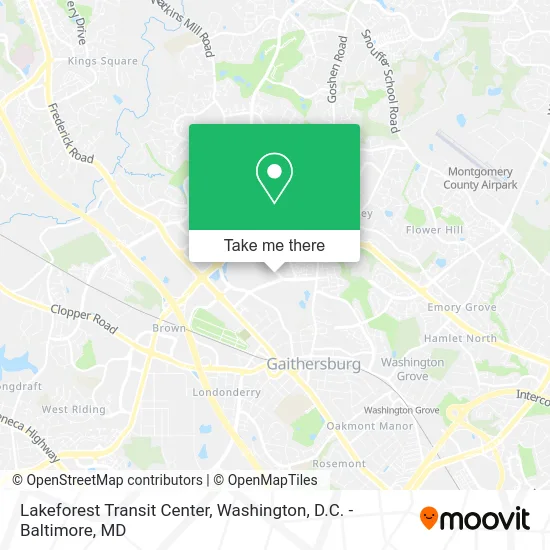
See Lakeforest Transit Center, Montgomery County, on the map
Public Transit to Lakeforest Transit Center in Montgomery County
Wondering how to get to Lakeforest Transit Center in Montgomery County? Moovit helps you find the best way to get to Lakeforest Transit Center with step-by-step directions from the nearest public transit station.
Moovit provides free maps and live directions to help you navigate through your city. View schedules, routes, timetables, and find out how long does it take to get to Lakeforest Transit Center in real time.
Looking for the nearest stop or station to Lakeforest Transit Center? Check out this list of stops closest to your destination: Lakeforest Transit Center & Odendhal Ave; Washington Grove Marc Eb.
Bus: 101, 55, 56, 57, 61, 54, 58.Train: MARC.
Want to see if there’s another route that gets you there at an earlier time? Moovit helps you find alternative routes or times. Get directions from and directions to Lakeforest Transit Center easily from the Moovit App or Website.
We make riding to Lakeforest Transit Center easy, which is why over 1.7 million users, including users in Montgomery County, trust Moovit as the best app for public transit. You don’t need to download an individual bus app or train app, Moovit is your all-in-one transit app that helps you find the best bus time or train time available.
For information on prices of bus, metro and train, costs and ride fares to Lakeforest Transit Center, please check the Moovit app.
Use the app to navigate to popular places including to the airport, hospital, stadium, grocery store, mall, coffee shop, school, college, and university.
Lakeforest Transit Center Address: Lost Knife & Odenhal Road street in Montgomery County
- Lakeforest TRANSIT Center & Odendhal Ave (Lake Forest TRANSIT Center),
- Slab Leak Repair Plumbing,
- Favor Loving Care LLC,
- Trader Joe's,
- B2j Fish Soup,
- La Caleta,
- Patel Brothers,
- DD's Discount,
- Zumiez,
- Icing,
- Foreign Cinema,
- Shoe Dept Encore,
- Services Unlimited,
- Auntie Anne's,
- Barber Shop,
- Milano,
- Jackson Hewitt Tax Service,
- Tingling Stop Chiropractor,
- Trader Joe's-Gaithersburg,MD,
- Garcia Ruben
Places Near Lakeforest Transit Center (Montgomery County)
- Camden Yards, Baltimore,
- National Zoo, Washington,
- Sibley Memorial Hospital, Washington,
- Amazon Hq2, Arlington County,
- Washington DC VA Medical Center, Washington,
- National Theatre, Washington,
- Georgetown, Washington,
- The Anthem, Washington,
- National Museum of African American History and Culture, Washington,
- Westfield Montgomery Mall, Montgomery County,
- Basilica of the National Shrine, Washington,
- Capital One Arena, Washington,
- Marriott Marquis Washington, DC, Washington,
- Washington National Cathedral, Washington,
- Pennsylvania Ave NW (3rd st and pennsylvania), Washington,
- PG Mall, Prince George's County,
- Warner Theatre, Washington,
- Rock Creek Tennis Center, Washington,
- Museum Of The Bible, Washington,
- M&T Bank Stadium, Baltimore
How to get to popular places in Washington, D.C. - Baltimore, MD with public transit
Get around Montgomery County by public transit!
Traveling around Montgomery County has never been so easy. See step by step directions as you travel to any attraction, street or major public transit station. View bus and train schedules, arrival times, service alerts and detailed routes on a map, so you know exactly how to get to anywhere in Montgomery County.
When traveling to any destination around Montgomery County use Moovit's Live Directions with Get Off Notifications to know exactly where and how far to walk, how long to wait for your line, and how many stops are left. Moovit will alert you when it's time to get off — no need to constantly re-check whether yours is the next stop.
Wondering how to use public transit in Montgomery County or how to pay for public transit in Montgomery County? Moovit public transit app can help you navigate your way with public transit easily, and at minimum cost. It includes public transit fees, ticket prices, and costs. Looking for a map of Montgomery County public transit lines? Moovit public transit app shows all public transit maps in Montgomery County with all Bus, Train, Metro, Light Rail and Ferry routes and stops on an interactive map.
Washington, D.C. - Baltimore, MD has 5 transit type(s), including: Bus, Train, Metro, Light Rail and Ferry, operated by several transit agencies, including WMATA, Montgomery County Ride On, Fairfax Connector, TheBus, PRTC, DASH - Alexandria, Arlington Transit (ART), RTA of Central Maryland, MDOT MTA, MDOT MTA Light RailLink, MDOT MTA Commuter Bus, MDOT MTA Local Bus, FXBGO!, Virginia Railway Express (VRE) and MARC