How to get to Lakeside Center by bus?
Click on the bus route to see step by step directions with maps, line arrival times and updated time schedules.
From Suncoast High School, Riviera Beach
28 minFrom Donald Ross Rd / Military Trl, Jupiter
45 minFrom Tanger Outlets Palm Beach, West Palm Beach
48 minFrom Palm Beach Outlets, West Palm Beach
48 minFrom St. Mary's Medical Center, West Palm Beach
61 minFrom I-95, West Palm Beach
47 minFrom William T. Dwyer High School, Jupiter
59 minFrom The Ballpark of the Palm Beaches, West Palm Beach
38 minFrom Brightline, West Palm Beach
71 minFrom Keiser University Flagship Campus, West Palm Beach
40 min
Bus stops near Lakeside Center in Riviera Beach
Bus lines to Lakeside Center in Riviera Beach
What are the closest stations to Lakeside Center?
The closest stations to Lakeside Center are:
- MILITARY TRL at PBG REC CTR is 140 yards away, 2 min walk.
- MILITARY TRL at HOLLY DR is 875 yards away, 11 min walk.
Which bus line stops near Lakeside Center?
3 (Rt 3 Northbound)
What’s the nearest bus station to Lakeside Center in Riviera Beach?
The nearest bus station to Lakeside Center in Riviera Beach is MILITARY TRL at PBG REC CTR. It’s a 2 min walk away.
What time is the first bus to Lakeside Center in Riviera Beach?
The 3 is the first bus that goes to Lakeside Center in Riviera Beach. It stops nearby at 5:21 AM.
What time is the last bus to Lakeside Center in Riviera Beach?
The 3 is the last bus that goes to Lakeside Center in Riviera Beach. It stops nearby at 9:44 PM.
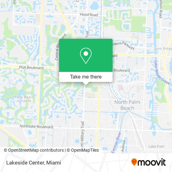
See Lakeside Center, Riviera Beach, on the map
Public Transit to Lakeside Center in Riviera Beach
Wondering how to get to Lakeside Center in Riviera Beach? Moovit helps you find the best way to get to Lakeside Center with step-by-step directions from the nearest public transit station.
Moovit provides free maps and live directions to help you navigate through your city. View schedules, routes, timetables, and find out how long does it take to get to Lakeside Center in real time.
Looking for the nearest stop or station to Lakeside Center? Check out this list of stops closest to your destination: MILITARY TRL at PBG REC CTR; MILITARY TRL at HOLLY DR.
Bus: 3, 33.
Want to see if there’s another route that gets you there at an earlier time? Moovit helps you find alternative routes or times. Get directions from and directions to Lakeside Center easily from the Moovit App or Website.
We make riding to Lakeside Center easy, which is why over 1.5 million users, including users in Riviera Beach, trust Moovit as the best app for public transit. You don’t need to download an individual bus app or train app, Moovit is your all-in-one transit app that helps you find the best bus time or train time available.
For information on prices of bus, costs and ride fares to Lakeside Center, please check the Moovit app.
Use the app to navigate to popular places including to the airport, hospital, stadium, grocery store, mall, coffee shop, school, college, and university.
Lakeside Center Address: 10410 Military Trl Palm Beach Gardens, FL 33410 street in Riviera Beach
- The Purple Shrimp South Florida,
- Thompson River Linear Park,
- Easy Computing,
- Poblano South,
- City of Palm Beach Gardens City Hall,
- Blink Charging,
- Kenneth Gerszberg, Orthopaedic Foot and Ankle Specialist - South Florida,
- United Vein Centers,
- Singer Island Health and Fitness,
- United Mortgage Lenders,
- Plant Drive Park,
- Cruise Brothers,
- Mind and Body Doctor,
- DUNKIN',
- Chulados,
- George Ryan Hair Lounge,
- Aesthetics at Cima Health,
- St Ignatius Outreach Center,
- Chancery,
- Jason Kovan - International Tax Attorney & CPA, Palm Beach
Places Near Lakeside Center (Riviera Beach)
- Brickell City Centre, Miami,
- Port of Miami Cruise Terminal, Miami,
- Bayside Marketplace, Miami,
- Little Havana, Miami,
- Miami Design District, Miami,
- Sawgrass mall ( FL ), Miami Beach,
- Sawgrass Mall, Miami,
- 1351 NW 12th St, Miami,
- Marlins Park, Miami,
- Hard Rock Stadium, Miami Gardens,
- Zoo Miami, Miami,
- Aventura Mall, Miami Beach,
- Keiser University Flagship Campus, West Palm Beach,
- Miami Freedom Park, Miami,
- Richard E. Gerstein Justice Building, Miami,
- Dolphin Mall Bus, Miami,
- Aventura Mall, Miami,
- Wynwood, Miami,
- Miami-Dade County Courthouse, Miami,
- Dolphin Mall, Miami
How to get to popular places in Miami with public transit
Get around Riviera Beach by public transit!
Traveling around Riviera Beach has never been so easy. See step by step directions as you travel to any attraction, street or major public transit station. View bus and train schedules, arrival times, service alerts and detailed routes on a map, so you know exactly how to get to anywhere in Riviera Beach.
When traveling to any destination around Riviera Beach use Moovit's Live Directions with Get Off Notifications to know exactly where and how far to walk, how long to wait for your line, and how many stops are left. Moovit will alert you when it's time to get off — no need to constantly re-check whether yours is the next stop.
Wondering how to use public transit in Riviera Beach or how to pay for public transit in Riviera Beach? Moovit public transit app can help you navigate your way with public transit easily, and at minimum cost. It includes public transit fees, ticket prices, and costs. Looking for a map of Riviera Beach public transit lines? Moovit public transit app shows all public transit maps in Riviera Beach with all Bus, Train, Light Rail and Ferry routes and stops on an interactive map.
Miami has 4 transit type(s), including: Bus, Train, Light Rail and Ferry, operated by several transit agencies, including Broward County Transit, Miami-Dade Transit, Metrorail, Palm Tran, Tri-Rail, Brightline, MARTY, City of Homestead Trolley, Key West Transit, Treasure Coast Connector, GoLine IRT, Amtrak, Greyhound-us, FlixBus-us and Aventura Express Shuttle Bus