How to get to Lakeside Exxon by bus?
Click on the bus route to see step by step directions with maps, line arrival times and updated time schedules.
From Clarion Inn & Suites Miami Airport, Miami
77 minFrom NW 37th Ave, Miami
87 minFrom Florida Lottery, Miami
84 minFrom NW 57th Ave / NW 199th St, Miami Gardens
128 minFrom St Thomas University, Miami
73 minFrom Conchitas Transit Express, Hialeah
77 minFrom Red Coach, Miami
84 minFrom Irent Car Rental, Miami
65 minFrom Amelia Earhart Park, Miami
55 minFrom Flamingo Parking Garage, Miami
84 min
Bus stops near Lakeside Exxon in Hialeah
Train station near Lakeside Exxon in Hialeah
- Palmetto Station Rail Northbound, 38 min walk,VIEW
Bus lines to Lakeside Exxon in Hialeah
What are the closest stations to Lakeside Exxon?
The closest stations to Lakeside Exxon are:
- Nw 103 St & Nw 82 Av is 287 yards away, 4 min walk.
- Frontage Rd (Okech)@nw 87 Av is 908 yards away, 12 min walk.
- Palmetto Station Rail Northbound is 3208 yards away, 38 min walk.
Which bus lines stop near Lakeside Exxon?
These bus lines stop near Lakeside Exxon: 103, HIAMAR.
What’s the nearest bus station to Lakeside Exxon in Hialeah?
The nearest bus station to Lakeside Exxon in Hialeah is Nw 103 St & Nw 82 Av. It’s a 4 min walk away.
What time is the first train to Lakeside Exxon in Hialeah?
The GREEN is the first train that goes to Lakeside Exxon in Hialeah. It stops nearby at 5:00 AM.
What time is the last train to Lakeside Exxon in Hialeah?
The GREEN is the last train that goes to Lakeside Exxon in Hialeah. It stops nearby at 1:01 AM.
What time is the first bus to Lakeside Exxon in Hialeah?
The 103 is the first bus that goes to Lakeside Exxon in Hialeah. It stops nearby at 4:53 AM.
What time is the last bus to Lakeside Exxon in Hialeah?
The 103 is the last bus that goes to Lakeside Exxon in Hialeah. It stops nearby at 11:56 PM.
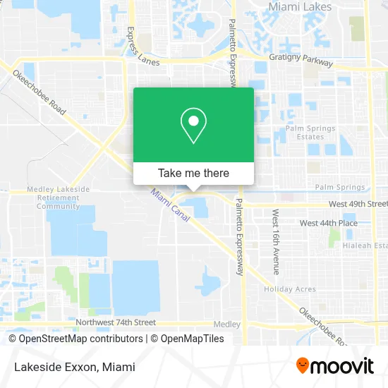
See Lakeside Exxon, Hialeah, on the map
Public Transit to Lakeside Exxon in Hialeah
Wondering how to get to Lakeside Exxon in Hialeah? Moovit helps you find the best way to get to Lakeside Exxon with step-by-step directions from the nearest public transit station.
Moovit provides free maps and live directions to help you navigate through your city. View schedules, routes, timetables, and find out how long does it take to get to Lakeside Exxon in real time.
Looking for the nearest stop or station to Lakeside Exxon? Check out this list of stops closest to your destination: Nw 103 St & Nw 82 Av; Frontage Rd (Okech)@nw 87 Av; Palmetto Station Rail Northbound.
Bus: 103, HIAMAR.Train: GREEN.
Want to see if there’s another route that gets you there at an earlier time? Moovit helps you find alternative routes or times. Get directions from and directions to Lakeside Exxon easily from the Moovit App or Website.
We make riding to Lakeside Exxon easy, which is why over 1.7 million users, including users in Hialeah, trust Moovit as the best app for public transit. You don’t need to download an individual bus app or train app, Moovit is your all-in-one transit app that helps you find the best bus time or train time available.
For information on prices of bus, light rail and train, costs and ride fares to Lakeside Exxon, please check the Moovit app.
Use the app to navigate to popular places including to the airport, hospital, stadium, grocery store, mall, coffee shop, school, college, and university.
Lakeside Exxon Address: 8314 NW 103 ST street in Hialeah
- Catholic Charities,
- NW 87th Ave / NW 103rd St,
- Hialeah Gardens,
- El Flaco Team 3,
- Sedano's,
- Baja Y Chupa,
- Jose Marti Mast 6-12 Academy,
- Okeechobee Rd & Hialeah Gardens Blvd,
- Key Food,
- Gallardo Law Firm,
- Palmetto-103 Properties,
- Bucky Dent Park,
- Holiday Inn-Miami West,
- Holiday Inn Miami West - Hialeah Gardens,
- City of Hialeah Gardens,
- NW 103rd St Exit,
- Entrance SR-826 N,
- Unico Health Center,
- Hobby Lobby,
- Botanica Almacenes Inshe
Places Near Lakeside Exxon (Hialeah)
- Aventura Mall, Miami Beach,
- Brickell City Centre, Miami,
- Little Havana, Miami,
- Zoo Miami, Miami,
- Bayside Marketplace, Miami,
- Wynwood, Miami,
- Aventura Mall, Miami,
- Sawgrass Mall, Miami,
- Sawgrass mall ( FL ), Miami Beach,
- Dolphin Mall, Miami,
- Richard E. Gerstein Justice Building, Miami,
- Keiser University Flagship Campus, West Palm Beach,
- Hard Rock Stadium, Miami Gardens,
- Marlins Park, Miami,
- Miami-Dade County Courthouse, Miami,
- Miami Freedom Park, Miami,
- Miami VA Hospital, Miami,
- Miami Design District, Miami,
- Port of Miami Cruise Terminal, Miami,
- Dolphin Mall Bus, Miami
How to get to popular places in Miami with public transit
Get around Hialeah by public transit!
Traveling around Hialeah has never been so easy. See step by step directions as you travel to any attraction, street or major public transit station. View bus and train schedules, arrival times, service alerts and detailed routes on a map, so you know exactly how to get to anywhere in Hialeah.
When traveling to any destination around Hialeah use Moovit's Live Directions with Get Off Notifications to know exactly where and how far to walk, how long to wait for your line, and how many stops are left. Moovit will alert you when it's time to get off — no need to constantly re-check whether yours is the next stop.
Wondering how to use public transit in Hialeah or how to pay for public transit in Hialeah? Moovit public transit app can help you navigate your way with public transit easily, and at minimum cost. It includes public transit fees, ticket prices, and costs. Looking for a map of Hialeah public transit lines? Moovit public transit app shows all public transit maps in Hialeah with all Bus, Train, Light Rail and Ferry routes and stops on an interactive map.
Miami has 4 transit type(s), including: Bus, Train, Light Rail and Ferry, operated by several transit agencies, including Broward County Transit, Miami-Dade Transit, Metrorail, Palm Tran, Tri-Rail, Brightline, MARTY, City of Homestead Trolley, Key West Transit, Treasure Coast Connector, GoLine IRT, Amtrak, Greyhound-us, FlixBus-us and Aventura Express Shuttle Bus