Directions to Lander Mark (Santa Quitéria) with public transportation
The following transit lines have routes that pass near Lander Mark
How to get to Lander Mark by bus?
Click on the bus route to see step by step directions with maps, line arrival times and updated time schedules.
From Alameda Augusto Stellfeld, Centro
38 minFrom Parque Tanguá, Taboão
83 minFrom Vista Alegre, Vista Alegre
60 minFrom Bairro Thomaz Coelho, Araucária
96 minFrom Hospital De Clínicas Da Ufpr, Centro
52 minFrom Puteiro Da Ana, Cajuru
79 minFrom CEASA - Centrais de Abastecimento do Paraná, Tatuquara
62 minFrom Avenida Marechal Floriano Peixoto 9450, Boqueirão
64 minFrom Decathlon, Jardim Botânico
51 minFrom terminal do hauer, Boqueirão
95 min
Bus stops near Lander Mark in Santa Quitéria
Bus lines to Lander Mark in Santa Quitéria
What are the closest stations to Lander Mark?
The closest stations to Lander Mark are:
- Rua Reinaldo Pazello, 2900 is 228 meters away, 3 min walk.
- Rua Reinaldo Pazello, 2905 is 228 meters away, 4 min walk.
- R. Major França Gomes, 1282 is 754 meters away, 10 min walk.
Which bus lines stop near Lander Mark?
These bus lines stop near Lander Mark: 703 CAIUÁ, 760 SANTA QUITÉRIA, 777 VILA VELHA, 778 COTOLENGO.
What’s the nearest bus station to Lander Mark in Santa Quitéria?
The nearest bus station to Lander Mark in Santa Quitéria is Rua Reinaldo Pazello, 2900. It’s a 3 min walk away.
What time is the first bus to Lander Mark in Santa Quitéria?
The 788 MAD. VILA VELHA is the first bus that goes to Lander Mark in Santa Quitéria. It stops nearby at 3:12 AM.
What time is the last bus to Lander Mark in Santa Quitéria?
The 788 MAD. VILA VELHA is the last bus that goes to Lander Mark in Santa Quitéria. It stops nearby at 2:37 AM.
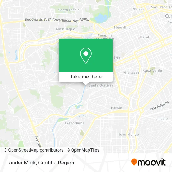
See Lander Mark, Santa Quitéria, on the map
Public Transit to Lander Mark in Santa Quitéria
Wondering how to get to Lander Mark in Santa Quitéria? Moovit helps you find the best way to get to Lander Mark with step-by-step directions from the nearest public transit station.
Moovit provides free maps and live directions to help you navigate through your city. View schedules, routes, timetables, and find out how long does it take to get to Lander Mark in real time.
Looking for the nearest stop or station to Lander Mark? Check out this list of stops closest to your destination: Rua Reinaldo Pazello; Rua Reinaldo Pazello; R. Major França Gomes.
Bus: 703 CAIUÁ, 760 SANTA QUITÉRIA, 777 VILA VELHA, 778 COTOLENGO, 779 VILA VELHA / BURITI, 788 MAD. VILA VELHA.
Want to see if there’s another route that gets you there at an earlier time? Moovit helps you find alternative routes or times. Get directions from and directions to Lander Mark easily from the Moovit App or Website.
We make riding to Lander Mark easy, which is why over 1.5 million users, including users in Santa Quitéria, trust Moovit as the best app for public transit. You don’t need to download an individual bus app or train app, Moovit is your all-in-one transit app that helps you find the best bus time or train time available.
For information on prices of bus, costs and ride fares to Lander Mark, please check the Moovit app.
Use the app to navigate to popular places including to the airport, hospital, stadium, grocery store, mall, coffee shop, school, college, and university.
Lander Mark Address: Rua Reinaldo Pazello, 225 Santa Quitéria Curitiba-PR street in Santa Quitéria
- Toca do Ogre,
- Jrj Moveis,
- Cid - Centro de Integracao Digital / Sao Luis Orione,
- Sanepar - Santa Quitéria,
- Lmeph Closet Infantil,
- Ete Santa Quitéria,
- Rua Reinaldo Pazello 2888,
- Karesi - Materiais de Construcao do Vizinho,
- Nuvem Informatica,
- Roberta,
- Vitoria Estevo Hameister,
- Rua Doutor Celso Luiz Peixoto Ribas 3454,
- Ricardo Oliveira Ferraz Veiculos,
- Sesc Paraná,
- Tm Prestadora de Servicos,
- Consertmaq,
- Hamburgueria Dois Irmao Hot Dog,
- Transparana Transportes,
- Fabrica de Roupas,
- Tectiba Manutencao de Geradores
Places Near Lander Mark (Santa Quitéria)
- Pontifícia Universidade Católica do Paraná (PUCPR), Prado Velho,
- Hospital Madalena Sofia, Bairro Alto,
- Park Shopping Barigüi, Mossunguê,
- Shopping Estação, Rebouças,
- Parque Barigui, Mercês,
- Jockey Plaza Shopping Center, Tarumã,
- Shopping Palladium, Portão,
- Jardim Botânico de Curitiba PR, Centro,
- Hospital do Rocio, Campo,
- Arena Da Baixada - Curitiba,
- Hospital Nossa Senhora Das Graças, Mercês,
- Rua Martim Afonso 558, Mercês,
- Hospital Erasto Gaertner, Jardim Das Américas,
- Hhhhh, Fazendinha,
- Hospital Da Cruz Vermelha, Batel,
- Hospital de Clínicas (HC - UFPR), Centro,
- Rua General Mário Tourinho, Campina Do Siqueira,
- Hospital Angelina Caron, Campina Grande Do Sul,
- Campo Largo, Campo,
- Hospital Universitário Evangélico de Curitiba, Bigorrilho
How to get to popular places in Curitiba Region with public transit
Get around Santa Quitéria by public transit!
Traveling around Santa Quitéria has never been so easy. See step by step directions as you travel to any attraction, street or major public transit station. View bus and train schedules, arrival times, service alerts and detailed routes on a map, so you know exactly how to get to anywhere in Santa Quitéria.
When traveling to any destination around Santa Quitéria use Moovit's Live Directions with Get Off Notifications to know exactly where and how far to walk, how long to wait for your line, and how many stops are left. Moovit will alert you when it's time to get off — no need to constantly re-check whether yours is the next stop.
Wondering how to use public transit in Santa Quitéria or how to pay for public transit in Santa Quitéria? Moovit public transit app can help you navigate your way with public transit easily, and at minimum cost. It includes public transit fees, ticket prices, and costs. Looking for a map of Santa Quitéria public transit lines? Moovit public transit app shows all public transit maps in Santa Quitéria with all Bus and Cable Car routes and stops on an interactive map.
Curitiba Region has 2 transit type(s), including: Bus and Cable Car, operated by several transit agencies, including Sistema Integrado de Mobilidade (URBS), Sistema Integrado de Mobilidade (AMEP), URBS (Cartões bancários e Dinheiro), URBS (Cartões bancários / Cartão URBS), AMEP (Cartões bancários / Cartão MetroCard), AMEP (Cartões bancários / Cartão MetroCard / Dinheiro), Viação Colombo (Dinheiro), TRIAR (Cartão TRIAR / Dinheiro), Empresa Curitiba Cerro Azul (Dinheiro), Expresso Nossa Senhora da Penha (Dinheiro), Empresa Campo Alto Tijucas (Dinheiro), Auto Viação São José (Cartão VEM / Dinheiro), BRT S/A (Cartão VEM / Dinheiro), TransPiedade (Cartão Cidadão / Dinheiro) and Oceânica Sul (Cartão Transporte / Dinheiro)