How to get to Landeros Lopez Sergio Alejandro by bus?
Click on the bus route to see step by step directions with maps, line arrival times and updated time schedules.
From Bosque Sereno, Aguascalientes
47 minFrom Canchas de futbol Cruz Azul, Aguascalientes
54 minFrom 49, Aguascalientes
28 minFrom Campos De Futbol Loma Bonita, Aguascalientes
53 minFrom Museo Descubre, Aguascalientes
37 minFrom Pension Municipal, Aguascalientes
47 minFrom Parque Acuatico Valladolid Oficial, Aguascalientes
41 minFrom Casa Club Necaxa, Aguascalientes
68 minFrom Jesús María, Aguascalientes
50 minFrom Terminal 50, Aguascalientes
50 min
Bus stops near Landeros Lopez Sergio Alejandro in Aguascalientes
Bus lines to Landeros Lopez Sergio Alejandro in Aguascalientes
What are the closest stations to Landeros Lopez Sergio Alejandro?
The closest stations to Landeros Lopez Sergio Alejandro are:
- Bulevar Guadalupano, 303 is 67 meters away, 2 min walk.
- Bulevar Guadalupano, 302 is 129 meters away, 2 min walk.
- No Name is 748 meters away, 10 min walk.
- Nazario Ortiz Garza, 702 is 765 meters away, 10 min walk.
Which bus lines stop near Landeros Lopez Sergio Alejandro?
These bus lines stop near Landeros Lopez Sergio Alejandro: RUTA 09, RUTA 16, RUTA 37, RUTA 40.
What’s the nearest bus station to Landeros Lopez Sergio Alejandro in Aguascalientes?
The nearest bus stations to Landeros Lopez Sergio Alejandro in Aguascalientes are Bulevar Guadalupano, 303 and Bulevar Guadalupano, 302. The closest one is a 2 min walk away.
What time is the first bus to Landeros Lopez Sergio Alejandro in Aguascalientes?
The RUTA 20S is the first bus that goes to Landeros Lopez Sergio Alejandro in Aguascalientes. It stops nearby at 5:42 AM.
What time is the last bus to Landeros Lopez Sergio Alejandro in Aguascalientes?
The RUTA 40 is the last bus that goes to Landeros Lopez Sergio Alejandro in Aguascalientes. It stops nearby at 10:32 PM.
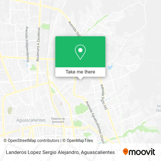
See Landeros Lopez Sergio Alejandro, Aguascalientes, on the map
Public Transit to Landeros Lopez Sergio Alejandro in Aguascalientes
Wondering how to get to Landeros Lopez Sergio Alejandro in Aguascalientes? Moovit helps you find the best way to get to Landeros Lopez Sergio Alejandro with step-by-step directions from the nearest public transit station.
Moovit provides free maps and live directions to help you navigate through your city. View schedules, routes, timetables, and find out how long does it take to get to Landeros Lopez Sergio Alejandro in real time.
Looking for the nearest stop or station to Landeros Lopez Sergio Alejandro? Check out this list of stops closest to your destination: Bulevar Guadalupano; Bulevar Guadalupano; No Name; Nazario Ortiz Garza.
Bus: RUTA 09, RUTA 16, RUTA 37, RUTA 40, RUTA 20N, RUTA 20S.
Want to see if there’s another route that gets you there at an earlier time? Moovit helps you find alternative routes or times. Get directions from and directions to Landeros Lopez Sergio Alejandro easily from the Moovit App or Website.
We make riding to Landeros Lopez Sergio Alejandro easy, which is why over 1.5 million users, including users in Aguascalientes, trust Moovit as the best app for public transit. You don’t need to download an individual bus app or train app, Moovit is your all-in-one transit app that helps you find the best bus time or train time available.
For information on prices of bus, costs and ride fares to Landeros Lopez Sergio Alejandro, please check the Moovit app.
Use the app to navigate to popular places including to the airport, hospital, stadium, grocery store, mall, coffee shop, school, college, and university.
Landeros Lopez Sergio Alejandro Address: Landeros Lopez Sergio Alejandro, Boulevard Guadalupano 409, Fraccionamiento Nazario Ortiz Garza, 20 street in Aguascalientes
- Wonder Gym,
- Rancho La Plenitud,
- Carniceria El Chino,
- Fundación Médica México Franco Brasileña,
- Templo del Tepeyac,
- Blvd. Guadalupano 505,
- Hospital de Ropa Raliz,
- Oriente,
- Estética Imelda,
- carnicería Tepeyac,
- Parroquia Ntra. Sra. del Tepeyac Oficial,
- Gorditas Doña Lupe,
- Centro de Salud Urbano Progreso,
- Centro de Salud Progreso,
- Reparacion de Amortiguadores,
- Taller Mecanico Automotriz,
- Abarrotes-Humberto Bravo Sánchez,
- MUEBLERIA VALDEZ,
- Escuela Secundaria General #9 Amado Nervo,
- Pintura y Modificaciones
Places Near Landeros Lopez Sergio Alejandro (Aguascalientes)
- Terminal De Combis, Aguascalientes,
- Blvd. Luis Donaldo Colosio, Aguascalientes,
- Imss Clinica 1, Aguascalientes,
- Universidad Autónoma de Aguascalientes, Aguascalientes,
- Hospital Imss No. 3, Aguascalientes,
- Central De Autobuses, Aguascalientes,
- Centro, Aguascalientes,
- Agropecuario, Aguascalientes,
- Aeropuerto de Aguascalientes S.A. de C.V., Aguascalientes,
- Ciudad industrial, Aguascalientes,
- Jesús María, Aguascalientes,
- Parque Las Tres Centurias, Aguascalientes,
- clinica 3 uaa, Aguascalientes,
- Isla San Marcos, Aguascalientes,
- ESPACIOS, Aguascalientes,
- La Isla San Marcos, Aguascalientes,
- Centro Comercial Altaria, Aguascalientes,
- Villasuncion, Aguascalientes,
- Nuevo Hospital Hidalgo, Aguascalientes,
- Villas de Nuestra Señora de la Asunción, Aguascalientes
How to get to popular places in Aguascalientes with public transit
Get around Aguascalientes by public transit!
Traveling around Aguascalientes has never been so easy. See step by step directions as you travel to any attraction, street or major public transit station. View bus and train schedules, arrival times, service alerts and detailed routes on a map, so you know exactly how to get to anywhere in Aguascalientes.
When traveling to any destination around Aguascalientes use Moovit's Live Directions with Get Off Notifications to know exactly where and how far to walk, how long to wait for your line, and how many stops are left. Moovit will alert you when it's time to get off — no need to constantly re-check whether yours is the next stop.
Wondering how to use public transit in Aguascalientes or how to pay for public transit in Aguascalientes? Moovit public transit app can help you navigate your way with public transit easily, and at minimum cost. It includes public transit fees, ticket prices, and costs. Looking for a map of Aguascalientes public transit lines? Moovit public transit app shows all public transit maps in Aguascalientes with all bus routes and stops on an interactive map.
Aguascalientes has 1 transit type(s), including: bus, operated by several transit agencies, including Coordinación General de Movilidad