How to get to Larry Letich LCSW by bus?
Click on the bus route to see step by step directions with maps, line arrival times and updated time schedules.
From Clarksburg Premium Outlets, Montgomery County
300 minFrom Walmart Supercenter, Montgomery County
170 minFrom Clarksburg Premium Outlets, Montgomery County
343 minFrom Kaiser Permanente - Gaithersburg Medical Center, Montgomery County
148 minFrom Montgomery County Fairgrounds, Montgomery County
146 minFrom Leesburg Corner Premium Outlet, Loudoun County
117 minFrom I-270 Exit 10 (Clopper Rd. / West Diamond Ave.), Montgomery County
113 minFrom Montgomery Village, Maryland, Montgomery County
129 minFrom Germantown, Maryland, Montgomery County
164 min
How to get to Larry Letich LCSW by train?
Click on the train route to see step by step directions with maps, line arrival times and updated time schedules.
Bus stops near Larry Letich LCSW in Frederick
Train station near Larry Letich LCSW in Frederick
- Frederick Marc Wb, 51 min walk,VIEW
Bus lines to Larry Letich LCSW in Frederick
What are the closest stations to Larry Letich LCSW?
The closest stations to Larry Letich LCSW are:
- Hillcrest Drive at Route 40 is 259 yards away, 4 min walk.
- Hillcrest Drive at Consett Place is 381 yards away, 5 min walk.
- Westridge Plaza at H Mart is 420 yards away, 6 min walk.
- Mccain Drive at Orchard Way is 798 yards away, 10 min walk.
- Key Parkway at Taskers Chance Park is 802 yards away, 10 min walk.
- Frederick Marc Wb is 4349 yards away, 51 min walk.
Which bus lines stop near Larry Letich LCSW?
These bus lines stop near Larry Letich LCSW: 10, 50.
Which train line stops near Larry Letich LCSW?
MARC (Inbound - Brunswick)
What’s the nearest bus station to Larry Letich LCSW in Frederick?
The nearest bus station to Larry Letich LCSW in Frederick is Hillcrest Drive at Route 40. It’s a 4 min walk away.
What time is the first train to Larry Letich LCSW in Frederick?
The MARC is the first train that goes to Larry Letich LCSW in Frederick. It stops nearby at 5:00 AM.
What time is the last train to Larry Letich LCSW in Frederick?
The MARC is the last train that goes to Larry Letich LCSW in Frederick. It stops nearby at 8:21 PM.
What time is the first bus to Larry Letich LCSW in Frederick?
The 50 is the first bus that goes to Larry Letich LCSW in Frederick. It stops nearby at 5:40 AM.
What time is the last bus to Larry Letich LCSW in Frederick?
The 10 is the last bus that goes to Larry Letich LCSW in Frederick. It stops nearby at 10:07 PM.
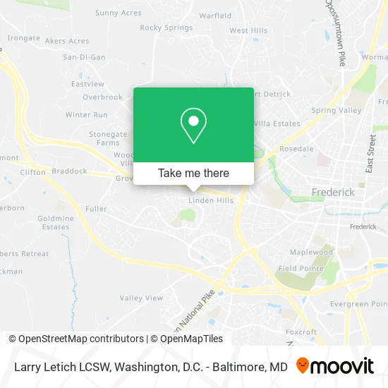
See Larry Letich LCSW, Frederick, on the map
Public Transit to Larry Letich LCSW in Frederick
Wondering how to get to Larry Letich LCSW in Frederick? Moovit helps you find the best way to get to Larry Letich LCSW with step-by-step directions from the nearest public transit station.
Moovit provides free maps and live directions to help you navigate through your city. View schedules, routes, timetables, and find out how long does it take to get to Larry Letich LCSW in real time.
Looking for the nearest stop or station to Larry Letich LCSW? Check out this list of stops closest to your destination: Hillcrest Drive at Route 40; Hillcrest Drive at Consett Place; Westridge Plaza at H Mart; Mccain Drive at Orchard Way; Key Parkway at Taskers Chance Park; Frederick Marc Wb.
Bus: 10, 50, 51, 40, 80.Train: MARC.
Want to see if there’s another route that gets you there at an earlier time? Moovit helps you find alternative routes or times. Get directions from and directions to Larry Letich LCSW easily from the Moovit App or Website.
We make riding to Larry Letich LCSW easy, which is why over 1.5 million users, including users in Frederick, trust Moovit as the best app for public transit. You don’t need to download an individual bus app or train app, Moovit is your all-in-one transit app that helps you find the best bus time or train time available.
For information on prices of bus and train, costs and ride fares to Larry Letich LCSW, please check the Moovit app.
Get to Larry Letich LCSW with public transit and pay for the ride in the Moovit app. In addition to all info you may need for your trip to Larry Letich LCSW, including live directions, real-time arrivals and fare prices, you can also buy public transit passes for your rides. No need for cash or paper tickets to get to Larry Letich LCSW - everything you need is accessible in the app with a click of the button.
Use the app to navigate to popular places including to the airport, hospital, stadium, grocery store, mall, coffee shop, school, college, and university.
Larry Letich LCSW Address: 3 Hillcrest Dr Frederick, MD 21703 street in Frederick
- BJ Multiservices,
- Khadeja Family Practice,
- Ecf Insurance & Tax Services LLC,
- Botanica Gran Poder II,
- Health Mart Pharmacy,
- Chic Hair Braiding,
- Magnificent Plumbing Service,
- Interstate Batteries,
- TACO BELL,
- Teriyaki Bowl,
- Naz's Halal Food,
- Family Foot Care,
- Grace Tabernacle Fellowship Church,
- Anna's Restaurant,
- Coinstar - Bitcoin ATM,
- OH K-Dog & Egg Toast,
- Lee's Sushi,
- Delicious Chinese Restaurant,
- Juno Bakery & Cafe,
- Westridge Square
Places Near Larry Letich LCSW (Frederick)
- Amazon Hq2, Arlington County,
- Rock Creek Tennis Center, Washington,
- Georgetown, Washington,
- Basilica of the National Shrine, Washington,
- National Zoo, Washington,
- The Anthem, Washington,
- National Museum of African American History and Culture, Washington,
- Marriott Marquis Washington, DC, Washington,
- National Mall, Washington,
- Camden Yards, Baltimore,
- Westfield Montgomery Mall, Montgomery County,
- Washington DC VA Medical Center, Washington,
- Washington National Cathedral, Washington,
- Sibley Memorial Hospital, Washington,
- Capital One Arena, Washington,
- PG Mall, Prince George's County,
- Pennsylvania Ave NW (3rd st and pennsylvania), Washington,
- Museum Of The Bible, Washington,
- Warner Theatre, Washington,
- M&T Bank Stadium, Baltimore
How to get to popular places in Washington, D.C. - Baltimore, MD with public transit
Get around Frederick by public transit!
Traveling around Frederick has never been so easy. See step by step directions as you travel to any attraction, street or major public transit station. View bus and train schedules, arrival times, service alerts and detailed routes on a map, so you know exactly how to get to anywhere in Frederick.
When traveling to any destination around Frederick use Moovit's Live Directions with Get Off Notifications to know exactly where and how far to walk, how long to wait for your line, and how many stops are left. Moovit will alert you when it's time to get off — no need to constantly re-check whether yours is the next stop.
Wondering how to use public transit in Frederick or how to pay for public transit in Frederick? Moovit public transit app can help you navigate your way with public transit easily, and at minimum cost. It includes public transit fees, ticket prices, and costs. Looking for a map of Frederick public transit lines? Moovit public transit app shows all public transit maps in Frederick with all Bus, Train, Metro, Light Rail and Ferry routes and stops on an interactive map.
Washington, D.C. - Baltimore, MD has 5 transit type(s), including: Bus, Train, Metro, Light Rail and Ferry, operated by several transit agencies, including WMATA, Montgomery County Ride On, Fairfax Connector, TheBus, PRTC, DASH - Alexandria, Arlington Transit (ART), RTA of Central Maryland, MDOT MTA, MDOT MTA Light RailLink, MDOT MTA Commuter Bus, MDOT MTA Local Bus, FXBGO!, Virginia Railway Express (VRE) and MARC