How to get to Lars Englund Data by bus?
Click on the bus route to see step by step directions with maps, line arrival times and updated time schedules.
Bus stops near Lars Englund Data in Stockholm
- Åkerberget, 5 min walk,VIEW
Light Rail stations near Lars Englund Data in Stockholm
- Tynnered Smaragdgatan, 17 min walk,VIEW
Bus lines to Lars Englund Data in Stockholm
What are the closest stations to Lars Englund Data?
The closest stations to Lars Englund Data are:
- Åkerberget is 309 meters away, 5 min walk.
- Tynnered Smaragdgatan is 1270 meters away, 17 min walk.
Which bus lines stop near Lars Englund Data?
These bus lines stop near Lars Englund Data: 90, 94, 99, X3.
Which light rail line stops near Lars Englund Data?
1 (Tynnered Opaltorget)
What’s the nearest light rail station to Lars Englund Data in Stockholm?
The nearest light rail station to Lars Englund Data in Stockholm is Tynnered Smaragdgatan. It’s a 17 min walk away.
What’s the nearest bus station to Lars Englund Data in Stockholm?
The nearest bus station to Lars Englund Data in Stockholm is Åkerberget. It’s a 5 min walk away.
What time is the first light rail to Lars Englund Data in Stockholm?
The 1 is the first light rail that goes to Lars Englund Data in Stockholm. It stops nearby at 3:09 AM.
What time is the last light rail to Lars Englund Data in Stockholm?
The X is the last light rail that goes to Lars Englund Data in Stockholm. It stops nearby at 2:27 AM.
What time is the first bus to Lars Englund Data in Stockholm?
The 94 is the first bus that goes to Lars Englund Data in Stockholm. It stops nearby at 3:03 AM.
What time is the last bus to Lars Englund Data in Stockholm?
The 90 is the last bus that goes to Lars Englund Data in Stockholm. It stops nearby at 1:35 AM.
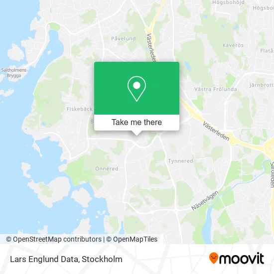
See Lars Englund Data, Stockholm, on the map
Public Transit to Lars Englund Data in Stockholm
Wondering how to get to Lars Englund Data in Stockholm? Moovit helps you find the best way to get to Lars Englund Data with step-by-step directions from the nearest public transit station.
Moovit provides free maps and live directions to help you navigate through your city. View schedules, routes, timetables, and find out how long does it take to get to Lars Englund Data in real time.
Looking for the nearest stop or station to Lars Englund Data? Check out this list of stops closest to your destination: Åkerberget; Tynnered Smaragdgatan.
Bus: 90, 94, 99, X3, 194, 196, 194, 196, 194, 196.Light Rail: 1.
Want to see if there’s another route that gets you there at an earlier time? Moovit helps you find alternative routes or times. Get directions from and directions to Lars Englund Data easily from the Moovit App or Website.
We make riding to Lars Englund Data easy, which is why over 1.7 million users, including users in Stockholm, trust Moovit as the best app for public transit. You don’t need to download an individual bus app or train app, Moovit is your all-in-one transit app that helps you find the best bus time or train time available.
For information on prices of bus, light rail, train and cable car, costs and ride fares to Lars Englund Data, please check the Moovit app.
Use the app to navigate to popular places including to the airport, hospital, stadium, grocery store, mall, coffee shop, school, college, and university.
Lars Englund Data Address: Hallstenshagen 64 SE-426 56 Västra Frölunda street in Stockholm
- Popcornmannen,
- Lagerberg Thunes, Charlotta,
- Zocalo,
- Gbg Måleridesign,
- Kings Head Gothenburg Kb,
- Munkby Consulting,
- Inventriz,
- Mattias Kjellberg Marin & Teknik AB,
- Maddes Place,
- Kulturföreningen Liljan,
- Hultén Music & Event,
- Hogedal, Stefan,
- Förskolan Stenskärsgatan 2,
- Hagerius, Alexander,
- Lilla Grevegårdsvägen 6 Förskola,
- Turabdin Kulturförening,
- Tolk. Net,
- Lyckan i Bloms,
- Förskolan Lilla Grevergårdsvägen,
- Tynnereds bilverkstad AB
Places Near Lars Englund Data (Stockholm)
- Värtahamnen, Stockholm,
- Monitor Erp Arena, Gävle,
- Avicii Arena, Stockholm,
- Westfield Mall of Scandinavia, Solna,
- Djurgården, Stockholm,
- China Teatern, Stockholm,
- Frihamnen, Stockholm,
- Postnord Veddesta Paketterminal, Järfälla,
- Spår 11-12, Stockholm,
- Älvsjömässan, Stockholm,
- Göta Lejon, Stockholm,
- Viking Line Terminal, Stockholm,
- Stadsgården, Tegelvikshamn, Stockholm,
- Älvsjö, Stockholm,
- Vikingterminalen, Stockholm,
- SSSB, Stockholm,
- 3Arena, Stockholm,
- Åhléns City, Stockholm,
- Gärdet, Stockholm,
- Clarion Hotel Stockholm, Stockholm
How to get to popular places in Stockholm with public transit
Get around Stockholm by public transit!
Traveling around Stockholm has never been so easy. See step by step directions as you travel to any attraction, street or major public transit station. View bus and train schedules, arrival times, service alerts and detailed routes on a map, so you know exactly how to get to anywhere in Stockholm.
When traveling to any destination around Stockholm use Moovit's Live Directions with Get Off Notifications to know exactly where and how far to walk, how long to wait for your line, and how many stops are left. Moovit will alert you when it's time to get off — no need to constantly re-check whether yours is the next stop.
Wondering how to use public transit in Stockholm or how to pay for public transit in Stockholm? Moovit public transit app can help you navigate your way with public transit easily, and at minimum cost. It includes public transit fees, ticket prices, and costs. Looking for a map of Stockholm public transit lines? Moovit public transit app shows all public transit maps in Stockholm with all Bus, Train, Metro, Light Rail, Ferry and Cable Car routes and stops on an interactive map.
Stockholm has 6 transit type(s), including: Bus, Train, Metro, Light Rail, Ferry and Cable Car, operated by several transit agencies, including SL, SL Rail, UL, Flygbussarna, Sörmlandstrafiken, X-trafik, Region Gotland, VL, Dalatrafik, SJ AB, Flixbus, Länstrafiken Örebro, Mälartåg, Tåg i Bergslagen and Waxholmsbolaget Ångfartygs AB