How to get to Las Charcas by bus?
Click on the bus route to see step by step directions with maps, line arrival times and updated time schedules.
From Conde Duque, Área Metropolitana De Madrid Y Corredor Del Henares
37 minFrom Real Jardín Botánico Alfonso XIII, Área Metropolitana De Madrid Y Corredor Del Henares
66 minFrom Cementerio de la Almudena, Madrid
53 minFrom Barrio de Salamanca, Madrid
36 minFrom Hospital Carlos III-Urgencias, Madrid
76 minFrom Calle Miguel Yuste, Madrid
72 minFrom Conde de Orgaz, Madrid
83 minFrom Calle de Agustín de Foxá & Estación de Chamartín, Madrid
68 minFrom ILUNION Pio XII, Madrid
60 minFrom Estación Avenida América, Madrid
44 min
How to get to Las Charcas by train?
Click on the train route to see step by step directions with maps, line arrival times and updated time schedules.
From Conde Duque, Área Metropolitana De Madrid Y Corredor Del Henares
59 minFrom Barrio de Salamanca, Madrid
57 minFrom Hospital Carlos III-Urgencias, Madrid
73 minFrom Calle de Agustín de Foxá & Estación de Chamartín, Madrid
53 minFrom ILUNION Pio XII, Madrid
75 minFrom Estación Avenida América, Madrid
77 min
How to get to Las Charcas by metro?
Click on the metro route to see step by step directions with maps, line arrival times and updated time schedules.
From Conde Duque, Área Metropolitana De Madrid Y Corredor Del Henares
28 minFrom Real Jardín Botánico Alfonso XIII, Área Metropolitana De Madrid Y Corredor Del Henares
36 minFrom Cementerio de la Almudena, Madrid
34 minFrom Barrio de Salamanca, Madrid
31 minFrom Hospital Carlos III-Urgencias, Madrid
47 minFrom Calle Miguel Yuste, Madrid
37 minFrom Conde de Orgaz, Madrid
50 minFrom Calle de Agustín de Foxá & Estación de Chamartín, Madrid
43 minFrom ILUNION Pio XII, Madrid
41 minFrom Estación Avenida América, Madrid
25 min
Bus stops near Las Charcas in Madrid
- La Vía - Plaza Elíptica, 1 min walk,VIEW
- Braganza - Vía Lusitana, 4 min walk,VIEW
- Plaza Elíptica, 4 min walk,VIEW
- Intercambiador Plaza Elíptica, 4 min walk,VIEW
- Intercambiador De Plaza Elíptica, 4 min walk,VIEW
- P.º Sta. M.ª Cabeza - Est. Plaza Elíptica, 4 min walk,VIEW
- Vía Lusitana - Plaza Elíptica, 5 min walk,VIEW
Metro stations near Las Charcas in Madrid
Bus lines to Las Charcas in Madrid
- 55, Batan,VIEW
- 81, H. 12 Octubre,VIEW
- N17, Carabanchel Alto,VIEW
- 47, Carabanchel Alto,VIEW
- 247, San Jose Obrero,VIEW
- 60, Orcasitas,VIEW
- 116, Villaverde Cruce,VIEW
- 441, P.º Juan José Rosón - Est. Arroyo Culebro,VIEW
- 442, P.º Sta. M.ª Cabeza - Est. Plaza Elíptica,VIEW
- N802, Pontevedra - Huelva,VIEW
- N803, Galicia - El Naranjo,VIEW
- N804, Teide - Pol. Ind. La Estación,VIEW
- E1, La Peseta,VIEW
- SE832, H. Fund. San Jose,VIEW
- 443, Madrid (Plaza Elíptica) - Getafe (Barrio Las Margaritas),VIEW
- 444, Madrid (Plaza Elíptica) - Getafe (Sector III - Islas Canarias),VIEW
- 446, Madrid (Plaza Elíptica) - Getafe (El Bercial),VIEW
- 460, Madrid (Plaza Elíptica) - Parla - Batres,VIEW
- 461, Madrid (Plaza Elíptica) - Parla,VIEW
- 463, Madrid (Plaza Elíptica) - Parla - Torrejón de Velasco,VIEW
What are the closest stations to Las Charcas?
The closest stations to Las Charcas are:
- La Vía - Plaza Elíptica is 48 meters away, 1 min walk.
- Braganza - Vía Lusitana is 238 meters away, 4 min walk.
- Plaza Elíptica is 250 meters away, 4 min walk.
- Intercambiador Plaza Elíptica is 253 meters away, 4 min walk.
- Intercambiador De Plaza Elíptica is 271 meters away, 4 min walk.
- P.º Sta. M.ª Cabeza - Est. Plaza Elíptica is 281 meters away, 4 min walk.
- Vía Lusitana - Plaza Elíptica is 309 meters away, 5 min walk.
- Abrantes is 518 meters away, 7 min walk.
- Urgel is 821 meters away, 11 min walk.
- Oporto is 946 meters away, 13 min walk.
Which bus lines stop near Las Charcas?
These bus lines stop near Las Charcas: 55, E1.
Which train line stops near Las Charcas?
C10 (Madrid-Chamartín-Clara Campoamor)
Which metro line stops near Las Charcas?
M-6 (Circular Andén 1)
What’s the nearest metro station to Las Charcas in Madrid?
The nearest metro station to Las Charcas in Madrid is Abrantes. It’s a 7 min walk away.
What’s the nearest bus station to Las Charcas in Madrid?
The nearest bus station to Las Charcas in Madrid is La Vía - Plaza Elíptica. It’s a 1 min walk away.
What time is the first metro to Las Charcas in Madrid?
The M-5 is the first metro that goes to Las Charcas in Madrid. It stops nearby at 6:05 AM.
What time is the last metro to Las Charcas in Madrid?
The M-5 is the last metro that goes to Las Charcas in Madrid. It stops nearby at 2:13 AM.
What time is the first bus to Las Charcas in Madrid?
The N804 is the first bus that goes to Las Charcas in Madrid. It stops nearby at 3:04 AM.
What time is the last bus to Las Charcas in Madrid?
The N805 is the last bus that goes to Las Charcas in Madrid. It stops nearby at 3:51 AM.
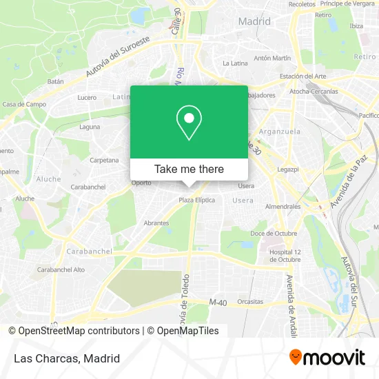
See Las Charcas, Madrid, on the map
Public Transit to Las Charcas in Madrid
Wondering how to get to Las Charcas in Madrid? Moovit helps you find the best way to get to Las Charcas with step-by-step directions from the nearest public transit station.
Moovit provides free maps and live directions to help you navigate through your city. View schedules, routes, timetables, and find out how long does it take to get to Las Charcas in real time.
Looking for the nearest stop or station to Las Charcas? Check out this list of stops closest to your destination: La Vía - Plaza Elíptica; Braganza - Vía Lusitana; Plaza Elíptica; Intercambiador Plaza Elíptica; Intercambiador De Plaza Elíptica; P.º Sta. M.ª Cabeza - Est. Plaza Elíptica; Vía Lusitana - Plaza Elíptica; Abrantes; Urgel; Oporto.
Bus: 55, E1, 81, N17, 47, 247, 60, 116.Train: C10.Metro: M-6, M-11, M-5.
Want to see if there’s another route that gets you there at an earlier time? Moovit helps you find alternative routes or times. Get directions from and directions to Las Charcas easily from the Moovit App or Website.
We make riding to Las Charcas easy, which is why over 1.5 million users, including users in Madrid, trust Moovit as the best app for public transit. You don’t need to download an individual bus app or train app, Moovit is your all-in-one transit app that helps you find the best bus time or train time available.
For information on prices of metro, bus and train, costs and ride fares to Las Charcas, please check the Moovit app.
Use the app to navigate to popular places including to the airport, hospital, stadium, grocery store, mall, coffee shop, school, college, and university.
Las Charcas Address: Travesía Antonia Lancha 1 street in Madrid
- Provivienda,
- Trancon Varela Eloy,
- Pupuseria La Ceiba,
- Avenida de Oporto 10,
- Estanco Pilar Corrales,
- Rincon Catracho Madrid,
- Virgo,
- Farmacia - Calle Vía 48,
- Saneamientos Pereda,
- Calle de Enrique Moyano,
- Calle de Santa Lucrecia, 7,
- Sala Oporto Bingo,
- Jose Pan la Vaguada,
- José Pan,
- Casa Aparicio,
- Acebo,
- Restaurante La Madreña,
- Metro Opañel,
- Plaza de San Vicente de Paúl,
- Metro Oporto
Places Near Las Charcas (Madrid)
- Palacio De Vistalegre, Área Metropolitana De Madrid Y Corredor Del Henares,
- Centro Comercial La Vaguada, Área Metropolitana De Madrid Y Corredor Del Henares,
- Tres Aguas, Alcorcón,
- Hospital Universitario La Paz, Madrid,
- Hospital Universitario Ramón y Cajal, Madrid,
- Mercadillo de Majadahonda, Majadahonda,
- Estacion de Chamartin, Madrid,
- Nassica, Área Metropolitana De Madrid Y Corredor Del Henares,
- Mendez Alvaro, Madrid,
- Plaza Mayor, Madrid,
- Centro Comercial La Gavia, Área Metropolitana De Madrid Y Corredor Del Henares,
- Centro Comercial Oasiz Madrid, Área Metropolitana De Madrid Y Corredor Del Henares,
- Wizink Center, Madrid,
- Rastro De Madrid, Área Metropolitana De Madrid Y Corredor Del Henares,
- Sala La Riviera, Madrid,
- Calle de López de Hoyos 169, Madrid,
- Hospital Clínico Universitario San Carlos, Madrid,
- Centro Comercial Islazul, Área Metropolitana De Madrid Y Corredor Del Henares,
- Plenilunio, Área Metropolitana De Madrid Y Corredor Del Henares,
- Estadio Wanda Metropolitano, Área Metropolitana De Madrid Y Corredor Del Henares
How to get to popular places in Madrid with public transit
Get around Madrid by public transit!
Traveling around Madrid has never been so easy. See step by step directions as you travel to any attraction, street or major public transit station. View bus and train schedules, arrival times, service alerts and detailed routes on a map, so you know exactly how to get to anywhere in Madrid.
When traveling to any destination around Madrid use Moovit's Live Directions with Get Off Notifications to know exactly where and how far to walk, how long to wait for your line, and how many stops are left. Moovit will alert you when it's time to get off — no need to constantly re-check whether yours is the next stop.
Wondering how to use public transit in Madrid or how to pay for public transit in Madrid? Moovit public transit app can help you navigate your way with public transit easily, and at minimum cost. It includes public transit fees, ticket prices, and costs. Looking for a map of Madrid public transit lines? Moovit public transit app shows all public transit maps in Madrid with all Bus, Train, Metro and Light Rail routes and stops on an interactive map.
Madrid has 4 transit type(s), including: Bus, Train, Metro and Light Rail, operated by several transit agencies, including Metro de Madrid, Metro Ligero, Tranvía de Parla, Renfe Cercanías - Servicios de Autobús especiales, Renfe Cercanias, Renfe Cercanías, EMT, Interurbanos, Urbanos de Alcalá de Henares, Urbanos de Alcobendas, Urbanos de Alcorcón, Urbanos de Algete, Urbanos de Aranjuez, Urbanos de Arganda del Rey and Urbanos de Arroyomolinos