How to get to Last Tangle by bus?
Click on the bus route to see step by step directions with maps, line arrival times and updated time schedules.
From Eden Center, Falls Church
65 minFrom Hyattsville District Court, Prince George's County
62 minFrom Rock Creek Tennis Center, Washington
33 minFrom Millie’S, Washington
46 minFrom Hyattsville, MD, Prince George's County
66 minFrom Seven Corners Center (Seven Corners Shopping Center Falls Church VA), Fairfax County
66 minFrom Citi Open, Washington
31 minFrom St John's College High School, Washington
45 minFrom U.S. Naval Research Laboratory - NRL, Washington
105 minFrom Prince George's Plaza Metro Station, Prince George's County
81 min
How to get to Last Tangle by metro?
Click on the metro route to see step by step directions with maps, line arrival times and updated time schedules.
Bus stops near Last Tangle in Washington
Metro stations near Last Tangle in Washington
Bus lines to Last Tangle in Washington
- 335, 335/1 Washington Dc,VIEW
- 345, 345/2 Washington Dc,VIEW
- 305, 305/5 Columbia,VIEW
- 325, 325/3 Washington Dc / Capitol Hill,VIEW
- D94, East To Gallery Place,VIEW
- D96, South To Potomac Park,VIEW
- D70, South To Farragut Sq,VIEW
- D72, North To Mt Pleasant,VIEW
- 725, 725/1 Washington Dc,VIEW
- 810, 810/2 Washington Dc,VIEW
- 820, 820/9 Washington Dc,VIEW
- 830, 830/3 Washington Dc,VIEW
- 840, 840/1 Washington Dc,VIEW
- 630, 630/3 Washington Dc,VIEW
- D74, East To Rhode Island Av,VIEW
What are the closest stations to Last Tangle?
The closest stations to Last Tangle are:
- 19th St & M St NW Sb is 24 yards away, 1 min walk.
- 20 St Nw+L St NW is 223 yards away, 4 min walk.
- Connecticut Av Nw+M St NW is 316 yards away, 5 min walk.
- K St & 19th St NW Wb is 326 yards away, 5 min walk.
- M St & 21st St NW Wb is 328 yards away, 5 min walk.
- Farragut North is 392 yards away, 6 min walk.
- New Hampshire Av Nw+M St NW is 408 yards away, 6 min walk.
- Farragut West is 518 yards away, 7 min walk.
Which bus lines stop near Last Tangle?
These bus lines stop near Last Tangle: 305, A58, D10, D6X, D70, D94, D96.
Which metro lines stop near Last Tangle?
These metro lines stop near Last Tangle: RED, SILVER.
What’s the nearest metro station to Last Tangle in Washington?
The nearest metro station to Last Tangle in Washington is Farragut North. It’s a 6 min walk away.
What’s the nearest bus station to Last Tangle in Washington?
The nearest bus station to Last Tangle in Washington is 19th St & M St NW Sb. It’s a 1 min walk away.
What time is the first metro to Last Tangle in Washington?
The BLUE is the first metro that goes to Last Tangle in Washington. It stops nearby at 5:23 AM.
What time is the last metro to Last Tangle in Washington?
The RED is the last metro that goes to Last Tangle in Washington. It stops nearby at 12:10 AM.
What time is the first bus to Last Tangle in Washington?
The D72 is the first bus that goes to Last Tangle in Washington. It stops nearby at 4:21 AM.
What time is the last bus to Last Tangle in Washington?
The D70 is the last bus that goes to Last Tangle in Washington. It stops nearby at 2:01 AM.
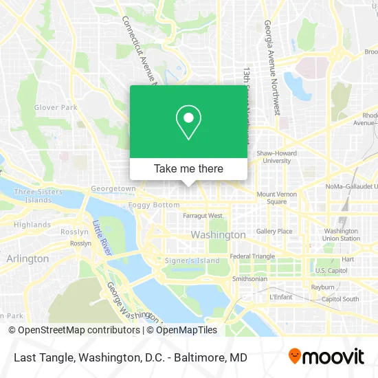
See Last Tangle, Washington, on the map
Public Transit to Last Tangle in Washington
Wondering how to get to Last Tangle in Washington? Moovit helps you find the best way to get to Last Tangle with step-by-step directions from the nearest public transit station.
Moovit provides free maps and live directions to help you navigate through your city. View schedules, routes, timetables, and find out how long does it take to get to Last Tangle in real time.
Looking for the nearest stop or station to Last Tangle? Check out this list of stops closest to your destination: 19th St & M St NW Sb; 20 St Nw+L St NW; Connecticut Av Nw+M St NW; K St & 19th St NW Wb; M St & 21st St NW Wb; Farragut North; New Hampshire Av Nw+M St NW; Farragut West.
Bus: 305, A58, D10, D6X, D70, D94, D96, 335, 345, 325, D72.Metro: RED, SILVER, BLUE, ORANGE.
Want to see if there’s another route that gets you there at an earlier time? Moovit helps you find alternative routes or times. Get directions from and directions to Last Tangle easily from the Moovit App or Website.
We make riding to Last Tangle easy, which is why over 1.5 million users, including users in Washington, trust Moovit as the best app for public transit. You don’t need to download an individual bus app or train app, Moovit is your all-in-one transit app that helps you find the best bus time or train time available.
For information on prices of bus and metro, costs and ride fares to Last Tangle, please check the Moovit app.
Use the app to navigate to popular places including to the airport, hospital, stadium, grocery store, mall, coffee shop, school, college, and university.
Last Tangle Address: 1146 19th St NW street in Washington
- Sandy Spring Bank,
- Grant Thornton,
- Plaza Art (Plz Artist Matls & Picture Framing),
- Ace MD Lipson,
- Embassy Of Honduras,
- Sección Consular de la Embajada de Honduras,
- Swahili Village - the Consulate DC,
- McDonald's,
- Nooshi,
- 301,
- The Feldman Hearing Studio (Feldman Enterprise Group PC - Seth F Oringher MD),
- Eugene Miknowski,
- Rehabilitation Center,
- GW Imaging,
- Roti,
- AC Hotel by Marriott Washington DC Downtown (AC Hotel Washington DC Downtown),
- Boqueria,
- Wawa,
- Mckinsey & Company,
- The Camelot Showbar
Places Near Last Tangle (Washington)
- Rock Creek Tennis Center, Washington,
- The Anthem, Washington,
- National Museum of African American History and Culture, Washington,
- Capital One Arena, Washington,
- Camden Yards, Baltimore,
- Museum Of The Bible, Washington,
- National Theatre, Washington,
- Georgetown, Washington,
- Pennsylvania Ave NW (3rd st and pennsylvania), Washington,
- Westfield Montgomery Mall, Montgomery County,
- National Zoo, Washington,
- Marriott Marquis Washington, DC, Washington,
- PG Mall, Prince George's County,
- M&T Bank Stadium, Baltimore,
- Basilica of the National Shrine, Washington,
- Sibley Memorial Hospital, Washington,
- Washington DC VA Medical Center, Washington,
- Washington National Cathedral, Washington,
- Amazon Hq2, Arlington County,
- Warner Theatre, Washington
How to get to popular places in Washington, D.C. - Baltimore, MD with public transit
Get around Washington by public transit!
Traveling around Washington has never been so easy. See step by step directions as you travel to any attraction, street or major public transit station. View bus and train schedules, arrival times, service alerts and detailed routes on a map, so you know exactly how to get to anywhere in Washington.
When traveling to any destination around Washington use Moovit's Live Directions with Get Off Notifications to know exactly where and how far to walk, how long to wait for your line, and how many stops are left. Moovit will alert you when it's time to get off — no need to constantly re-check whether yours is the next stop.
Wondering how to use public transit in Washington or how to pay for public transit in Washington? Moovit public transit app can help you navigate your way with public transit easily, and at minimum cost. It includes public transit fees, ticket prices, and costs. Looking for a map of Washington public transit lines? Moovit public transit app shows all public transit maps in Washington with all Bus, Train, Metro, Light Rail and Ferry routes and stops on an interactive map.
Washington, D.C. - Baltimore, MD has 5 transit type(s), including: Bus, Train, Metro, Light Rail and Ferry, operated by several transit agencies, including WMATA, Montgomery County Ride On, Fairfax Connector, TheBus, PRTC, DASH - Alexandria, Arlington Transit (ART), RTA of Central Maryland, MDOT MTA, MDOT MTA Light RailLink, MDOT MTA Commuter Bus, MDOT MTA Local Bus, FXBGO!, Virginia Railway Express (VRE) and MARC