Directions to Lc Moveis (Cic) with public transportation
The following transit lines have routes that pass near Lc Moveis
How to get to Lc Moveis by bus?
Click on the bus route to see step by step directions with maps, line arrival times and updated time schedules.
From Praça Nossa Senhora de Salette, Centro Cívico
55 minFrom Alphasonic, Batel
47 minFrom São Braz, São Braz
42 minFrom Rua Emílio de Menezes, São Francisco
48 minFrom Alameda Augusto Stellfeld 1908, Bigorrilho
60 minFrom Mexico 70, Sítio Cercado
68 minFrom Rua Professora Maria De Assumpção, Boqueirão
63 minFrom Hospital Oswaldo Cruz, Alto Da Rua XV
54 minFrom C.D. Condor Hipermercados, Umbará
64 minFrom Rua Brigadeiro Arthur Carlos Peralta 137, Boqueirão
63 min
Bus stops near Lc Moveis in Cic
Bus lines to Lc Moveis in Cic
- 710 SANTA AMÉLIA / PORTO BELO, Terminal Fazendinha ↺ Porto Belo (Circular),VIEW
- 718 PORTO BELO, Terminal Fazendinha → Porto Belo (Circular),VIEW
- 703 CAIUÁ, CAIUÁ,VIEW
- 706 CAIUÁ - FAZENDINHA / CENTRO, CAIUÁ - FAZENDINHA / CENTRO,VIEW
- 724 FAZENDINHA / CAIUÁ - BELA VISTA, FAZENDINHA - CAIUÁ / BELA VISTA,VIEW
- 789 MAD. CAIUÁ, MAD. CAIUÁ,VIEW
- 711 ITATIAIA, Terminal Fazendinha → Itatiaia,VIEW
- 788 MAD. VILA VELHA, Praça Rui Barbosa ↺ Vila Velha (Circular),VIEW
- 040 INTERBAIRROS IV, Terminal Pinheirinho → Terminal Santa Felicidade,VIEW
- 720 FAZENDINHA / CAMPO COMPRIDO, Terminal Campo Comprido → Terminal Fazendinha,VIEW
What are the closest stations to Lc Moveis?
The closest stations to Lc Moveis are:
- R. Município De Enéas Marquês, 16 is 65 meters away, 1 min walk.
- R. Raul Pompéia, 1034 is 93 meters away, 2 min walk.
- R. Raul Pompéia, 648 is 250 meters away, 4 min walk.
- R. Raul Pompéia, 649 is 265 meters away, 4 min walk.
- R. João Dembinski, 3323 is 472 meters away, 7 min walk.
Which bus lines stop near Lc Moveis?
These bus lines stop near Lc Moveis: 040 INTERBAIRROS IV, 703 CAIUÁ, 711 ITATIAIA, 724 FAZENDINHA / CAIUÁ - BELA VISTA.
What’s the nearest bus station to Lc Moveis in Cic?
The nearest bus station to Lc Moveis in Cic is R. Município De Enéas Marquês, 16. It’s a 1 min walk away.
What time is the first bus to Lc Moveis in Cic?
The 788 MAD. VILA VELHA is the first bus that goes to Lc Moveis in Cic. It stops nearby at 3:25 AM.
What time is the last bus to Lc Moveis in Cic?
The 789 MAD. CAIUÁ is the last bus that goes to Lc Moveis in Cic. It stops nearby at 2:55 AM.
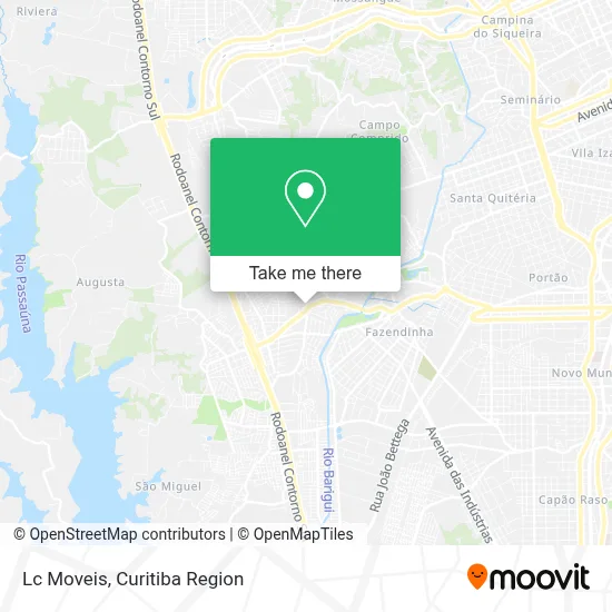
See Lc Moveis, Cic, on the map
Public Transit to Lc Moveis in Cic
Wondering how to get to Lc Moveis in Cic? Moovit helps you find the best way to get to Lc Moveis with step-by-step directions from the nearest public transit station.
Moovit provides free maps and live directions to help you navigate through your city. View schedules, routes, timetables, and find out how long does it take to get to Lc Moveis in real time.
Looking for the nearest stop or station to Lc Moveis? Check out this list of stops closest to your destination: R. Município De Enéas Marquês; R. Raul Pompéia; R. Raul Pompéia; R. Raul Pompéia; R. João Dembinski.
Bus: 040 INTERBAIRROS IV, 703 CAIUÁ, 711 ITATIAIA, 724 FAZENDINHA / CAIUÁ - BELA VISTA, 710 SANTA AMÉLIA / PORTO BELO, 718 PORTO BELO, 706 CAIUÁ - FAZENDINHA / CENTRO, 789 MAD. CAIUÁ, 788 MAD. VILA VELHA, 720 FAZENDINHA / CAMPO COMPRIDO.
Want to see if there’s another route that gets you there at an earlier time? Moovit helps you find alternative routes or times. Get directions from and directions to Lc Moveis easily from the Moovit App or Website.
We make riding to Lc Moveis easy, which is why over 1.5 million users, including users in Cic, trust Moovit as the best app for public transit. You don’t need to download an individual bus app or train app, Moovit is your all-in-one transit app that helps you find the best bus time or train time available.
For information on prices of bus, costs and ride fares to Lc Moveis, please check the Moovit app.
Use the app to navigate to popular places including to the airport, hospital, stadium, grocery store, mall, coffee shop, school, college, and university.
Lc Moveis Address: Rua Professor Theodócio Jorge Atherino, 342 Cidade Industrial de Curitiba Curitiba-PR 81250-265 street in Cic
- Style Cutz Barbershop,
- Imperio das Coifas,
- Maria Souza,
- Ar Manutencoes de Maquinas,
- Ferragens Filus,
- Amis Boutique,
- Viviane Costa,
- Eats Potato,
- Carla Jeanete,
- Little Baby Shop,
- Escapamentos Fabricio,
- Marcelohenrique,
- Desentupidora Express,
- Rodrigues Ensino de Esportes,
- Estrada Velha do Barigui 2,
- Senhor dos Cortes,
- J.Lemebarber,
- Barbearia Studio Vk,
- CMEI Cananeia,
- Neves Car Multimarcas
Places Near Lc Moveis (Cic)
- Park Shopping Barigüi, Mossunguê,
- Rua Martim Afonso 558, Mercês,
- Hospital Angelina Caron, Campina Grande Do Sul,
- Arena Da Baixada - Curitiba,
- Parque Barigui, Mercês,
- Hospital do Rocio, Campo,
- Hospital Do Senhor - Madre Virgínia, São José Dos Pinhais,
- Hospital de Clínicas (HC - UFPR), Centro,
- Pontifícia Universidade Católica do Paraná (PUCPR), Prado Velho,
- Hhhhh, Fazendinha,
- Shopping Palladium, Portão,
- Hospital Erasto Gaertner, Jardim Das Américas,
- Shopping Estação, Rebouças,
- Hospital Universitário Evangélico de Curitiba, Bigorrilho,
- Hospital Nossa Senhora Das Graças, Mercês,
- Hospital Da Cruz Vermelha, Batel,
- Rua General Mário Tourinho, Campina Do Siqueira,
- Jockey Plaza Shopping Center, Tarumã,
- Jardim Botânico de Curitiba PR, Centro,
- Hospital Madalena Sofia, Bairro Alto
How to get to popular places in Curitiba Region with public transit
Get around Cic by public transit!
Traveling around Cic has never been so easy. See step by step directions as you travel to any attraction, street or major public transit station. View bus and train schedules, arrival times, service alerts and detailed routes on a map, so you know exactly how to get to anywhere in Cic.
When traveling to any destination around Cic use Moovit's Live Directions with Get Off Notifications to know exactly where and how far to walk, how long to wait for your line, and how many stops are left. Moovit will alert you when it's time to get off — no need to constantly re-check whether yours is the next stop.
Wondering how to use public transit in Cic or how to pay for public transit in Cic? Moovit public transit app can help you navigate your way with public transit easily, and at minimum cost. It includes public transit fees, ticket prices, and costs. Looking for a map of Cic public transit lines? Moovit public transit app shows all public transit maps in Cic with all Bus and Cable Car routes and stops on an interactive map.
Curitiba Region has 2 transit type(s), including: Bus and Cable Car, operated by several transit agencies, including Sistema Integrado de Mobilidade (URBS), Sistema Integrado de Mobilidade (AMEP), URBS (Cartões bancários e Dinheiro), URBS (Cartões bancários / Cartão URBS), AMEP (Cartões bancários / Cartão MetroCard), AMEP (Cartões bancários / Cartão MetroCard / Dinheiro), Viação Colombo (Dinheiro), TRIAR (Cartão TRIAR / Dinheiro), Empresa Curitiba Cerro Azul (Dinheiro), Expresso Nossa Senhora da Penha (Dinheiro), Empresa Campo Alto Tijucas (Dinheiro), Auto Viação São José (Cartão VEM / Dinheiro), BRT S/A (Cartão VEM / Dinheiro), TransPiedade (Cartão Cidadão / Dinheiro) and Oceânica Sul (Cartão Transporte / Dinheiro)