How to get to Le Labo by bus?
Click on the bus route to see step by step directions with maps, line arrival times and updated time schedules.
From Weill Cornell Greenberg Center 1305 York Avenue, Manhattan
52 minFrom Baruch College, Manhattan
49 minFrom 72-06 Northern Boulevard, Queens
82 minFrom Macy's Thanksgiving Day Parade, Manhattan
30 minFrom Roosevelt Ave / 74th St, Queens
83 minFrom Broadway & 50th St, Manhattan
36 minFrom New York City Center, Manhattan
29 minFrom Middle Village, NY, Queens
70 minFrom Queens Center Mall, Queens
74 minFrom Hallets Point, Queens
87 min
How to get to Le Labo by train?
Click on the train route to see step by step directions with maps, line arrival times and updated time schedules.
How to get to Le Labo by subway?
Click on the subway route to see step by step directions with maps, line arrival times and updated time schedules.
From Weill Cornell Greenberg Center 1305 York Avenue, Manhattan
33 minFrom Baruch College, Manhattan
34 minFrom 72-06 Northern Boulevard, Queens
48 minFrom Macy's Thanksgiving Day Parade, Manhattan
21 minFrom Roosevelt Ave / 74th St, Queens
36 minFrom Broadway & 50th St, Manhattan
22 minFrom New York City Center, Manhattan
22 minFrom Middle Village, NY, Queens
52 minFrom Queens Center Mall, Queens
49 minFrom Hallets Point, Queens
63 min
Bus stops near Le Labo in Manhattan
Subway stations near Le Labo in Manhattan
Bus lines to Le Labo in Manhattan
- 120, New York Lower Manhattan,VIEW
- SIM34, Mariners Harbor Via Watchogue Rd,VIEW
- SUBURBAN TRANSIT, New York,VIEW
- SIM33C, Mariners Harbor Via N Gannon Av,VIEW
- SIM1, Eltngvlle Trans Ctr Via Hylan Via Rich,VIEW
- SIM1C, Eltngvlle Trans Ctr Via Hylan Via Rich,VIEW
- SIM3C, Pt Rchmnd Via Narrows Rd N Via Watchogue,VIEW
- SIM4, Annadale Via Richmond Av,VIEW
- SIM4C, Huguenot Via Richmond Av Via Arthur Kill,VIEW
- BXM18, Riverdale 263 St Via Madison Av Via H. Hudson Pky,VIEW
- SIM2, Tottenville Via Huguenot Av Via Hylan Bl,VIEW
- SHORTLINE HUDSON, New York,VIEW
- SHORTLINE HUDSON, Circleville,VIEW
- SIM32, Travis Via N Gannon Av Via Victory Bl,VIEW
- M55, South Ferry,VIEW
- X27, Bay Ridge Shore Rd Via Broadway,VIEW
- X28, Coney Island Sea Gate Via Broadway,VIEW
- SHORTLINE HUDSON, 500 - Monroe - Chester - Goshen,VIEW
- SHORTLINE HUDSON, 800 - Pennsylvania,VIEW
- SHORTLINE HUDSON, 700 - Newburgh - Poughkeepsie,VIEW
What are the closest stations to Le Labo?
The closest stations to Le Labo are:
- Broadway/Thomas St is 104 yards away, 2 min walk.
- Broadway Between Worth & Thomas St is 109 yards away, 2 min walk.
- Broadway/Worth St is 140 yards away, 2 min walk.
- Worth St/Church St is 217 yards away, 3 min walk.
- Church St & Leonard St is 218 yards away, 3 min walk.
- Canal St is 229 yards away, 3 min walk.
- Franklin St is 364 yards away, 5 min walk.
- Broadway/Walker St is 386 yards away, 5 min walk.
- Brooklyn Bridge-City Hall is 521 yards away, 7 min walk.
- Broadway & Leonard St is 524 yards away, 7 min walk.
Which bus lines stop near Le Labo?
These bus lines stop near Le Labo: BXM18, M20.
Which train lines stop near Le Labo?
These train lines stop near Le Labo: BLU, GRE, RED.
Which subway lines stop near Le Labo?
These subway lines stop near Le Labo: 1, 2, E, J, N, Q, R.
What’s the nearest subway station to Le Labo in Manhattan?
The nearest subway station to Le Labo in Manhattan is Canal St. It’s a 3 min walk away.
What’s the nearest bus station to Le Labo in Manhattan?
The nearest bus stations to Le Labo in Manhattan are Broadway/Thomas St, Broadway Between Worth & Thomas St and Broadway/Worth St. The closest one is a 2 min walk away.
What time is the first subway to Le Labo in Manhattan?
The J is the first subway that goes to Le Labo in Manhattan. It stops nearby at 3:00 AM.
What time is the last subway to Le Labo in Manhattan?
The 2 is the last subway that goes to Le Labo in Manhattan. It stops nearby at 4:06 AM.
What time is the first bus to Le Labo in Manhattan?
The SIM1C is the first bus that goes to Le Labo in Manhattan. It stops nearby at 3:52 AM.
What time is the last bus to Le Labo in Manhattan?
The SIM1C is the last bus that goes to Le Labo in Manhattan. It stops nearby at 2:52 AM.
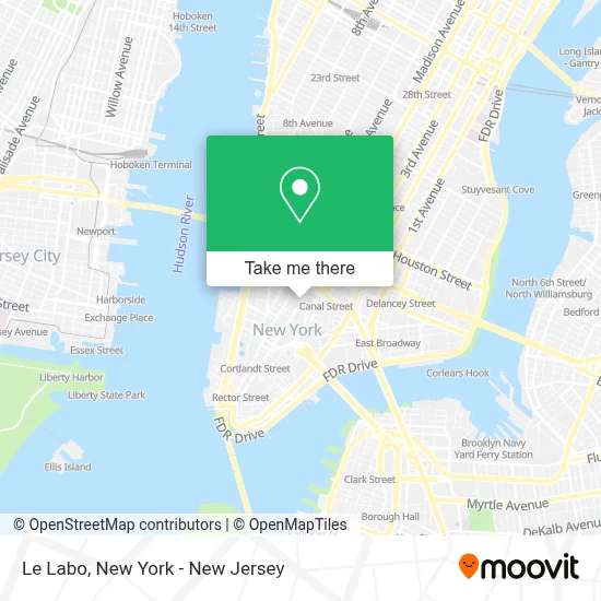
See Le Labo, Manhattan, on the map
Public Transit to Le Labo in Manhattan
Wondering how to get to Le Labo in Manhattan? Moovit helps you find the best way to get to Le Labo with step-by-step directions from the nearest public transit station.
Moovit provides free maps and live directions to help you navigate through your city. View schedules, routes, timetables, and find out how long does it take to get to Le Labo in real time.
Looking for the nearest stop or station to Le Labo? Check out this list of stops closest to your destination: Broadway/Thomas St; Broadway Between Worth & Thomas St; Broadway/Worth St; Worth St/Church St; Church St & Leonard St; Canal St; Franklin St; Broadway/Walker St; Brooklyn Bridge-City Hall; Broadway & Leonard St.
Bus: BXM18, M20, 120, SIM34, SUBURBAN TRANSIT.Train: BLU, GRE, RED.Subway: 1, 2, E, J, N, Q, R, W, 5, A, C.
Want to see if there’s another route that gets you there at an earlier time? Moovit helps you find alternative routes or times. Get directions from and directions to Le Labo easily from the Moovit App or Website.
We make riding to Le Labo easy, which is why over 1.5 million users, including users in Manhattan, trust Moovit as the best app for public transit. You don’t need to download an individual bus app or train app, Moovit is your all-in-one transit app that helps you find the best bus time or train time available.
For information on prices of subway, bus and train, costs and ride fares to Le Labo, please check the Moovit app.
Use the app to navigate to popular places including to the airport, hospital, stadium, grocery store, mall, coffee shop, school, college, and university.
Le Labo Address: 359 Broadway street in Manhattan
- The Barbarian Agency,
- The Triple A Loft Nyc,
- Herbalife Distributor,
- Hard Turn Bk,
- Roll and Go,
- Soho & Tribeca Map,
- Black Burger,
- Jaxon James Couture Bridal,
- Juvenile Justice Department,
- Faith Exchange,
- Stephén Seo,
- Leonard St (broadway and leonard),
- Gourmet Garage Of Tribeca,
- Space Zeroone,
- O.K. Uniform Co.,
- Hemingway African Gallery,
- Diamond City Studios,
- Barbarian,
- Prime Essentials,
- Nicelle Beauchene Gallery
Places Near Le Labo (Manhattan)
- Mountainside Hospital, Glen Ridge,
- San Gennaro Feast, Manhattan,
- Pier 83, Manhattan,
- Queens Center Mall, Queens,
- Rockefeller Center, Manhattan,
- 1 Police Plaza, Manhattan,
- Bellevue Hospital, Manhattan,
- Chinatown, Manhattan,
- 376 Hudson Street, Manhattan,
- 911 Memorial, Manhattan,
- Wall Street, Manhattan,
- SoHo, Manhattan,
- Katz's Deli, Manhattan,
- 3 Stone St, Manhattan,
- 111 Centre New York City Supreme Court, Manhattan,
- 66 John Street, Manhattan,
- Times Square, Manhattan,
- Hudson Yards, Manhattan,
- 26 Federal Plaza, Manhattan,
- qqqq, Manhattan
How to get to popular places in New York - New Jersey with public transit
Get around Manhattan by public transit!
Traveling around Manhattan has never been so easy. See step by step directions as you travel to any attraction, street or major public transit station. View bus and train schedules, arrival times, service alerts and detailed routes on a map, so you know exactly how to get to anywhere in Manhattan.
When traveling to any destination around Manhattan use Moovit's Live Directions with Get Off Notifications to know exactly where and how far to walk, how long to wait for your line, and how many stops are left. Moovit will alert you when it's time to get off — no need to constantly re-check whether yours is the next stop.
Wondering how to use public transit in Manhattan or how to pay for public transit in Manhattan? Moovit public transit app can help you navigate your way with public transit easily, and at minimum cost. It includes public transit fees, ticket prices, and costs. Looking for a map of Manhattan public transit lines? Moovit public transit app shows all public transit maps in Manhattan with all Bus, Train, Subway, Light Rail, Ferry and Cable Car routes and stops on an interactive map.
New York - New Jersey has 6 transit type(s), including: Bus, Train, Subway, Light Rail, Ferry and Cable Car, operated by several transit agencies, including MTA Subway, Metro-North Railroad, LIRR, PATH, MTA New York City Transit - Express routes, MTA Bus, NJ Transit, NYC Ferry, NICE bus, Bee-Line Bus, NJ Transit Rail, Norwalk Transit District, Hartford Line, River Valley Transit and HART