How to get to Le Triangle D'Or by bus?
Click on the bus route to see step by step directions with maps, line arrival times and updated time schedules.
From Jean Lain Automobiles Annecy, Annecy
62 minFrom Gruffy, Annecy
61 minFrom Bibliothèque Municipale de Saint-Martin Bellevue, Annecy
61 minFrom Lycee Agricole de Poisy Chavanod, Annecy
52 minFrom Le Coin Fermier, Annecy
56 minFrom Balmont, Annecy
49 minFrom Salle Communale la Fruitiere, Annecy
49 minFrom Srp, Annecy
53 minFrom Groupe Scolaire de Balmont, Annecy
69 min
Bus stops near Le Triangle D'Or in Annecy
Bus lines to Le Triangle D'Or in Annecy
What are the closest stations to Le Triangle D'Or?
The closest stations to Le Triangle D'Or are:
- Paul Guiton is 5 meters away, 1 min walk.
- Annapurna is 561 meters away, 8 min walk.
- Henri Dunant is 597 meters away, 8 min walk.
- Montremont is 818 meters away, 11 min walk.
- Bel Air is 884 meters away, 12 min walk.
Which bus lines stop near Le Triangle D'Or?
These bus lines stop near Le Triangle D'Or: 2, 4.
What’s the nearest bus station to Le Triangle D'Or in Annecy?
The nearest bus station to Le Triangle D'Or in Annecy is Paul Guiton. It’s a 1 min walk away.
What time is the first bus to Le Triangle D'Or in Annecy?
The 3 is the first bus that goes to Le Triangle D'Or in Annecy. It stops nearby at 5:28 AM.
What time is the last bus to Le Triangle D'Or in Annecy?
The 1 is the last bus that goes to Le Triangle D'Or in Annecy. It stops nearby at 11:58 PM.
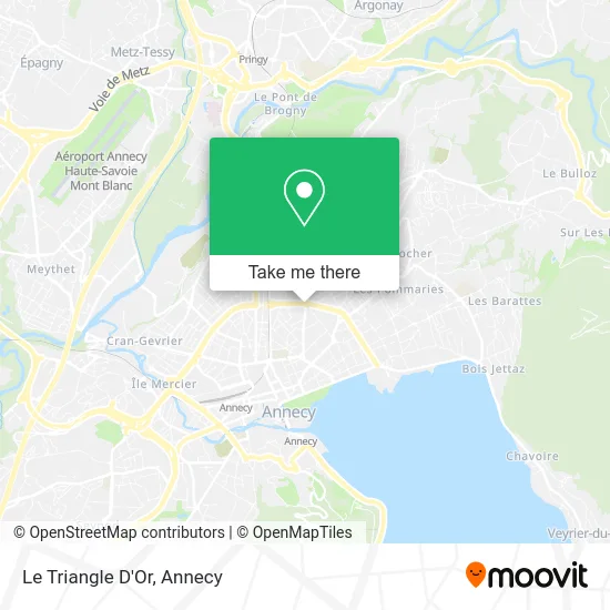
See Le Triangle D'Or, Annecy, on the map
Public Transit to Le Triangle D'Or in Annecy
Wondering how to get to Le Triangle D'Or in Annecy? Moovit helps you find the best way to get to Le Triangle D'Or with step-by-step directions from the nearest public transit station.
Moovit provides free maps and live directions to help you navigate through your city. View schedules, routes, timetables, and find out how long does it take to get to Le Triangle D'Or in real time.
Looking for the nearest stop or station to Le Triangle D'Or? Check out this list of stops closest to your destination: Paul Guiton; Annapurna; Henri Dunant; Montremont; Bel Air.
Bus: 2, 4, 3, 1, 10, 82, 20.
Want to see if there’s another route that gets you there at an earlier time? Moovit helps you find alternative routes or times. Get directions from and directions to Le Triangle D'Or easily from the Moovit App or Website.
We make riding to Le Triangle D'Or easy, which is why over 1.5 million users, including users in Annecy, trust Moovit as the best app for public transit. You don’t need to download an individual bus app or train app, Moovit is your all-in-one transit app that helps you find the best bus time or train time available.
For information on prices of bus, costs and ride fares to Le Triangle D'Or, please check the Moovit app.
Use the app to navigate to popular places including to the airport, hospital, stadium, grocery store, mall, coffee shop, school, college, and university.
Le Triangle D'Or Address: Place du Général de Gaulle street in Annecy
- Fenêtrier Veka Vma,
- Marilyn Arnaud,
- Fresque le Mont Blanc,
- Soboczynski,
- Institut Alexandra Beauté,
- Sirac,
- Evidence Habitat,
- Chez Mme Audrey Bocquin,
- Sarl Pizzina,
- Ng Frères,
- Perraudin Jennyfer,
- Centre de Départs et de Retours de Colonies Ufoval,
- École Maternelle de La Plaine,
- Cercle des Vins Fins,
- Pro Eft,
- Office Léman,
- Société Générale,
- Lucile Romain,
- Thirion Clement,
- Deplante Cottet Sylvie
Places Near Le Triangle D'Or (Annecy)
- Seynod, Annecy,
- Avenue de Genève, Annecy,
- Les Gorges du Fier, Annecy,
- Centre Hospitalier Annecy-Genevois, Annecy,
- Lycée St Michel, Annecy,
- Col de La Forclaz, Annecy,
- Lycée Charles Baudelaire, Annecy,
- Leroy Merlin, Annecy,
- Galeries Lafayette, Annecy,
- Leclerc, Annecy,
- 27 Bca, Annecy,
- Clinique Generale D'annecy, Annecy,
- Cran-Gevrier, Annecy,
- Carrefour, Annecy,
- Basilique De La Visitation, Annecy,
- Annecy-Le-Vieux, Annecy,
- 27e Bataillon De Chasseurs Alpins, Annecy,
- L'Impérial Palace, Annecy,
- Centre Hospitalier Annecy, Annecy,
- Iut annecy, Annecy
How to get to popular places in Annecy with public transit
Get around Annecy by public transit!
Traveling around Annecy has never been so easy. See step by step directions as you travel to any attraction, street or major public transit station. View bus and train schedules, arrival times, service alerts and detailed routes on a map, so you know exactly how to get to anywhere in Annecy.
When traveling to any destination around Annecy use Moovit's Live Directions with Get Off Notifications to know exactly where and how far to walk, how long to wait for your line, and how many stops are left. Moovit will alert you when it's time to get off — no need to constantly re-check whether yours is the next stop.
Wondering how to use public transit in Annecy or how to pay for public transit in Annecy? Moovit public transit app can help you navigate your way with public transit easily, and at minimum cost. It includes public transit fees, ticket prices, and costs. Looking for a map of Annecy public transit lines? Moovit public transit app shows all public transit maps in Annecy with all bus routes and stops on an interactive map.
Annecy has 1 transit type(s), including: bus, operated by several transit agencies, including SIBRA