How to get to Learn To Drive Driving School by bus?
Click on the bus route to see step by step directions with maps, line arrival times and updated time schedules.
From Peekskill, NY, Peekskill
45 minFrom Elmsford, NY, Elmsford
95 minFrom Palisades mall, West Nyack
125 minFrom Regeneron Pharmaceuticals Inc, Tarrytown
130 minFrom Westchester Mall, White Plains
104 minFrom 11A Bus to Port Authority, Spring Valley
137 minFrom White Plains, NY, White Plains
97 minFrom GFFF, Stamford
182 min
Bus stop near Learn To Drive Driving School in Yorktown
- Commerce St @ Veterans Rd, 2 min walk,VIEW
Bus lines to Learn To Drive Driving School in Yorktown
What are the closest stations to Learn To Drive Driving School?
The closest stations to Learn To Drive Driving School are:
- Commerce St @ Veterans Rd is 96 yards away, 2 min walk.
Which bus line stops near Learn To Drive Driving School?
15 (Ej Conroy Dr @ Main St)
What’s the nearest bus station to Learn To Drive Driving School in Yorktown?
The nearest bus station to Learn To Drive Driving School in Yorktown is Commerce St @ Veterans Rd. It’s a 2 min walk away.
What time is the first bus to Learn To Drive Driving School in Yorktown?
The 10 is the first bus that goes to Learn To Drive Driving School in Yorktown. It stops nearby at 5:44 AM.
What time is the last bus to Learn To Drive Driving School in Yorktown?
The 15 is the last bus that goes to Learn To Drive Driving School in Yorktown. It stops nearby at 7:18 PM.
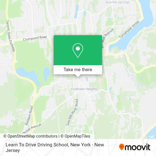
See Learn To Drive Driving School, Yorktown, on the map
Public Transit to Learn To Drive Driving School in Yorktown
Wondering how to get to Learn To Drive Driving School in Yorktown? Moovit helps you find the best way to get to Learn To Drive Driving School with step-by-step directions from the nearest public transit station.
Moovit provides free maps and live directions to help you navigate through your city. View schedules, routes, timetables, and find out how long does it take to get to Learn To Drive Driving School in real time.
Looking for the nearest stop or station to Learn To Drive Driving School? Check out this list of stops closest to your destination: Commerce St @ Veterans Rd.
Bus: 15, 10.
Want to see if there’s another route that gets you there at an earlier time? Moovit helps you find alternative routes or times. Get directions from and directions to Learn To Drive Driving School easily from the Moovit App or Website.
We make riding to Learn To Drive Driving School easy, which is why over 1.5 million users, including users in Yorktown, trust Moovit as the best app for public transit. You don’t need to download an individual bus app or train app, Moovit is your all-in-one transit app that helps you find the best bus time or train time available.
For information on prices of bus and train, costs and ride fares to Learn To Drive Driving School, please check the Moovit app.
Use the app to navigate to popular places including to the airport, hospital, stadium, grocery store, mall, coffee shop, school, college, and university.
Learn To Drive Driving School Address: 1974 Commerce St street in Yorktown
- Yorktown Nutrition Center For Senior Citizens,
- Philam School Of Self Defense,
- Yorktown Parks and Recreation,
- Kitchen Headquarters,
- Cst Kitchens and Baths,
- Jeremy Liang, Od - Sightmd Yorktown,
- Libri,
- Chase Atm,
- Lifestance Therapists & Psychiatrists Yorktown Heights,
- Morris Glassman, M.D.,
- Sybil Mouzon, Psychiatrist,
- Crossfire Consulting,
- Kintronics,
- Audibel Hearing Centers,
- Claudia Mitchell-Gambino, Counselor,
- Jing Wang,
- Dr. Christian Piccolo, Md,
- Atm 7eleven-Fcti,
- Gross Law NY,
- Banktrade LLC.
Places Near Learn To Drive Driving School (Yorktown)
- Wall Street, Manhattan,
- 111 Centre New York City Supreme Court, Manhattan,
- 376 Hudson Street, Manhattan,
- 66 John Street, Manhattan,
- San Gennaro Feast, Manhattan,
- Hudson Yards, Manhattan,
- Rockefeller Center, Manhattan,
- Katz's Deli, Manhattan,
- Times Square, Manhattan,
- 26 Federal Plaza, Manhattan,
- qqqq, Manhattan,
- 911 Memorial, Manhattan,
- Queens Center Mall, Queens,
- 3 Stone St, Manhattan,
- Mountainside Hospital, Glen Ridge,
- Bellevue Hospital, Manhattan,
- Chinatown, Manhattan,
- 1 Police Plaza, Manhattan,
- SoHo, Manhattan,
- Pier 83, Manhattan
How to get to popular places in New York - New Jersey with public transit
Get around Yorktown by public transit!
Traveling around Yorktown has never been so easy. See step by step directions as you travel to any attraction, street or major public transit station. View bus and train schedules, arrival times, service alerts and detailed routes on a map, so you know exactly how to get to anywhere in Yorktown.
When traveling to any destination around Yorktown use Moovit's Live Directions with Get Off Notifications to know exactly where and how far to walk, how long to wait for your line, and how many stops are left. Moovit will alert you when it's time to get off — no need to constantly re-check whether yours is the next stop.
Wondering how to use public transit in Yorktown or how to pay for public transit in Yorktown? Moovit public transit app can help you navigate your way with public transit easily, and at minimum cost. It includes public transit fees, ticket prices, and costs. Looking for a map of Yorktown public transit lines? Moovit public transit app shows all public transit maps in Yorktown with all Bus, Train, Subway, Light Rail, Ferry and Cable Car routes and stops on an interactive map.
New York - New Jersey has 6 transit type(s), including: Bus, Train, Subway, Light Rail, Ferry and Cable Car, operated by several transit agencies, including MTA Subway, Metro-North Railroad, LIRR, PATH, MTA New York City Transit - Express routes, MTA Bus, NJ Transit, NYC Ferry, NICE bus, Bee-Line Bus, NJ Transit Rail, Norwalk Transit District, Hartford Line, River Valley Transit and HART