How to get to Leesburg Locksmith Store by bus?
Click on the bus route to see step by step directions with maps, line arrival times and updated time schedules.
From Northern Virginia Community College - Loudoun Campus, Loudoun County
67 minFrom Hookers & Blow, Fairfax County
88 minFrom Chantilly, VA, Fairfax County
128 minFrom Dulles Discovery, Fairfax County
101 minFrom Amazon Iad28, Fairfax County
92 minFrom Ashby Ponds, Loudoun County
54 minFrom Amazon Web Services - IAD21, Fairfax County
117 minFrom Reston Town Center, Fairfax County
105 minFrom Sterling VA USA, Loudoun County
87 min
Bus stop near Leesburg Locksmith Store in Loudoun County
- Wegmans, 5 min walk,VIEW
Bus lines to Leesburg Locksmith Store in Loudoun County
- 57, Government Center,VIEW
What are the closest stations to Leesburg Locksmith Store?
The closest stations to Leesburg Locksmith Store are:
- Wegmans is 306 yards away, 5 min walk.
Which bus lines stop near Leesburg Locksmith Store?
These bus lines stop near Leesburg Locksmith Store: 57, 70.
What’s the nearest bus station to Leesburg Locksmith Store in Loudoun County?
The nearest bus station to Leesburg Locksmith Store in Loudoun County is Wegmans. It’s a 5 min walk away.
What time is the first bus to Leesburg Locksmith Store in Loudoun County?
The 57 is the first bus that goes to Leesburg Locksmith Store in Loudoun County. It stops nearby at 7:23 AM.
What time is the last bus to Leesburg Locksmith Store in Loudoun County?
The 57 is the last bus that goes to Leesburg Locksmith Store in Loudoun County. It stops nearby at 6:28 PM.
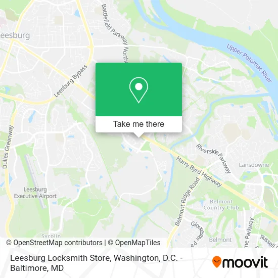
See Leesburg Locksmith Store, Loudoun County, on the map
Public Transit to Leesburg Locksmith Store in Loudoun County
Wondering how to get to Leesburg Locksmith Store in Loudoun County? Moovit helps you find the best way to get to Leesburg Locksmith Store with step-by-step directions from the nearest public transit station.
Moovit provides free maps and live directions to help you navigate through your city. View schedules, routes, timetables, and find out how long does it take to get to Leesburg Locksmith Store in real time.
Looking for the nearest stop or station to Leesburg Locksmith Store? Check out this list of stops closest to your destination: Wegmans.
Bus: 57, 70.
Want to see if there’s another route that gets you there at an earlier time? Moovit helps you find alternative routes or times. Get directions from and directions to Leesburg Locksmith Store easily from the Moovit App or Website.
We make riding to Leesburg Locksmith Store easy, which is why over 1.5 million users, including users in Loudoun County, trust Moovit as the best app for public transit. You don’t need to download an individual bus app or train app, Moovit is your all-in-one transit app that helps you find the best bus time or train time available.
For information on prices of bus and metro, costs and ride fares to Leesburg Locksmith Store, please check the Moovit app.
Use the app to navigate to popular places including to the airport, hospital, stadium, grocery store, mall, coffee shop, school, college, and university.
Leesburg Locksmith Store Address: 101 Crosstrail Blvd SE Leesburg, VA 20175 street in Loudoun County
- Pharmacy,
- Kestler Jason,
- Sylvan Learning,
- Spitz,
- Whiteivorystore,
- Marines,
- Seven Teahouse,
- Poth,
- Sienna Sky Boutique,
- Leesburg VA 20175-,
- Charlotte Tilbury,
- USMC RSS Leesburg,
- Allcare Primary & Immediate Care,
- Anchor Bar,
- Loudoun Islamic Center,
- State Farm,
- O'Connor, Desmarais, & Bolyard,
- Manassas Living,
- Prejuvenation Aesthetics,
- Windsor Leesburg Apartments
Places Near Leesburg Locksmith Store (Loudoun County)
- Basilica of the National Shrine, Washington,
- Washington DC VA Medical Center, Washington,
- Westfield Montgomery Mall, Montgomery County,
- Warner Theatre, Washington,
- Rock Creek Tennis Center, Washington,
- National Museum of African American History and Culture, Washington,
- Washington National Cathedral, Washington,
- Marriott Marquis Washington, DC, Washington,
- Sibley Memorial Hospital, Washington,
- PG Mall, Prince George's County,
- Capital One Arena, Washington,
- Georgetown, Washington,
- Pennsylvania Ave NW (3rd st and pennsylvania), Washington,
- Amazon Hq2, Arlington County,
- The Anthem, Washington,
- Camden Yards, Baltimore,
- National Theatre, Washington,
- M&T Bank Stadium, Baltimore,
- Museum Of The Bible, Washington,
- National Zoo, Washington
How to get to popular places in Washington, D.C. - Baltimore, MD with public transit
Get around Loudoun County by public transit!
Traveling around Loudoun County has never been so easy. See step by step directions as you travel to any attraction, street or major public transit station. View bus and train schedules, arrival times, service alerts and detailed routes on a map, so you know exactly how to get to anywhere in Loudoun County.
When traveling to any destination around Loudoun County use Moovit's Live Directions with Get Off Notifications to know exactly where and how far to walk, how long to wait for your line, and how many stops are left. Moovit will alert you when it's time to get off — no need to constantly re-check whether yours is the next stop.
Wondering how to use public transit in Loudoun County or how to pay for public transit in Loudoun County? Moovit public transit app can help you navigate your way with public transit easily, and at minimum cost. It includes public transit fees, ticket prices, and costs. Looking for a map of Loudoun County public transit lines? Moovit public transit app shows all public transit maps in Loudoun County with all Bus, Train, Metro, Light Rail and Ferry routes and stops on an interactive map.
Washington, D.C. - Baltimore, MD has 5 transit type(s), including: Bus, Train, Metro, Light Rail and Ferry, operated by several transit agencies, including WMATA, Montgomery County Ride On, Fairfax Connector, TheBus, PRTC, DASH - Alexandria, Arlington Transit (ART), RTA of Central Maryland, MDOT MTA, MDOT MTA Light RailLink, MDOT MTA Commuter Bus, MDOT MTA Local Bus, FXBGO!, Virginia Railway Express (VRE) and MARC