Directions to Legend Design Build (Indianapolis City (Balance)) with public transportation
The following transit lines have routes that pass near Legend Design Build
 Bus: 24.
How to get to Legend Design Build by bus?
Click on the bus route to see step by step directions with maps, line arrival times and updated time schedules.
From Allison Transmission Plant 4, Speedway
113 minFrom Crispus Attucks High School, Indianapolis City (Balance)
82 minFrom Ferencc, Indianapolis City (Balance)
69 minFrom Je Auto Sales, Indianapolis City (Balance)
107 minFrom Exacttarget, Indianapolis City (Balance)
69 minFrom No 7 Salon & Spa Studio, Indianapolis City (Balance)
73 minFrom Expo Design, Indianapolis City (Balance)
51 minFrom Salesforce Tower, Indianapolis City (Balance)
62 minFrom Hyatt Regency, Indianapolis City (Balance)
58 min
Bus stop near Legend Design Build in Indianapolis City (Balance)
- Troy Ave & Seerley Creek Dr, 16 min walk,VIEW
Bus lines to Legend Design Build in Indianapolis City (Balance)
- 24, Ameriplex,VIEW
What are the closest stations to Legend Design Build?
The closest stations to Legend Design Build are:
- Troy Ave & Seerley Creek Dr is 1356 yards away, 16 min walk.
Which bus line stops near Legend Design Build?
24 (Ameriplex)
What time is the first bus to Legend Design Build in Indianapolis City (Balance)?
The 24 is the first bus that goes to Legend Design Build in Indianapolis City (Balance). It stops nearby at 5:33 AM.
What time is the last bus to Legend Design Build in Indianapolis City (Balance)?
The 24 is the last bus that goes to Legend Design Build in Indianapolis City (Balance). It stops nearby at 9:48 PM.
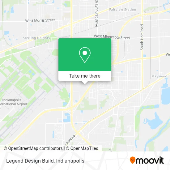
See Legend Design Build, Indianapolis City (Balance), on the map
Public Transit to Legend Design Build in Indianapolis City (Balance)
Wondering how to get to Legend Design Build in Indianapolis City (Balance)? Moovit helps you find the best way to get to Legend Design Build with step-by-step directions from the nearest public transit station.
Moovit provides free maps and live directions to help you navigate through your city. View schedules, routes, timetables, and find out how long does it take to get to Legend Design Build in real time.
Looking for the nearest stop or station to Legend Design Build? Check out this list of stops closest to your destination: Troy Ave & Seerley Creek Dr.
Bus: 24.
Want to see if there’s another route that gets you there at an earlier time? Moovit helps you find alternative routes or times. Get directions from and directions to Legend Design Build easily from the Moovit App or Website.
We make riding to Legend Design Build easy, which is why over 1.5 million users, including users in Indianapolis City (Balance), trust Moovit as the best app for public transit. You don’t need to download an individual bus app or train app, Moovit is your all-in-one transit app that helps you find the best bus time or train time available.
For information on prices of bus, costs and ride fares to Legend Design Build, please check the Moovit app.
Use the app to navigate to popular places including to the airport, hospital, stadium, grocery store, mall, coffee shop, school, college, and university.
Legend Design Build Address: 5524 Fortune Cir S # G street in Indianapolis City (Balance)
- Windsong Trailer Park Community Building,
- troy and lynhurst,
- The Indiana Manufactured Housing Association,
- Indiana Manufactured Housing,
- Gxo,
- Gxo,
- John Rutledge Construction,
- Keila S Smith,
- Lynhurst 7th & 8th Grade Center,
- Suds N Scissors,
- Fairfield Inn & Suites Indianapolis Airport,
- Exit 75/Sam Jones Expwy/E,
- Wayne Township Schools,
- Mara Evangelical Church Indiana, USA,
- Skyway Manufactured Home Community,
- Shea Ink,
- Gleaners Food Bank of Indiana,
- Weise,
- Life Church 180 Assembly of God,
- Welke Law Firm
Places Near Legend Design Build (Indianapolis City (Balance))
- 119 W 19th St Parking, Indianapolis City (Balance),
- Jersey Barn, Indianapolis City (Balance),
- St. Vincent Hospital - Indianapolis, Indianapolis City (Balance),
- THE BALT, Indianapolis City (Balance),
- Plainfield, IN, Plainfield,
- Indianapolis Motor Speedway, Speedway,
- Indiana Convention Center, Indianapolis City (Balance),
- Lilly Corporate Center (Eli Lilly & Co), Indianapolis City (Balance),
- Train Ride At Castleton Mall, Indianapolis City (Balance),
- I-465 / I-65 Interchange, Indianapolis City (Balance),
- Indiana, Indianapolis City (Balance),
- St. Vincent entrance #1, Indianapolis City (Balance),
- Lucas Oil Stadium, Indianapolis City (Balance),
- Eskenazi Hospital, Indianapolis City (Balance),
- Castleton Square Mall, Indianapolis,
- Indianapolis Airport Zone 2, Indianapolis City (Balance),
- I U Health Methodist Hospital, Indianapolis City (Balance),
- Cotter's Massage Parlor With Happy Endings, Indianapolis City (Balance),
- Gainbridge Fieldhouse, Indianapolis City (Balance),
- Methodist Hospital of Indianapolis, Indianapolis City (Balance)
How to get to popular places in Indianapolis with public transit
Get around Indianapolis City (Balance) by public transit!
Traveling around Indianapolis City (Balance) has never been so easy. See step by step directions as you travel to any attraction, street or major public transit station. View bus and train schedules, arrival times, service alerts and detailed routes on a map, so you know exactly how to get to anywhere in Indianapolis City (Balance).
When traveling to any destination around Indianapolis City (Balance) use Moovit's Live Directions with Get Off Notifications to know exactly where and how far to walk, how long to wait for your line, and how many stops are left. Moovit will alert you when it's time to get off — no need to constantly re-check whether yours is the next stop.
Wondering how to use public transit in Indianapolis City (Balance) or how to pay for public transit in Indianapolis City (Balance)? Moovit public transit app can help you navigate your way with public transit easily, and at minimum cost. It includes public transit fees, ticket prices, and costs. Looking for a map of Indianapolis City (Balance) public transit lines? Moovit public transit app shows all public transit maps in Indianapolis City (Balance) with all bus routes and stops on an interactive map.
Indianapolis has 1 transit type(s), including: bus, operated by several transit agencies, including IndyGo, FlixBus-us and Greyhound-us