How to get to Lenflash.Com by bus?
Click on the bus route to see step by step directions with maps, line arrival times and updated time schedules.
From Pier 16, Manhattan
50 minFrom MTA X80 - Manhattan to Randall's Island, Manhattan
63 minFrom Costco, Queens
36 minFrom Aaaaa Aaaa, Bronx
103 minFrom The Bronx, NY, Bronx
66 minFrom Century 21 Department Store, Manhattan
41 minFrom Community Lines, Jersey City
68 minFrom MetLife Stadium, East Rutherford
46 min
How to get to Lenflash.Com by train?
Click on the train route to see step by step directions with maps, line arrival times and updated time schedules.
How to get to Lenflash.Com by subway?
Click on the subway route to see step by step directions with maps, line arrival times and updated time schedules.
Bus stops near Lenflash.Com in Manhattan
- W 37 St/Broadway, 2 min walk,VIEW
- 6 Av/W 36 St, 2 min walk,VIEW
- 6th Ave & W 40th St, 2 min walk,VIEW
- 6 Av/W 38 St, 3 min walk,VIEW
- 6 Av/W 35 St, 3 min walk,VIEW
- W 40th St & 6th Ave, 3 min walk,VIEW
- 6 Av/W 40 St, 3 min walk,VIEW
- 6 Av/W 37 St, 3 min walk,VIEW
- 37th St & 6th Ave Westsider, 3 min walk,VIEW
- Avenue Of the Americas/W 41 St, 4 min walk,VIEW
- W 42 St/6 Av, 5 min walk,VIEW
Subway stations near Lenflash.Com in Manhattan
Train stations near Lenflash.Com in Manhattan
Bus lines to Lenflash.Com in Manhattan
- Q32, Penn Station,VIEW
- QM4, Electchester 164 St Via Jewel Av,VIEW
- SHORTLINE HUDSON, New York,VIEW
- M5, Limited Washington Heights Gw Bridge,VIEW
- M7, Harlem 147 St Via 6 Av Via Amsterdam,VIEW
- M55, 44 St 6 Av,VIEW
- QM2, Bay Terrace Bell Bl Via Whitestone Exy,VIEW
- QM20, Bay Terrace 211 St Via Willets Pt Bl,VIEW
- QM15, Arverne Beach 54 St Via Woodhaven Bl Via Cross Bay Bl,VIEW
- QM16, Neponsit Riis Park Via Cross Bay Bl Via Rock Bch Bl,VIEW
- QM17, Midtown 57 St Via 6 Av,VIEW
- QM18, S. Ozone Pk 130 St Via Lefferts Bl,VIEW
- BXM2, Riverdale 263 St Via H. Hudson Pky,VIEW
- QM10, Lefrak City - Midtown Express,VIEW
- QM12, Forest Hills - Midtown Express,VIEW
- QM24, Glendale - Midtown Express,VIEW
- HAMPTON JITNEY MONTAUK, Amagansett,VIEW
- SIM1C, Eltingville - Manhattan Express,VIEW
- SIM3, Pt. Richmond - Midtown Manhattan Express,VIEW
- SIM3C, Pt. Richmond - Manhattan Express,VIEW
What are the closest stations to Lenflash.Com?
The closest stations to Lenflash.Com are:
- W 37 St/Broadway is 80 yards away, 2 min walk.
- 42 St-Bryant Pk is 109 yards away, 2 min walk.
- 6 Av/W 36 St is 147 yards away, 2 min walk.
- 6th Ave & W 40th St is 151 yards away, 2 min walk.
- 6 Av/W 38 St is 183 yards away, 3 min walk.
- 6 Av/W 35 St is 183 yards away, 3 min walk.
- W 40th St & 6th Ave is 198 yards away, 3 min walk.
- 6 Av/W 40 St is 220 yards away, 3 min walk.
- 6 Av/W 37 St is 222 yards away, 3 min walk.
- 37th St & 6th Ave Westsider is 225 yards away, 3 min walk.
- Avenue Of the Americas/W 41 St is 270 yards away, 4 min walk.
- W 42 St/6 Av is 330 yards away, 5 min walk.
- Times Sq-42 St is 337 yards away, 4 min walk.
- 34 St-Penn Station is 489 yards away, 6 min walk.
- 33rd Street is 621 yards away, 8 min walk.
Which bus lines stop near Lenflash.Com?
These bus lines stop near Lenflash.Com: 119, 160, BXM4, M1, M42, M55, QM18, QM24, X37.
Which train lines stop near Lenflash.Com?
These train lines stop near Lenflash.Com: 2, YEL.
Which subway lines stop near Lenflash.Com?
These subway lines stop near Lenflash.Com: 3, 7, B, D, M, R.
What’s the nearest subway station to Lenflash.Com in Manhattan?
The nearest subway station to Lenflash.Com in Manhattan is 42 St-Bryant Pk. It’s a 2 min walk away.
What’s the nearest train station to Lenflash.Com in Manhattan?
The nearest train station to Lenflash.Com in Manhattan is 34 St-Penn Station. It’s a 6 min walk away.
What’s the nearest bus station to Lenflash.Com in Manhattan?
The nearest bus stations to Lenflash.Com in Manhattan are W 37 St/Broadway, 6 Av/W 36 St and 6th Ave & W 40th St. The closest one is a 2 min walk away.
What time is the first subway to Lenflash.Com in Manhattan?
The 2 is the first subway that goes to Lenflash.Com in Manhattan. It stops nearby at 3:00 AM.
What time is the last subway to Lenflash.Com in Manhattan?
The N is the last subway that goes to Lenflash.Com in Manhattan. It stops nearby at 4:01 AM.
What time is the first train to Lenflash.Com in Manhattan?
The PORT JEFFERSON BRANCH is the first train that goes to Lenflash.Com in Manhattan. It stops nearby at 3:01 AM.
What time is the last train to Lenflash.Com in Manhattan?
The ATW is the last train that goes to Lenflash.Com in Manhattan. It stops nearby at 3:21 AM.
What time is the first bus to Lenflash.Com in Manhattan?
The SIM1C is the first bus that goes to Lenflash.Com in Manhattan. It stops nearby at 3:00 AM.
What time is the last bus to Lenflash.Com in Manhattan?
The SIM1C is the last bus that goes to Lenflash.Com in Manhattan. It stops nearby at 3:00 AM.
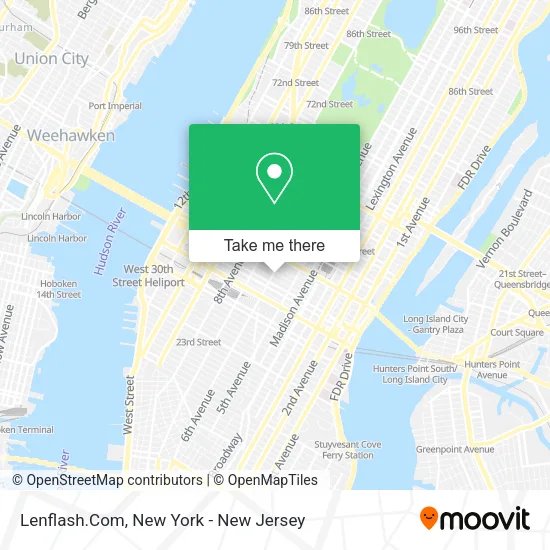
See Lenflash.Com, Manhattan, on the map
Public Transit to Lenflash.Com in Manhattan
Wondering how to get to Lenflash.Com in Manhattan? Moovit helps you find the best way to get to Lenflash.Com with step-by-step directions from the nearest public transit station.
Moovit provides free maps and live directions to help you navigate through your city. View schedules, routes, timetables, and find out how long does it take to get to Lenflash.Com in real time.
Looking for the nearest stop or station to Lenflash.Com? Check out this list of stops closest to your destination: W 37 St/Broadway; 42 St-Bryant Pk; 6 Av/W 36 St; 6th Ave & W 40th St; 6 Av/W 38 St; 6 Av/W 35 St; W 40th St & 6th Ave; 6 Av/W 40 St; 6 Av/W 37 St; 37th St & 6th Ave Westsider; Avenue Of the Americas/W 41 St; W 42 St/6 Av; Times Sq-42 St; 34 St-Penn Station; 33rd Street.
Bus: 119, 160, BXM4, M1, M42, M55, QM18, QM24, X37, Q32, SHORTLINE HUDSON.Train: 2, YEL, ACELA, ADIRONDACK, BERKSHIRE FLYER, CARDINAL, CAROLINIAN, ATW, BLU.Subway: 3, 7, B, D, M, R, F, FX, N, Q, S, W.
Want to see if there’s another route that gets you there at an earlier time? Moovit helps you find alternative routes or times. Get directions from and directions to Lenflash.Com easily from the Moovit App or Website.
We make riding to Lenflash.Com easy, which is why over 1.5 million users, including users in Manhattan, trust Moovit as the best app for public transit. You don’t need to download an individual bus app or train app, Moovit is your all-in-one transit app that helps you find the best bus time or train time available.
For information on prices of subway, bus and train, costs and ride fares to Lenflash.Com, please check the Moovit app.
Use the app to navigate to popular places including to the airport, hospital, stadium, grocery store, mall, coffee shop, school, college, and university.
Lenflash.Com Address: 1026 6th Ave street in Manhattan
- Fit and Fab Studios New York,
- Tourtropolis,
- Nunez Tax Services Inc,
- Kkommmander Tattoo,
- Nyc Tattoo Manhattan New York,
- Di Ink Nyc,
- Immersespa,
- In-N-Out Pizza,
- Dekco,
- J + L Game,
- Tmrw Studio,
- Napoli Pizza,
- Refinery Hotel,
- Ground Control Public Relations,
- Alma Yoga Studio,
- Parker & Quinn,
- Fit to a T,
- Americana Inn,
- Americana Inn New York NY USA,
- Fast Tax Accounting Llc
Places Near Lenflash.Com (Manhattan)
- Bellevue Hospital, Manhattan,
- Katz's Deli, Manhattan,
- 66 John Street, Manhattan,
- 376 Hudson Street, Manhattan,
- Hudson Yards, Manhattan,
- San Gennaro Feast, Manhattan,
- Mountainside Hospital, Glen Ridge,
- Queens Center Mall, Queens,
- Pier 83, Manhattan,
- SoHo, Manhattan,
- Rockefeller Center, Manhattan,
- 1 Police Plaza, Manhattan,
- 26 Federal Plaza, Manhattan,
- Chinatown, Manhattan,
- 111 Centre New York City Supreme Court, Manhattan,
- Wall Street, Manhattan,
- 911 Memorial, Manhattan,
- qqqq, Manhattan,
- Times Square, Manhattan,
- 3 Stone St, Manhattan
How to get to popular places in New York - New Jersey with public transit
Get around Manhattan by public transit!
Traveling around Manhattan has never been so easy. See step by step directions as you travel to any attraction, street or major public transit station. View bus and train schedules, arrival times, service alerts and detailed routes on a map, so you know exactly how to get to anywhere in Manhattan.
When traveling to any destination around Manhattan use Moovit's Live Directions with Get Off Notifications to know exactly where and how far to walk, how long to wait for your line, and how many stops are left. Moovit will alert you when it's time to get off — no need to constantly re-check whether yours is the next stop.
Wondering how to use public transit in Manhattan or how to pay for public transit in Manhattan? Moovit public transit app can help you navigate your way with public transit easily, and at minimum cost. It includes public transit fees, ticket prices, and costs. Looking for a map of Manhattan public transit lines? Moovit public transit app shows all public transit maps in Manhattan with all Bus, Train, Subway, Light Rail, Ferry and Cable Car routes and stops on an interactive map.
New York - New Jersey has 6 transit type(s), including: Bus, Train, Subway, Light Rail, Ferry and Cable Car, operated by several transit agencies, including MTA Subway, Metro-North Railroad, LIRR, PATH, MTA New York City Transit - Express routes, MTA Bus, NJ Transit, NYC Ferry, NICE bus, Bee-Line Bus, NJ Transit Rail, Norwalk Transit District, Hartford Line, River Valley Transit and HART