How to get to Lenox Ave @ 138th St by bus?
Click on the bus route to see step by step directions with maps, line arrival times and updated time schedules.
From Lafayette Ave, Bronx
69 minFrom Strand Bookstore, Manhattan
78 minFrom The Westin New York at Times Square, Manhattan
64 minFrom Manhattan, NY, Manhattan
65 minFrom 30-56 Whitestone Expwy, Queens
117 minFrom 32nd St W St, Manhattan
62 minFrom Museum Of Illusions, Manhattan
90 minFrom W 13th St (6th avenue and 13th street), Manhattan
86 minFrom Grand Central Station, Manhattan
57 minFrom Winter Garden Theatre, Manhattan
61 min
How to get to Lenox Ave @ 138th St by train?
Click on the train route to see step by step directions with maps, line arrival times and updated time schedules.
From Strand Bookstore, Manhattan
125 minFrom The Westin New York at Times Square, Manhattan
46 minFrom Manhattan, NY, Manhattan
44 minFrom 30-56 Whitestone Expwy, Queens
95 minFrom 32nd St W St, Manhattan
47 minFrom Museum Of Illusions, Manhattan
91 minFrom W 13th St (6th avenue and 13th street), Manhattan
99 minFrom Grand Central Station, Manhattan
31 minFrom Winter Garden Theatre, Manhattan
51 min
How to get to Lenox Ave @ 138th St by subway?
Click on the subway route to see step by step directions with maps, line arrival times and updated time schedules.
From Strand Bookstore, Manhattan
38 minFrom The Westin New York at Times Square, Manhattan
30 minFrom Manhattan, NY, Manhattan
33 minFrom 30-56 Whitestone Expwy, Queens
88 minFrom 32nd St W St, Manhattan
36 minFrom Museum Of Illusions, Manhattan
34 minFrom W 13th St (6th avenue and 13th street), Manhattan
35 minFrom Grand Central Station, Manhattan
32 minFrom Winter Garden Theatre, Manhattan
33 min
Bus stops near Lenox Ave @ 138th St in Manhattan
Subway stations near Lenox Ave @ 138th St in Manhattan
Bus lines to Lenox Ave @ 138th St in Manhattan
What are the closest stations to Lenox Ave @ 138th St?
The closest stations to Lenox Ave @ 138th St are:
- Malcolm X Blvd/W 137 St is 40 yards away, 1 min walk.
- W 139 St/Malcolm X Blvd is 109 yards away, 2 min walk.
- Lenox Ave & W 135th St is 302 yards away, 4 min walk.
- W 135 St/Malcolm X Blvd is 317 yards away, 4 min walk.
- Adam C Powell Blvd/W 137 St is 338 yards away, 4 min walk.
- 145 St is 585 yards away, 7 min walk.
- 135 St is 629 yards away, 8 min walk.
- 138 St-Grand Concourse is 1371 yards away, 17 min walk.
Which bus lines stop near Lenox Ave @ 138th St?
These bus lines stop near Lenox Ave @ 138th St: BX33, M1, M102, M2, M7.
Which train lines stop near Lenox Ave @ 138th St?
These train lines stop near Lenox Ave @ 138th St: 1, 2, 3.
Which subway lines stop near Lenox Ave @ 138th St?
These subway lines stop near Lenox Ave @ 138th St: 2, 3.
What’s the nearest subway station to Lenox Ave @ 138th St in Manhattan?
The nearest subway station to Lenox Ave @ 138th St in Manhattan is 145 St. It’s a 7 min walk away.
What’s the nearest bus station to Lenox Ave @ 138th St in Manhattan?
The nearest bus station to Lenox Ave @ 138th St in Manhattan is Malcolm X Blvd/W 137 St. It’s a 1 min walk away.
What time is the first subway to Lenox Ave @ 138th St in Manhattan?
The 2 is the first subway that goes to Lenox Ave @ 138th St in Manhattan. It stops nearby at 3:01 AM.
What time is the last subway to Lenox Ave @ 138th St in Manhattan?
The A is the last subway that goes to Lenox Ave @ 138th St in Manhattan. It stops nearby at 4:16 AM.
What time is the first bus to Lenox Ave @ 138th St in Manhattan?
The M102 is the first bus that goes to Lenox Ave @ 138th St in Manhattan. It stops nearby at 3:07 AM.
What time is the last bus to Lenox Ave @ 138th St in Manhattan?
The M7 is the last bus that goes to Lenox Ave @ 138th St in Manhattan. It stops nearby at 3:15 AM.
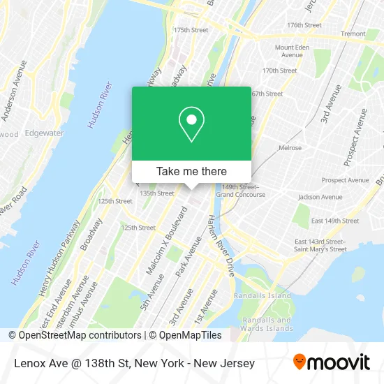
See Lenox Ave @ 138th St, Manhattan, on the map
Public Transit to Lenox Ave @ 138th St in Manhattan
Wondering how to get to Lenox Ave @ 138th St in Manhattan? Moovit helps you find the best way to get to Lenox Ave @ 138th St with step-by-step directions from the nearest public transit station.
Moovit provides free maps and live directions to help you navigate through your city. View schedules, routes, timetables, and find out how long does it take to get to Lenox Ave @ 138th St in real time.
Looking for the nearest stop or station to Lenox Ave @ 138th St? Check out this list of stops closest to your destination: Malcolm X Blvd/W 137 St; W 139 St/Malcolm X Blvd; Lenox Ave & W 135th St; W 135 St/Malcolm X Blvd; Adam C Powell Blvd/W 137 St; 145 St; 135 St; 138 St-Grand Concourse.
Bus: BX33, M1, M102, M2, M7.Train: 1, 2, 3.Subway: 2, 3, A, B, C, 4, 5.
Want to see if there’s another route that gets you there at an earlier time? Moovit helps you find alternative routes or times. Get directions from and directions to Lenox Ave @ 138th St easily from the Moovit App or Website.
We make riding to Lenox Ave @ 138th St easy, which is why over 1.5 million users, including users in Manhattan, trust Moovit as the best app for public transit. You don’t need to download an individual bus app or train app, Moovit is your all-in-one transit app that helps you find the best bus time or train time available.
For information on prices of subway, bus and train, costs and ride fares to Lenox Ave @ 138th St, please check the Moovit app.
Use the app to navigate to popular places including to the airport, hospital, stadium, grocery store, mall, coffee shop, school, college, and university.
Lenox Ave @ 138th St Address: New York, NY 10037 street in Manhattan
- Lenox Ave (lenox intersection W 138th St),
- The Salvation Army - Harlem Temple Corps,
- Harlem Temple Corps Community Center,
- 02682 Laundry Card,
- Keanes Family Pharmacy,
- Presto Fresh Cafe Mexican Grill,
- 138 Lenox,
- Leonard J. Catanzaro, Attorney at Law,
- The Salvation Army,
- Lenox Laundry,
- Rotary Club Of Harlem,
- Palace Pharmacy Inc,
- Harlem Hair Salon,
- Pj Nails and Spa,
- Subway,
- Chloe Michelle White,
- Soul-Delish" the Comfort Way Of Eatin',
- St. Mark Church- Harlem,
- W 137th St and Lenox Ave,
- All Pro Air Conditioning-Heating
Places Near Lenox Ave @ 138th St (Manhattan)
- 911 Memorial, Manhattan,
- 26 Federal Plaza, Manhattan,
- Hudson Yards, Manhattan,
- 3 Stone St, Manhattan,
- San Gennaro Feast, Manhattan,
- 1 Police Plaza, Manhattan,
- Times Square, Manhattan,
- Katz's Deli, Manhattan,
- 66 John Street, Manhattan,
- Chinatown, Manhattan,
- Pier 83, Manhattan,
- 111 Centre New York City Supreme Court, Manhattan,
- Rockefeller Center, Manhattan,
- Queens Center Mall, Queens,
- Wall Street, Manhattan,
- Bellevue Hospital, Manhattan,
- SoHo, Manhattan,
- Mountainside Hospital, Glen Ridge,
- 376 Hudson Street, Manhattan,
- qqqq, Manhattan
How to get to popular places in New York - New Jersey with public transit
Get around Manhattan by public transit!
Traveling around Manhattan has never been so easy. See step by step directions as you travel to any attraction, street or major public transit station. View bus and train schedules, arrival times, service alerts and detailed routes on a map, so you know exactly how to get to anywhere in Manhattan.
When traveling to any destination around Manhattan use Moovit's Live Directions with Get Off Notifications to know exactly where and how far to walk, how long to wait for your line, and how many stops are left. Moovit will alert you when it's time to get off — no need to constantly re-check whether yours is the next stop.
Wondering how to use public transit in Manhattan or how to pay for public transit in Manhattan? Moovit public transit app can help you navigate your way with public transit easily, and at minimum cost. It includes public transit fees, ticket prices, and costs. Looking for a map of Manhattan public transit lines? Moovit public transit app shows all public transit maps in Manhattan with all Bus, Train, Subway, Light Rail, Ferry and Cable Car routes and stops on an interactive map.
New York - New Jersey has 6 transit type(s), including: Bus, Train, Subway, Light Rail, Ferry and Cable Car, operated by several transit agencies, including MTA Subway, Metro-North Railroad, LIRR, PATH, MTA New York City Transit - Express routes, MTA Bus, NJ Transit, NYC Ferry, NICE bus, Bee-Line Bus, NJ Transit Rail, Norwalk Transit District, Hartford Line, River Valley Transit and HART