Directions to Leonel Auto Center (Colombo) with public transportation
The following transit lines have routes that pass near Leonel Auto Center
How to get to Leonel Auto Center by bus?
Click on the bus route to see step by step directions with maps, line arrival times and updated time schedules.
From Centro Universitário - Unibrasil, Tarumã
80 minFrom Jardim Social, Jardim Social
72 minFrom Rua Tv Particular II (VL ARAUJO), Colombo
44 minFrom Rua José Veríssimo, Bairro Alto
76 minFrom Mauá, Colombo
78 minFrom Rua Almirante Tamandaré, Almirante Tamandaré
99 minFrom Alphaville Graciosa, Pinhais
75 minFrom Avenida Monteiro Tourinho, Tingüi
56 minFrom Parque Tanguá, Taboão
77 minFrom Rua Konrad Adenauer, Tarumã
80 min
Bus stops near Leonel Auto Center in Colombo
Bus lines to Leonel Auto Center in Colombo
- S16 GUARACI, Terminal Sede Colombo → Terminal Roça Grande,VIEW
- U11 ITAJACURU / SANTA GEMA (IMBUIAL), Terminal Sede Colombo ↺ Itajacuru / Santa Gema (Circular),VIEW
- U01 SEDE / MARACANÃ, Terminal Maracanã → Terminal Sede Colombo,VIEW
- B78 SÃO GABRIEL / GUADALUPE, São Gabriel → Terminal Guadalupe,VIEW
- S89 SÃO SEBASTIÃO / GUADALUPE (VIA SÃO GABRIEL), São Sebastião → Terminal Guadalupe,VIEW
What are the closest stations to Leonel Auto Center?
The closest stations to Leonel Auto Center are:
- Rua Raphael Francisco Greca 168 is 180 meters away, 3 min walk.
- Rua Rafael Francisco Greca, 108 is 327 meters away, 5 min walk.
- Rua Alfredo Miguel Baduy, 162 is 1118 meters away, 15 min walk.
- Rua Alfredo Miguel Baduy, 353 is 1296 meters away, 17 min walk.
Which bus lines stop near Leonel Auto Center?
These bus lines stop near Leonel Auto Center: B76 SÃO SEBASTIÃO / GUADALUPE, S16 GUARACI, U01 SEDE / MARACANÃ.
What’s the nearest bus station to Leonel Auto Center in Colombo?
The nearest bus station to Leonel Auto Center in Colombo is Rua Raphael Francisco Greca 168. It’s a 3 min walk away.
What time is the first bus to Leonel Auto Center in Colombo?
The B78 SÃO GABRIEL / GUADALUPE is the first bus that goes to Leonel Auto Center in Colombo. It stops nearby at 5:05 AM.
What time is the last bus to Leonel Auto Center in Colombo?
The B78 SÃO GABRIEL / GUADALUPE is the last bus that goes to Leonel Auto Center in Colombo. It stops nearby at 11:53 PM.
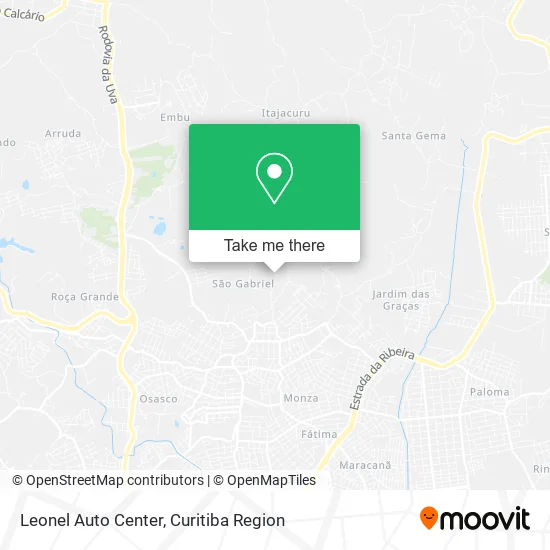
See Leonel Auto Center, Colombo, on the map
Public Transit to Leonel Auto Center in Colombo
Wondering how to get to Leonel Auto Center in Colombo? Moovit helps you find the best way to get to Leonel Auto Center with step-by-step directions from the nearest public transit station.
Moovit provides free maps and live directions to help you navigate through your city. View schedules, routes, timetables, and find out how long does it take to get to Leonel Auto Center in real time.
Looking for the nearest stop or station to Leonel Auto Center? Check out this list of stops closest to your destination: Rua Raphael Francisco Greca 168; Rua Rafael Francisco Greca; Rua Alfredo Miguel Baduy; Rua Alfredo Miguel Baduy.
Bus: B76 SÃO SEBASTIÃO / GUADALUPE, S16 GUARACI, U01 SEDE / MARACANÃ, U11 ITAJACURU / SANTA GEMA (IMBUIAL), B78 SÃO GABRIEL / GUADALUPE, S89 SÃO SEBASTIÃO / GUADALUPE (VIA SÃO GABRIEL).
Want to see if there’s another route that gets you there at an earlier time? Moovit helps you find alternative routes or times. Get directions from and directions to Leonel Auto Center easily from the Moovit App or Website.
We make riding to Leonel Auto Center easy, which is why over 1.5 million users, including users in Colombo, trust Moovit as the best app for public transit. You don’t need to download an individual bus app or train app, Moovit is your all-in-one transit app that helps you find the best bus time or train time available.
For information on prices of bus, costs and ride fares to Leonel Auto Center, please check the Moovit app.
Use the app to navigate to popular places including to the airport, hospital, stadium, grocery store, mall, coffee shop, school, college, and university.
Leonel Auto Center Address: Estrada de Colombo, São Gabriel Colombo-PR 83419-200 street in Colombo
- Nova Emoção,
- Matheus Luis Fernandes,
- Chacara Engenho Verde,
- Rua Raphael Francisco Greca,
- Chácara das Araras,
- Itajacuru,
- Cantibo's Bar Santuário do Seu Zé Pilintra,
- Clodoaldo Alberto Camara,
- Guimaraes & Castro - Representacao Comercial,
- Aviario do Campo,
- Machado Express,
- Geovanny Entregas,
- Residencial Cruzeiro do Sul,
- Bar do Baiano,
- Campo São Gabriel,
- Graff Treinamentos,
- Grêmio Esportivo Colombense,
- Condominio Edificio Colina dos Pinheiros II,
- Lucis Armarinho,
- Gfc Representante
Places Near Leonel Auto Center (Colombo)
- Pontifícia Universidade Católica do Paraná (PUCPR), Prado Velho,
- Rua Martim Afonso 558, Mercês,
- Park Shopping Barigüi, Mossunguê,
- Campo Largo, Campo,
- Hospital Erasto Gaertner, Jardim Das Américas,
- Hospital Universitário Evangélico de Curitiba, Bigorrilho,
- Hhhhh, Fazendinha,
- Shopping Palladium, Portão,
- Hospital de Clínicas (HC - UFPR), Centro,
- Hospital Nossa Senhora Das Graças, Mercês,
- Hospital Da Cruz Vermelha, Batel,
- Jardim Botânico de Curitiba PR, Centro,
- Rua General Mário Tourinho, Campina Do Siqueira,
- Arena Da Baixada - Curitiba,
- Shopping Estação, Rebouças,
- Hospital Angelina Caron, Campina Grande Do Sul,
- Parque Barigui, Mercês,
- Jockey Plaza Shopping Center, Tarumã,
- Hospital do Rocio, Campo,
- Hospital Madalena Sofia, Bairro Alto
How to get to popular places in Curitiba Region with public transit
Get around Colombo by public transit!
Traveling around Colombo has never been so easy. See step by step directions as you travel to any attraction, street or major public transit station. View bus and train schedules, arrival times, service alerts and detailed routes on a map, so you know exactly how to get to anywhere in Colombo.
When traveling to any destination around Colombo use Moovit's Live Directions with Get Off Notifications to know exactly where and how far to walk, how long to wait for your line, and how many stops are left. Moovit will alert you when it's time to get off — no need to constantly re-check whether yours is the next stop.
Wondering how to use public transit in Colombo or how to pay for public transit in Colombo? Moovit public transit app can help you navigate your way with public transit easily, and at minimum cost. It includes public transit fees, ticket prices, and costs. Looking for a map of Colombo public transit lines? Moovit public transit app shows all public transit maps in Colombo with all Bus and Cable Car routes and stops on an interactive map.
Curitiba Region has 2 transit type(s), including: Bus and Cable Car, operated by several transit agencies, including Sistema Integrado de Mobilidade (URBS), Sistema Integrado de Mobilidade (AMEP), URBS (Cartões bancários e Dinheiro), URBS (Cartões bancários / Cartão URBS), AMEP (Cartões bancários / Cartão MetroCard), AMEP (Cartões bancários / Cartão MetroCard / Dinheiro), Viação Colombo (Dinheiro), TRIAR (Cartão TRIAR / Dinheiro), Empresa Curitiba Cerro Azul (Dinheiro), Expresso Nossa Senhora da Penha (Dinheiro), Empresa Campo Alto Tijucas (Dinheiro), Auto Viação São José (Cartão VEM / Dinheiro), BRT S/A (Cartão VEM / Dinheiro), TransPiedade (Cartão Cidadão / Dinheiro) and Oceânica Sul (Cartão Transporte / Dinheiro)