How to get to Lets AS by bus?
Click on the bus route to see step by step directions with maps, line arrival times and updated time schedules.
From Aulerød, Tønsberg
150 minFrom Fokserød, Sandefjord
129 minFrom Tønsberg Trafikkstasjon, Tønsberg
218 minFrom Borgeskogen, Stokke
91 minFrom Furustrand Camping, Tønsberg
168 minFrom Color Line Sandefjord, Sandefjord
151 minFrom 01-bussen: Horten-Tønsberg-Sandefjord-Larvik-Stavern, Tønsberg
49 minFrom Engø, Tjøme
112 minFrom Sykehuset I Vestfold, Tønsberg, Tønsberg
57 minFrom Oslofjord Convention Center, Stokke
127 min
Bus lines to Lets AS in Nøtterøy
What are the closest stations to Lets AS?
The closest stations to Lets AS are:
- Blåskjellveien Syd is 63 meters away, 1 min walk.
- Nesveien is 1207 meters away, 16 min walk.
Which bus lines stop near Lets AS?
These bus lines stop near Lets AS: 113A, 113B.
What’s the nearest bus station to Lets AS in Nøtterøy?
The nearest bus station to Lets AS in Nøtterøy is Blåskjellveien Syd. It’s a 1 min walk away.
What time is the first bus to Lets AS in Nøtterøy?
The N113 is the first bus that goes to Lets AS in Nøtterøy. It stops nearby at 3:54 AM.
What time is the last bus to Lets AS in Nøtterøy?
The 113B is the last bus that goes to Lets AS in Nøtterøy. It stops nearby at 11:53 PM.
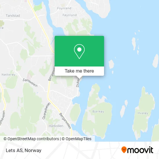
See Lets AS, Nøtterøy, on the map
Public Transit to Lets AS in Nøtterøy
Wondering how to get to Lets AS in Nøtterøy? Moovit helps you find the best way to get to Lets AS with step-by-step directions from the nearest public transit station.
Moovit provides free maps and live directions to help you navigate through your city. View schedules, routes, timetables, and find out how long does it take to get to Lets AS in real time.
Looking for the nearest stop or station to Lets AS? Check out this list of stops closest to your destination: Blåskjellveien Syd; Nesveien.
Bus: 113A, 113B, N113, 1553, 1555, 1585, 112, 1556.
Want to see if there’s another route that gets you there at an earlier time? Moovit helps you find alternative routes or times. Get directions from and directions to Lets AS easily from the Moovit App or Website.
We make riding to Lets AS easy, which is why over 1.5 million users, including users in Nøtterøy, trust Moovit as the best app for public transit. You don’t need to download an individual bus app or train app, Moovit is your all-in-one transit app that helps you find the best bus time or train time available.
For information on prices of bus and train, costs and ride fares to Lets AS, please check the Moovit app.
Use the app to navigate to popular places including to the airport, hospital, stadium, grocery store, mall, coffee shop, school, college, and university.
Lets AS Address: Dukenveien 32 3133 Duken street in Nøtterøy
- Portofino Herreklaer A,
- Meny,
- T.Ressurs Tommy Røed,
- Klippotek Petite,
- Pavarotti Pizza Nova,
- Fredrik Hartmann,
- Nøtterøy Varmeservice,
- Vinghøg,
- Duken,
- Nor Is Trading,
- Tomas Aleksandravicius,
- Kjeldsbergs Kompetanse og Veiledning,
- Knarberg Båtforening,
- Kaffe & Jordbær Monita Wrangsund Bravo,
- Il Falco AS,
- Gullet Dedign,
- Ole Andreas Jørnsen Herland,
- Norgeshus Saga Byggentreprenør AS,
- Malvern Instruments Nordic AB,
- Tech Partner
Places Near Lets AS (Nøtterøy)
- IKEA, Bergen,
- Vestby Outlet Store, Vestby,
- Radiumhospitalet, Oslo,
- Bjerke Travbane, Oslo,
- IKEA, Oslo,
- Tyholttårnet, Trondheim,
- Ikea Leangen, Trondheim,
- Ulriken, Bergen,
- DFDS Seaways, Oslo,
- Jekta Storsenter, Tromsø,
- Haukeland Universitetssjukehus, Bergen,
- Color Line Terminal, Oslo,
- Oslo S spor 19 (Trelastgata), Oslo,
- Rikshospitalet (trikk), Oslo,
- Quality Hotel Edvard Grieg, Bergen,
- Ullevål Stadion (T), Oslo,
- Nylandsbrua, Oslo,
- Lovisenberg Diakonale Sykehus, Oslo,
- Voldsløkka, Oslo,
- Drammen Sykehus, Drammen
How to get to popular places in Norway with public transit
Get around Nøtterøy by public transit!
Traveling around Nøtterøy has never been so easy. See step by step directions as you travel to any attraction, street or major public transit station. View bus and train schedules, arrival times, service alerts and detailed routes on a map, so you know exactly how to get to anywhere in Nøtterøy.
When traveling to any destination around Nøtterøy use Moovit's Live Directions with Get Off Notifications to know exactly where and how far to walk, how long to wait for your line, and how many stops are left. Moovit will alert you when it's time to get off — no need to constantly re-check whether yours is the next stop.
Wondering how to use public transit in Nøtterøy or how to pay for public transit in Nøtterøy? Moovit public transit app can help you navigate your way with public transit easily, and at minimum cost. It includes public transit fees, ticket prices, and costs. Looking for a map of Nøtterøy public transit lines? Moovit public transit app shows all public transit maps in Nøtterøy with all Bus, Train, Subway, Light Rail, Ferry and Cable Car routes and stops on an interactive map.
Norway has 6 transit type(s), including: Bus, Train, Subway, Light Rail, Ferry and Cable Car, operated by several transit agencies, including Ruter, Skyss, AtB, Flytoget, Vy Tåg, SJ, Go-Ahead Norge AS, SJ Nord, Vestfold Kollektivtrafikk as, Snelandia, Innlandstrafikk, FRAM, FlixBus, Kolumbus and Brakar