How to get to Lets Be Wireless by bus?
Click on the bus route to see step by step directions with maps, line arrival times and updated time schedules.
From Sawgrass Recreation Park / Airboat Rides, Plantation
79 minFrom Fort Lauderdale Florida, Fort Lauderdale
21 minFrom Central Terminal, Fort Lauderdale
18 minFrom Red Carpet Inn Fort Lauderdale Airport / Cruise Port, Hollywood
63 minFrom Oakland Park Boulevard & University Drive, Plantation
62 minFrom Amazon Fulfillment Center-DMF3, Pompano Beach
71 minFrom Fort Lauderdale Cruise Terminal, Fort Lauderdale
63 minFrom Margate, FL, Coral Springs-Margate
77 minFrom South Plantation High School, Plantation
56 minFrom Fort Lauderdale Marriott Harbor Beach Resort & Spa, Fort Lauderdale
47 min
How to get to Lets Be Wireless by train?
Click on the train route to see step by step directions with maps, line arrival times and updated time schedules.
Bus stops near Lets Be Wireless in Fort Lauderdale
Train station near Lets Be Wireless in Fort Lauderdale
- Cypress Creek Station, 60 min walk,VIEW
Bus lines to Lets Be Wireless in Fort Lauderdale
What are the closest stations to Lets Be Wireless?
The closest stations to Lets Be Wireless are:
- Andrews Avenue/Northeast 38th Street is 35 yards away, 1 min walk.
- Powerline Road/Northwest 38th Street - (Park Lane West) is 902 yards away, 11 min walk.
- Cypress Creek Station is 5082 yards away, 60 min walk.
Which bus lines stop near Lets Be Wireless?
These bus lines stop near Lets Be Wireless: 14, 60, 72.
Which train line stops near Lets Be Wireless?
TRIRAIL (Southbound To Miami Airport)
What’s the nearest bus station to Lets Be Wireless in Fort Lauderdale?
The nearest bus station to Lets Be Wireless in Fort Lauderdale is Andrews Avenue/Northeast 38th Street. It’s a 1 min walk away.
What time is the first train to Lets Be Wireless in Fort Lauderdale?
The TRIRAIL is the first train that goes to Lets Be Wireless in Fort Lauderdale. It stops nearby at 4:38 AM.
What time is the last train to Lets Be Wireless in Fort Lauderdale?
The TRIRAIL is the last train that goes to Lets Be Wireless in Fort Lauderdale. It stops nearby at 10:43 PM.
What time is the first bus to Lets Be Wireless in Fort Lauderdale?
The 14 is the first bus that goes to Lets Be Wireless in Fort Lauderdale. It stops nearby at 5:02 AM.
What time is the last bus to Lets Be Wireless in Fort Lauderdale?
The 14 is the last bus that goes to Lets Be Wireless in Fort Lauderdale. It stops nearby at 11:49 PM.
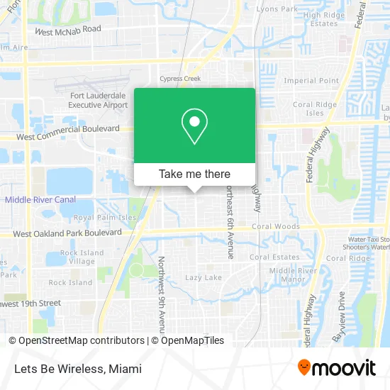
See Lets Be Wireless, Fort Lauderdale, on the map
Public Transit to Lets Be Wireless in Fort Lauderdale
Wondering how to get to Lets Be Wireless in Fort Lauderdale? Moovit helps you find the best way to get to Lets Be Wireless with step-by-step directions from the nearest public transit station.
Moovit provides free maps and live directions to help you navigate through your city. View schedules, routes, timetables, and find out how long does it take to get to Lets Be Wireless in real time.
Looking for the nearest stop or station to Lets Be Wireless? Check out this list of stops closest to your destination: Andrews Avenue/Northeast 38th Street; Powerline Road/Northwest 38th Street - (Park Lane West); Cypress Creek Station.
Bus: 14, 60, 72.Train: TRIRAIL.
Want to see if there’s another route that gets you there at an earlier time? Moovit helps you find alternative routes or times. Get directions from and directions to Lets Be Wireless easily from the Moovit App or Website.
We make riding to Lets Be Wireless easy, which is why over 1.5 million users, including users in Fort Lauderdale, trust Moovit as the best app for public transit. You don’t need to download an individual bus app or train app, Moovit is your all-in-one transit app that helps you find the best bus time or train time available.
For information on prices of bus and train, costs and ride fares to Lets Be Wireless, please check the Moovit app.
Use the app to navigate to popular places including to the airport, hospital, stadium, grocery store, mall, coffee shop, school, college, and university.
Lets Be Wireless Address: 3823 N Andrews Ave Fort Lauderdale, FL 33309 street in Fort Lauderdale
- Aly's Nutrition,
- Helper Auto Glass,
- Open Arms Deliverance Center,
- Edealer Outsource,
- Heclynn's Barber & Beauty,
- Eltine Multiservices,
- NW 38th St / N Andrews Ave,
- Broward County,
- Andrews Dental Car,
- Clean Vanity Plus,
- Unique Appliance Repair Service,
- Mario Barber Shop,
- Thunder Painting,
- National Association of Letter Carriers Br 1071,
- Innovative Medical Rehab Center,
- Jyg Mendez,
- Cbi,
- Florida Regional Center (U.S. Dept of State),
- Lafamilia Auto Lfaa,
- Eco Cleaners
Places Near Lets Be Wireless (Fort Lauderdale)
- Dolphin Mall, Miami,
- Port of Miami Cruise Terminal, Miami,
- Sawgrass Mall, Miami,
- Wynwood, Miami,
- Miami Design District, Miami,
- Keiser University Flagship Campus, West Palm Beach,
- Miami Freedom Park, Miami,
- Bayside Marketplace, Miami,
- Sawgrass mall ( FL ), Miami Beach,
- Dolphin Mall Bus, Miami,
- Little Havana, Miami,
- Miami VA Hospital, Miami,
- Zoo Miami, Miami,
- Miami-Dade County Courthouse, Miami,
- Aventura Mall, Miami,
- Marlins Park, Miami,
- Hard Rock Stadium, Miami Gardens,
- Richard E. Gerstein Justice Building, Miami,
- Brickell City Centre, Miami,
- Aventura Mall, Miami Beach
How to get to popular places in Miami with public transit
Get around Fort Lauderdale by public transit!
Traveling around Fort Lauderdale has never been so easy. See step by step directions as you travel to any attraction, street or major public transit station. View bus and train schedules, arrival times, service alerts and detailed routes on a map, so you know exactly how to get to anywhere in Fort Lauderdale.
When traveling to any destination around Fort Lauderdale use Moovit's Live Directions with Get Off Notifications to know exactly where and how far to walk, how long to wait for your line, and how many stops are left. Moovit will alert you when it's time to get off — no need to constantly re-check whether yours is the next stop.
Wondering how to use public transit in Fort Lauderdale or how to pay for public transit in Fort Lauderdale? Moovit public transit app can help you navigate your way with public transit easily, and at minimum cost. It includes public transit fees, ticket prices, and costs. Looking for a map of Fort Lauderdale public transit lines? Moovit public transit app shows all public transit maps in Fort Lauderdale with all Bus, Train, Light Rail and Ferry routes and stops on an interactive map.
Miami has 4 transit type(s), including: Bus, Train, Light Rail and Ferry, operated by several transit agencies, including Broward County Transit, Miami-Dade Transit, Metrorail, Palm Tran, Tri-Rail, Brightline, MARTY, City of Homestead Trolley, Key West Transit, Treasure Coast Connector, GoLine IRT, Amtrak, Greyhound-us, FlixBus-us and Aventura Express Shuttle Bus