How to get to Letts Bail Bonds by bus?
Click on the bus route to see step by step directions with maps, line arrival times and updated time schedules.
Bus stops near Letts Bail Bonds in Vero Beach
Bus lines to Letts Bail Bonds in Vero Beach
What are the closest stations to Letts Bail Bonds?
The closest stations to Letts Bail Bonds are:
- 16 Ave. (Courthouse) is 360 yards away, 5 min walk.
- 14th Ave. & 19th St. Nb is 388 yards away, 5 min walk.
- 21 St. & 7 Ave. EB is 430 yards away, 6 min walk.
- US 1 & 11th Ave. EB is 474 yards away, 6 min walk.
- 10TH Ave. & 20th PL is 723 yards away, 9 min walk.
- Main Transfer Center is 1785 yards away, 22 min walk.
Which bus lines stop near Letts Bail Bonds?
These bus lines stop near Letts Bail Bonds: RT 3, RT 6.
What’s the nearest bus station to Letts Bail Bonds in Vero Beach?
The nearest bus stations to Letts Bail Bonds in Vero Beach are 16 Ave. (Courthouse) and 14th Ave. & 19th St. Nb. The closest one is a 5 min walk away.
What time is the first bus to Letts Bail Bonds in Vero Beach?
The RT 8 is the first bus that goes to Letts Bail Bonds in Vero Beach. It stops nearby at 6:22 AM.
What time is the last bus to Letts Bail Bonds in Vero Beach?
The RT 1 is the last bus that goes to Letts Bail Bonds in Vero Beach. It stops nearby at 6:39 PM.
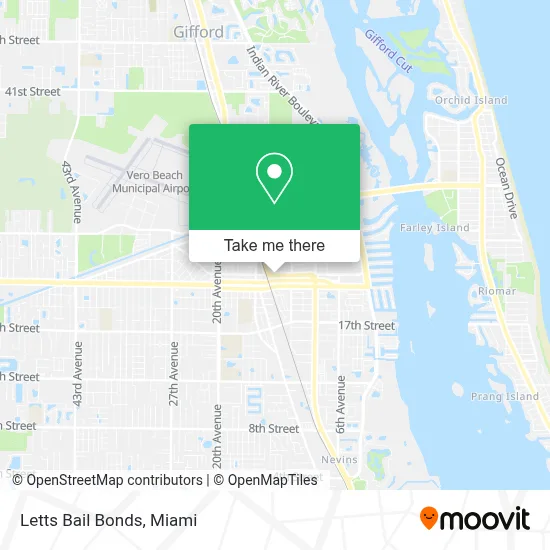
See Letts Bail Bonds, Vero Beach, on the map
Public Transit to Letts Bail Bonds in Vero Beach
Wondering how to get to Letts Bail Bonds in Vero Beach? Moovit helps you find the best way to get to Letts Bail Bonds with step-by-step directions from the nearest public transit station.
Moovit provides free maps and live directions to help you navigate through your city. View schedules, routes, timetables, and find out how long does it take to get to Letts Bail Bonds in real time.
Looking for the nearest stop or station to Letts Bail Bonds? Check out this list of stops closest to your destination: 16 Ave. (Courthouse); 14th Ave. & 19th St. Nb; 21 St. & 7 Ave. EB; US 1 & 11th Ave. EB; 10TH Ave. & 20th PL; Main Transfer Center.
Bus: RT 3, RT 6, RT 2, RT 8, RT 1, RT 11, RT 4.
Want to see if there’s another route that gets you there at an earlier time? Moovit helps you find alternative routes or times. Get directions from and directions to Letts Bail Bonds easily from the Moovit App or Website.
We make riding to Letts Bail Bonds easy, which is why over 1.7 million users, including users in Vero Beach, trust Moovit as the best app for public transit. You don’t need to download an individual bus app or train app, Moovit is your all-in-one transit app that helps you find the best bus time or train time available.
For information on prices of bus, costs and ride fares to Letts Bail Bonds, please check the Moovit app.
Use the app to navigate to popular places including to the airport, hospital, stadium, grocery store, mall, coffee shop, school, college, and university.
Letts Bail Bonds Address: 1126 21st St street in Vero Beach
- Treasure Coast Jewelers,
- Tim's Automotive And Ac Service,
- 3 Brothers Inc,
- Servicemax Of Indian River,
- Michael Thomas Williams - Financial Advisor, Ameriprise Financial Services, Llc,
- Shark Bait Beach Gear Rentals,
- C2 Financial Corporation - Vero Beach Office,
- Marina's Fashion And Alterations,
- Home Inspection Services,
- Jca Lawn Services,
- Expressions Art Beauty Studio,
- Tuohy’S Downtown,
- Poli Glow,
- Coldwell Banker,
- Luxury Appliances by Jetson (North),
- Focaccia 14th Ave,
- Napier & Rollin,
- Innovative Home Improvements Llc,
- Swingsation's 14th Avenue Dance,
- The Well Lab
Places Near Letts Bail Bonds (Vero Beach)
- Sawgrass Mall, Miami,
- Miami Design District, Miami,
- Miami Freedom Park, Miami,
- Dolphin Mall, Miami,
- Wynwood, Miami,
- Zoo Miami, Miami,
- Bayside Marketplace, Miami,
- Miami VA Hospital, Miami,
- Aventura Mall, Miami Beach,
- Richard E. Gerstein Justice Building, Miami,
- Hard Rock Stadium, Miami Gardens,
- Port of Miami Cruise Terminal, Miami,
- Miami-Dade County Courthouse, Miami,
- Keiser University Flagship Campus, West Palm Beach,
- Little Havana, Miami,
- Aventura Mall, Miami,
- Dolphin Mall Bus, Miami,
- Brickell City Centre, Miami,
- Sawgrass mall ( FL ), Miami Beach,
- Marlins Park, Miami
How to get to popular places in Miami with public transit
Get around Vero Beach by public transit!
Traveling around Vero Beach has never been so easy. See step by step directions as you travel to any attraction, street or major public transit station. View bus and train schedules, arrival times, service alerts and detailed routes on a map, so you know exactly how to get to anywhere in Vero Beach.
When traveling to any destination around Vero Beach use Moovit's Live Directions with Get Off Notifications to know exactly where and how far to walk, how long to wait for your line, and how many stops are left. Moovit will alert you when it's time to get off — no need to constantly re-check whether yours is the next stop.
Wondering how to use public transit in Vero Beach or how to pay for public transit in Vero Beach? Moovit public transit app can help you navigate your way with public transit easily, and at minimum cost. It includes public transit fees, ticket prices, and costs. Looking for a map of Vero Beach public transit lines? Moovit public transit app shows all public transit maps in Vero Beach with all Bus, Train, Light Rail and Ferry routes and stops on an interactive map.
Miami has 4 transit type(s), including: Bus, Train, Light Rail and Ferry, operated by several transit agencies, including Broward County Transit, Miami-Dade Transit, Metrorail, Palm Tran, Tri-Rail, Brightline, MARTY, City of Homestead Trolley, Key West Transit, Treasure Coast Connector, GoLine IRT, Amtrak, Greyhound-us, FlixBus-us and Aventura Express Shuttle Bus