Directions to Level One Graphics (Addison) with public transportation
The following transit lines have routes that pass near Level One Graphics
 Bus: TTSB/B, 116 COMMUTER.
How to get to Level One Graphics by bus?
Click on the bus route to see step by step directions with maps, line arrival times and updated time schedules.
From Shacksbury, Addison
65 minFrom The Hope Program, Addison
60 minFrom Little City Cycles, Addison
63 minFrom Vermont Investment Ventures, Addison
27 minFrom Vtlot Maplefieldsat Mi, Addison
30 minFrom Middlebury Falls, Addison
33 minFrom Vermont Custom Rug Company, Addison
64 minFrom WW Weight Watchers, Addison
61 minFrom Brennan Punderson & Donahue, PLLC, Addison
27 minFrom Malabar, Addison
57 min
Bus stops near Level One Graphics in Addison
Bus lines to Level One Graphics in Addison
What are the closest stations to Level One Graphics?
The closest stations to Level One Graphics are:
- Hewitt Road & Lover's Ln is 100 yards away, 2 min walk.
- Bristol Community Bank is 1156 yards away, 14 min walk.
Which bus line stops near Level One Graphics?
TTSB/B (Academy Street→Bristol Town Green)
What’s the nearest bus station to Level One Graphics in Addison?
The nearest bus station to Level One Graphics in Addison is Hewitt Road & Lover's Ln. It’s a 2 min walk away.
What time is the first bus to Level One Graphics in Addison?
The TTSB/B is the first bus that goes to Level One Graphics in Addison. It stops nearby at 6:05 AM.
What time is the last bus to Level One Graphics in Addison?
The 116 COMMUTER is the last bus that goes to Level One Graphics in Addison. It stops nearby at 6:20 PM.
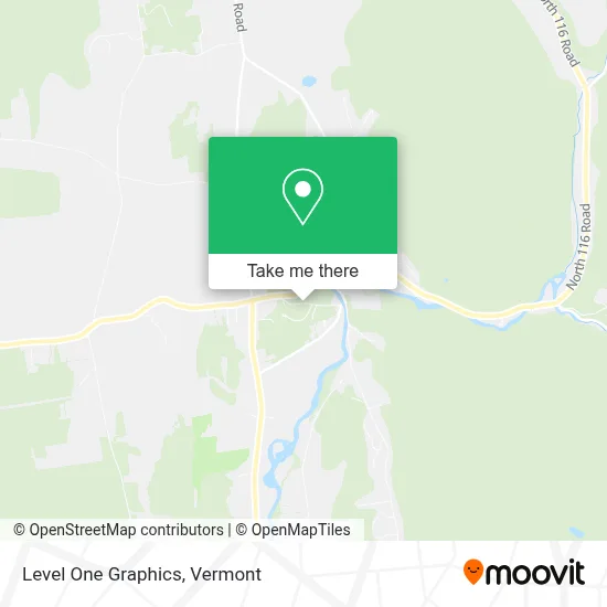
See Level One Graphics, Addison, on the map
Public Transit to Level One Graphics in Addison
Wondering how to get to Level One Graphics in Addison? Moovit helps you find the best way to get to Level One Graphics with step-by-step directions from the nearest public transit station.
Moovit provides free maps and live directions to help you navigate through your city. View schedules, routes, timetables, and find out how long does it take to get to Level One Graphics in real time.
Looking for the nearest stop or station to Level One Graphics? Check out this list of stops closest to your destination: Hewitt Road & Lover's Ln; Bristol Community Bank.
Bus: TTSB/B, 116 COMMUTER.
Want to see if there’s another route that gets you there at an earlier time? Moovit helps you find alternative routes or times. Get directions from and directions to Level One Graphics easily from the Moovit App or Website.
We make riding to Level One Graphics easy, which is why over 1.5 million users, including users in Addison, trust Moovit as the best app for public transit. You don’t need to download an individual bus app or train app, Moovit is your all-in-one transit app that helps you find the best bus time or train time available.
For information on prices of bus, costs and ride fares to Level One Graphics, please check the Moovit app.
Use the app to navigate to popular places including to the airport, hospital, stadium, grocery store, mall, coffee shop, school, college, and university.
Level One Graphics Address: 51 Woodland Dr street in Addison
- Hems Etc,
- Benjamin Moore,
- Mount Abraham Union High School,
- Cousino Financial Services,
- Saint Ambrose Church,
- USPS Collection Box - Po Lobby,
- Diocese of Burlington,
- Bristol Veterans Memorial,
- Bristol Municipal,
- Bristol Recreation Department,
- Bristol Town Green Playground,
- Optimal Energy,
- Village Shala,
- Alternative Horticultural Solutions,
- Vermont Hardwood Pens,
- The Bobcat Cafe And Brewery,
- Bobcat Cafe,
- Charlotte R McGray Psychologist,
- Katina Frances Ready Esq,
- Open Sky Studio
Places Near Level One Graphics (Addison)
- Missisquoi River Basin Association,
- Ecco,
- Derby Line Stanstead Border Crossing,
- Dartmouth-Hitchcock Medical Center, Clinical Systems, Grafton,
- WXXX, Chittenden,
- Sugarbush Resort,
- Waterbury, VT,
- Castleton, VT, Rutland,
- Rutland, VT, Rutland,
- MVU,
- Xxxxxxxxxxxxx, Chittenden,
- Hannaford, Rutland,
- Castleton University, Rutland,
- GLOBALFOUNDRIES, Chittenden,
- Champlain Valley Exposition, Chittenden,
- Springfield, VT, Windsor,
- Barre, VT,
- Richford Auto,
- Spring Step,
- University of Vermont Medical Center - Fanny Allen Campus, Chittenden
How to get to popular places in Vermont with public transit
Get around Addison by public transit!
Traveling around Addison has never been so easy. See step by step directions as you travel to any attraction, street or major public transit station. View bus and train schedules, arrival times, service alerts and detailed routes on a map, so you know exactly how to get to anywhere in Addison.
When traveling to any destination around Addison use Moovit's Live Directions with Get Off Notifications to know exactly where and how far to walk, how long to wait for your line, and how many stops are left. Moovit will alert you when it's time to get off — no need to constantly re-check whether yours is the next stop.
Wondering how to use public transit in Addison or how to pay for public transit in Addison? Moovit public transit app can help you navigate your way with public transit easily, and at minimum cost. It includes public transit fees, ticket prices, and costs. Looking for a map of Addison public transit lines? Moovit public transit app shows all public transit maps in Addison with all Bus, Train and Ferry routes and stops on an interactive map.
Vermont has 3 transit type(s), including: Bus, Train and Ferry, operated by several transit agencies, including Green Mountain Transit, Wilmington MOOver, Advance Transit, Vermont Translines, Rockingham MOOver, The Bus (Marble Valley Regional Transit District), Green Mountain Express, Rural Community Transportation, Addison County Transit Resources, Stagecoach Transportation Services, Amtrak, Greyhound-us, Dartmouth Campus Connector and Lake Champlain Ferries