How to get to Lex A Simpson MD by bus?
Click on the bus route to see step by step directions with maps, line arrival times and updated time schedules.
From Luxe Life Home Staging, Reno
45 minFrom Gandolfo Rodeo Arena, Sparks
72 minFrom Clark & Associates of Nevada, Reno
52 minFrom Nevada Humane Society, Reno
48 minFrom Thomas Cuisine, Reno
57 minFrom Vista Blvd / Baring Blvd, Sparks
83 minFrom The Home Depot, Reno
40 minFrom Target, Reno
44 minFrom RSN Logistics, Sparks
57 minFrom Prototype Drive at Igt, Reno
57 min
Bus stops near Lex A Simpson MD in Reno
Train station near Lex A Simpson MD in Reno
- Reno, 58 min walk,VIEW
Bus lines to Lex A Simpson MD in Reno
What are the closest stations to Lex A Simpson MD?
The closest stations to Lex A Simpson MD are:
- W 5th Street And N Arlington Avenue is 107 yards away, 2 min walk.
- N Arlington Avenue And W 4th Street is 304 yards away, 4 min walk.
- W 4th Street And N Arlington Avenue is 313 yards away, 4 min walk.
- N Sierra Street And Elm Street is 454 yards away, 6 min walk.
- North Virginia Street And 5th Street is 512 yards away, 7 min walk.
- Reno is 4888 yards away, 58 min walk.
Which bus lines stop near Lex A Simpson MD?
These bus lines stop near Lex A Simpson MD: 11, VRGN.
What’s the nearest bus station to Lex A Simpson MD in Reno?
The nearest bus station to Lex A Simpson MD in Reno is W 5th Street And N Arlington Avenue. It’s a 2 min walk away.
What time is the first train to Lex A Simpson MD in Reno?
The CALIFORNIA ZEPHYR is the first train that goes to Lex A Simpson MD in Reno. It stops nearby at 3:37 PM.
What time is the last train to Lex A Simpson MD in Reno?
The CALIFORNIA ZEPHYR is the last train that goes to Lex A Simpson MD in Reno. It stops nearby at 9:24 AM.
What time is the first bus to Lex A Simpson MD in Reno?
The 11 is the first bus that goes to Lex A Simpson MD in Reno. It stops nearby at 4:32 AM.
What time is the last bus to Lex A Simpson MD in Reno?
The 11 is the last bus that goes to Lex A Simpson MD in Reno. It stops nearby at 2:35 AM.
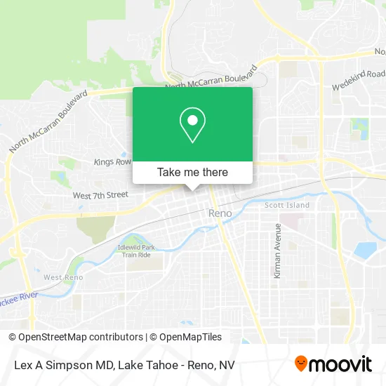
See Lex A Simpson MD, Reno, on the map
Public Transit to Lex A Simpson MD in Reno
Wondering how to get to Lex A Simpson MD in Reno? Moovit helps you find the best way to get to Lex A Simpson MD with step-by-step directions from the nearest public transit station.
Moovit provides free maps and live directions to help you navigate through your city. View schedules, routes, timetables, and find out how long does it take to get to Lex A Simpson MD in real time.
Looking for the nearest stop or station to Lex A Simpson MD? Check out this list of stops closest to your destination: W 5th Street And N Arlington Avenue; N Arlington Avenue And W 4th Street; W 4th Street And N Arlington Avenue; N Sierra Street And Elm Street; North Virginia Street And 5th Street; Reno.
Bus: 11, VRGN, 4, 6, 16, CRSN, 7.Train: CALIFORNIA ZEPHYR.
Want to see if there’s another route that gets you there at an earlier time? Moovit helps you find alternative routes or times. Get directions from and directions to Lex A Simpson MD easily from the Moovit App or Website.
We make riding to Lex A Simpson MD easy, which is why over 1.5 million users, including users in Reno, trust Moovit as the best app for public transit. You don’t need to download an individual bus app or train app, Moovit is your all-in-one transit app that helps you find the best bus time or train time available.
For information on prices of bus, costs and ride fares to Lex A Simpson MD, please check the Moovit app.
Use the app to navigate to popular places including to the airport, hospital, stadium, grocery store, mall, coffee shop, school, college, and university.
Lex A Simpson MD Address: 555 N Arlington Ave Reno, NV 89503 street in Reno
- Swarts Raymond L MD,
- Chad Watts, MD,
- Mara Timothy O J MD,
- Shukla Sanjai MD,
- Roost,
- Dme Shoppe - R,
- Reno Orthopedic Center,
- Ryan E Dobbs MD,
- Candalera L Slider, Pa-C,
- Asad Javed MD,
- My Eye Care Doc,
- Yen-Yi Peng, MD,
- Khalid Monzer, MD,
- Killeen Thomas MD,
- Peter Lawrence Fort MD,
- Margaret Elizabeth van Meter, MD,
- Steven A Schiff, MD,
- Center for Health,
- Holly Kroon Apn,
- Bernardo Marcos MD
Places Near Lex A Simpson MD (Reno)
- Social Security Administration, Reno,
- Reno, Nevada, Reno,
- Walmart Supercenter, Reno,
- Tesla, Reno,
- Grand Sierra Resort, Reno,
- The Nugget Sparks - Tesla Destination, Sparks,
- Boreal Mountain Resort, Truckee,
- University of Nevada, Reno, Reno,
- Meadowood Mall, Reno,
- Hidden Beach, Incline Village,
- DMV, Reno,
- The Summit (Summit Shopping Center), Reno,
- Tesla, Carson City,
- 2777 usa Parkway, Sparks,
- Peppermill, Reno,
- Boomtown Hotel, Reno,
- Emerald Bay, South Lake Tahoe,
- Tesla, Reno,
- Department of Motor Vehicles (DMV), Reno,
- Mount Rose Ski Resort Entrance, Reno
How to get to popular places in Lake Tahoe - Reno, NV with public transit
Get around Reno by public transit!
Traveling around Reno has never been so easy. See step by step directions as you travel to any attraction, street or major public transit station. View bus and train schedules, arrival times, service alerts and detailed routes on a map, so you know exactly how to get to anywhere in Reno.
When traveling to any destination around Reno use Moovit's Live Directions with Get Off Notifications to know exactly where and how far to walk, how long to wait for your line, and how many stops are left. Moovit will alert you when it's time to get off — no need to constantly re-check whether yours is the next stop.
Wondering how to use public transit in Reno or how to pay for public transit in Reno? Moovit public transit app can help you navigate your way with public transit easily, and at minimum cost. It includes public transit fees, ticket prices, and costs. Looking for a map of Reno public transit lines? Moovit public transit app shows all public transit maps in Reno with all Bus and Train routes and stops on an interactive map.
Lake Tahoe - Reno, NV has 2 transit type(s), including: Bus and Train, operated by several transit agencies, including RTC RIDE, Tahoe Truckee Area Regional Transit, North Lake Tahoe Express - 24 hour advance reservations required, Tahoe Transportation District, Amtrak and Greyhound-us