How to get to Liberte Tech by bus?
Click on the bus route to see step by step directions with maps, line arrival times and updated time schedules.
From John I. Leonard High School, Lake Worth
53 minFrom Somerset Academy Canyons Charter School, Sunshine Parkway
24 minFrom Pretty in Palm Beach, Boynton Beach-Delray Beach
65 minFrom JFK Medical Center, Lake Worth
43 minFrom Lake Worth, FL, Lake Worth
54 minFrom Greenacres, FL, Lake Worth
56 minFrom Lake Worth Tri Rail Station, Lake Worth
77 minFrom American Heritage School - Delray Beach, Boynton Beach-Delray Beach
80 minFrom Ollie's Bargain Outlet, Boynton Beach-Delray Beach
47 min
Bus stops near Liberte Tech in Boynton Beach-Delray Beach
Bus lines to Liberte Tech in Boynton Beach-Delray Beach
What are the closest stations to Liberte Tech?
The closest stations to Liberte Tech are:
- BOYNTON BCH BLVD at QUAIL COVEY RD is 250 yards away, 3 min walk.
- CONGRESS AVE at W BOYNTON BCH BLVD is 1012 yards away, 12 min walk.
Which bus lines stop near Liberte Tech?
These bus lines stop near Liberte Tech: 2, 3, 4, 73.
What’s the nearest bus station to Liberte Tech in Boynton Beach-Delray Beach?
The nearest bus station to Liberte Tech in Boynton Beach-Delray Beach is BOYNTON BCH BLVD at QUAIL COVEY RD. It’s a 3 min walk away.
What time is the first bus to Liberte Tech in Boynton Beach-Delray Beach?
The 73 is the first bus that goes to Liberte Tech in Boynton Beach-Delray Beach. It stops nearby at 5:32 AM.
What time is the last bus to Liberte Tech in Boynton Beach-Delray Beach?
The 2 is the last bus that goes to Liberte Tech in Boynton Beach-Delray Beach. It stops nearby at 10:35 PM.
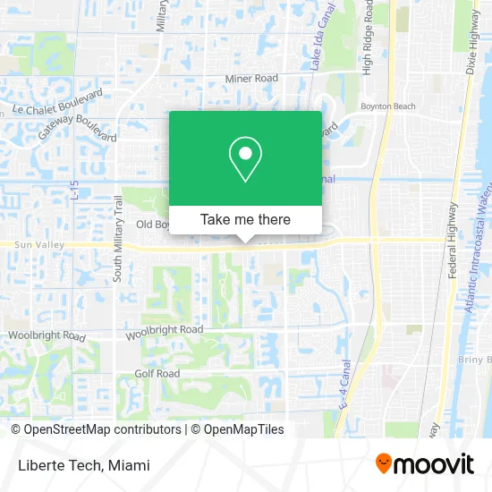
See Liberte Tech, Boynton Beach-Delray Beach, on the map
Public Transit to Liberte Tech in Boynton Beach-Delray Beach
Wondering how to get to Liberte Tech in Boynton Beach-Delray Beach? Moovit helps you find the best way to get to Liberte Tech with step-by-step directions from the nearest public transit station.
Moovit provides free maps and live directions to help you navigate through your city. View schedules, routes, timetables, and find out how long does it take to get to Liberte Tech in real time.
Looking for the nearest stop or station to Liberte Tech? Check out this list of stops closest to your destination: BOYNTON BCH BLVD at QUAIL COVEY RD; CONGRESS AVE at W BOYNTON BCH BLVD.
Bus: 2, 3, 4, 73.
Want to see if there’s another route that gets you there at an earlier time? Moovit helps you find alternative routes or times. Get directions from and directions to Liberte Tech easily from the Moovit App or Website.
We make riding to Liberte Tech easy, which is why over 1.7 million users, including users in Boynton Beach-Delray Beach, trust Moovit as the best app for public transit. You don’t need to download an individual bus app or train app, Moovit is your all-in-one transit app that helps you find the best bus time or train time available.
For information on prices of bus and train, costs and ride fares to Liberte Tech, please check the Moovit app.
Use the app to navigate to popular places including to the airport, hospital, stadium, grocery store, mall, coffee shop, school, college, and university.
Liberte Tech Address: 5450 Huddle Hill Rd Ste 2 Pmb 1190 street in Boynton Beach-Delray Beach
- BJ's Wholesale Club,
- N Congress Ave Boynton Beach Fl,
- Office Depot Store #71,
- Congress Middle School,
- Boynton Beach Mall,
- Magnolia,
- Conviva Ocean Drive,
- Boynton Beach Mall North Entrance,
- Sanitas Medical Center,
- Sky Zone Trampoline Park,
- Jii - Boynton Beach,
- Cargo World Latinoamerica,
- Flakowitz Restaurant & Deli,
- Beauty Pros,
- Boynton Beach Community High School,
- Gateway Boulevard & Congress Avenue,
- Quality Handmade Motorcycles,
- Sabor Latino Restaurant,
- Boynton Beach High School,
- Kingdom Advantage Church For All Nation
Places Near Liberte Tech (Boynton Beach-Delray Beach)
- Dolphin Mall, Miami,
- Richard E. Gerstein Justice Building, Miami,
- Hard Rock Stadium, Miami Gardens,
- Dolphin Mall Bus, Miami,
- Miami VA Hospital, Miami,
- Sawgrass Mall, Miami,
- Little Havana, Miami,
- Brickell City Centre, Miami,
- Zoo Miami, Miami,
- Bayside Marketplace, Miami,
- Miami Freedom Park, Miami,
- Wynwood, Miami,
- Aventura Mall, Miami,
- Sawgrass mall ( FL ), Miami Beach,
- Port of Miami Cruise Terminal, Miami,
- Miami-Dade County Courthouse, Miami,
- Keiser University Flagship Campus, West Palm Beach,
- Aventura Mall, Miami Beach,
- Miami Design District, Miami,
- Marlins Park, Miami
How to get to popular places in Miami with public transit
Get around Boynton Beach-Delray Beach by public transit!
Traveling around Boynton Beach-Delray Beach has never been so easy. See step by step directions as you travel to any attraction, street or major public transit station. View bus and train schedules, arrival times, service alerts and detailed routes on a map, so you know exactly how to get to anywhere in Boynton Beach-Delray Beach.
When traveling to any destination around Boynton Beach-Delray Beach use Moovit's Live Directions with Get Off Notifications to know exactly where and how far to walk, how long to wait for your line, and how many stops are left. Moovit will alert you when it's time to get off — no need to constantly re-check whether yours is the next stop.
Wondering how to use public transit in Boynton Beach-Delray Beach or how to pay for public transit in Boynton Beach-Delray Beach? Moovit public transit app can help you navigate your way with public transit easily, and at minimum cost. It includes public transit fees, ticket prices, and costs. Looking for a map of Boynton Beach-Delray Beach public transit lines? Moovit public transit app shows all public transit maps in Boynton Beach-Delray Beach with all Bus, Train, Light Rail and Ferry routes and stops on an interactive map.
Miami has 4 transit type(s), including: Bus, Train, Light Rail and Ferry, operated by several transit agencies, including Broward County Transit, Miami-Dade Transit, Metrorail, Palm Tran, Tri-Rail, Brightline, MARTY, City of Homestead Trolley, Key West Transit, Treasure Coast Connector, GoLine IRT, Amtrak, Greyhound-us, FlixBus-us and Aventura Express Shuttle Bus