Directions to Life Resource Center (Baltimore) with public transportation
The following transit lines have routes that pass near Life Resource Center
 Bus: 26, CITYLINK SILVER, 67, 69, 70.
How to get to Life Resource Center by bus?
Click on the bus route to see step by step directions with maps, line arrival times and updated time schedules.
From Joseph Meyerhoff Symphony Hall, Baltimore
33 minFrom Western High School, Baltimore
67 minFrom Morgan State University, Baltimore
60 minFrom Medstar Union Memorial Hospital, Baltimore
41 minFrom University Of Maryland Baltimore (Umbc), Baltimore County
59 minFrom Loyola University Maryland, Baltimore
59 minFrom Baltimore Polytechnic Institute, Baltimore
67 minFrom Baltimore Poly Tech High School, Baltimore
67 minFrom I-70 at Security Blvd Baltimore City Lot Park & Ride, Baltimore
70 minFrom Maryland, Baltimore
37 min
Bus stops near Life Resource Center in Baltimore
Light Rail stations near Life Resource Center in Baltimore
- Hamburg Street, 26 min walk,VIEW
Bus lines to Life Resource Center in Baltimore
What are the closest stations to Life Resource Center?
The closest stations to Life Resource Center are:
- Hanover St & Harbor Hospital Mid Nb is 94 yards away, 2 min walk.
- Hanover St & Reedbird Ave FS Nb is 221 yards away, 3 min walk.
- Medstar Harbor Hospital is 362 yards away, 5 min walk.
- Hanover St & Waterview Ave Nb is 362 yards away, 5 min walk.
- Hamburg Street is 2224 yards away, 26 min walk.
Which bus lines stop near Life Resource Center?
These bus lines stop near Life Resource Center: 26, CITYLINK SILVER.
What’s the nearest light rail station to Life Resource Center in Baltimore?
The nearest light rail station to Life Resource Center in Baltimore is Hamburg Street. It’s a 26 min walk away.
What’s the nearest bus station to Life Resource Center in Baltimore?
The nearest bus station to Life Resource Center in Baltimore is Hanover St & Harbor Hospital Mid Nb. It’s a 2 min walk away.
What time is the first light rail to Life Resource Center in Baltimore?
The LIGHT RAILLINK is the first light rail that goes to Life Resource Center in Baltimore. It stops nearby at 4:20 AM.
What time is the last light rail to Life Resource Center in Baltimore?
The LIGHT RAILLINK is the last light rail that goes to Life Resource Center in Baltimore. It stops nearby at 1:04 AM.
What time is the first bus to Life Resource Center in Baltimore?
The CITYLINK SILVER is the first bus that goes to Life Resource Center in Baltimore. It stops nearby at 4:15 AM.
What time is the last bus to Life Resource Center in Baltimore?
The CITYLINK SILVER is the last bus that goes to Life Resource Center in Baltimore. It stops nearby at 3:33 AM.
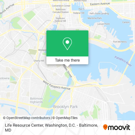
See Life Resource Center, Baltimore, on the map
Public Transit to Life Resource Center in Baltimore
Wondering how to get to Life Resource Center in Baltimore? Moovit helps you find the best way to get to Life Resource Center with step-by-step directions from the nearest public transit station.
Moovit provides free maps and live directions to help you navigate through your city. View schedules, routes, timetables, and find out how long does it take to get to Life Resource Center in real time.
Looking for the nearest stop or station to Life Resource Center? Check out this list of stops closest to your destination: Hanover St & Harbor Hospital Mid Nb; Hanover St & Reedbird Ave FS Nb; Medstar Harbor Hospital; Hanover St & Waterview Ave Nb; Hamburg Street.
Bus: 26, CITYLINK SILVER, 67, 69, 70, CHERRY ROUTE, 71.
Want to see if there’s another route that gets you there at an earlier time? Moovit helps you find alternative routes or times. Get directions from and directions to Life Resource Center easily from the Moovit App or Website.
We make riding to Life Resource Center easy, which is why over 1.5 million users, including users in Baltimore, trust Moovit as the best app for public transit. You don’t need to download an individual bus app or train app, Moovit is your all-in-one transit app that helps you find the best bus time or train time available.
For information on prices of bus and light rail, costs and ride fares to Life Resource Center, please check the Moovit app.
Use the app to navigate to popular places including to the airport, hospital, stadium, grocery store, mall, coffee shop, school, college, and university.
Life Resource Center Address: 2990 S Hanover St Brooklyn, MD 21225 street in Baltimore
- Parexel International Corporation,
- Medstar Harbor Hospital,
- Luciana Lera de Almeida Veiga MD,
- Guevara Forgue Raquel D - Guevara Forgue, Raquel D,
- Shashidhar Ankita - Shashidhar, Ankita MD,
- Murthy Gayathri - Murthy, Gayathri MD,
- Talaat Mardelli MD - Harbor Hospital,
- Nagamallika Jasti,
- Ahmed Saba - Ahmed, Saba MD,
- Gamliel Ziv - Gamliel, Ziv MD,
- Reena Ardeshna, MD,
- Soderstrom Aki Lauren Pa - Soderstrom Aki, Lauren Pa,
- Parajuli Tilachan - Parajuli, Tilachan MD,
- Gostomski Ivona - Gostomski, Ivona MD,
- Rana Harinder - Rana, Harinder MD,
- Reedbird Ave and Hanov St,
- Medstar Health Physical Therapy at South Baltimore,
- Jeffrey Mayer, MD,
- Harbor Hospital,
- social services
Places Near Life Resource Center (Baltimore)
- National Theatre, Washington,
- Washington National Cathedral, Washington,
- National Zoo, Washington,
- Georgetown, Washington,
- Rock Creek Tennis Center, Washington,
- Westfield Montgomery Mall, Montgomery County,
- Camden Yards, Baltimore,
- PG Mall, Prince George's County,
- Amazon Hq2, Arlington County,
- Basilica of the National Shrine, Washington,
- Warner Theatre, Washington,
- Museum Of The Bible, Washington,
- M&T Bank Stadium, Baltimore,
- Marriott Marquis Washington, DC, Washington,
- Pennsylvania Ave NW (3rd st and pennsylvania), Washington,
- Sibley Memorial Hospital, Washington,
- National Museum of African American History and Culture, Washington,
- The Anthem, Washington,
- Washington DC VA Medical Center, Washington,
- Capital One Arena, Washington
How to get to popular places in Washington, D.C. - Baltimore, MD with public transit
Get around Baltimore by public transit!
Traveling around Baltimore has never been so easy. See step by step directions as you travel to any attraction, street or major public transit station. View bus and train schedules, arrival times, service alerts and detailed routes on a map, so you know exactly how to get to anywhere in Baltimore.
When traveling to any destination around Baltimore use Moovit's Live Directions with Get Off Notifications to know exactly where and how far to walk, how long to wait for your line, and how many stops are left. Moovit will alert you when it's time to get off — no need to constantly re-check whether yours is the next stop.
Wondering how to use public transit in Baltimore or how to pay for public transit in Baltimore? Moovit public transit app can help you navigate your way with public transit easily, and at minimum cost. It includes public transit fees, ticket prices, and costs. Looking for a map of Baltimore public transit lines? Moovit public transit app shows all public transit maps in Baltimore with all Bus, Train, Metro, Light Rail and Ferry routes and stops on an interactive map.
Washington, D.C. - Baltimore, MD has 5 transit type(s), including: Bus, Train, Metro, Light Rail and Ferry, operated by several transit agencies, including WMATA, Montgomery County Ride On, Fairfax Connector, TheBus, PRTC, DASH - Alexandria, Arlington Transit (ART), RTA of Central Maryland, MDOT MTA, MDOT MTA Light RailLink, MDOT MTA Commuter Bus, MDOT MTA Local Bus, FXBGO!, Virginia Railway Express (VRE) and MARC